Maps of Israel

Israel is a sovereign nation that covers an area of about 20,770 sq. km in West Asia.
As observed on the physical map of Israel above, despite its small size, the country has a highly varied topography. It can be divided into four distinct physiographic regions.
The Mediterranean coastal plain: A fertile (and mostly flat) coastal plain fronts the Mediterranean Sea coastline of Israel. It is about 115 miles (185 km) long and is quite narrow. Several sandy beaches dot the coast.
Hills in central and northern Israel: Here, rolling hills dissect the country, including the central Samarian hills and the mountains and hills of Galilee in the north. Israel's highest point, Mt. Meron, which peaks at 3,963 ft. (1,208m) is located in the northern mountain region. It has been marked on the map by a yellow triangle. These mountains of this region end in an escarpment that overlooks the Great Rift Valley.
The Great Rift Valley: The valley runs south to the Gulf of Aqaba along its southern border with Jordan.
Negev Desert (part of the Sinai Desert) dominates the southern landscape.
The Dead Sea is the lowest point (below sea level) on earth. The River Jordan is the most significant river, forming the natural border between Israel and Jordan.
Lake Tiberias and the Jordan River comprises the main drainage system in Israel. Several other rivers also flow through the country.
Districts of Israel Map

Israel (officially, State of Israel) is divided into 6 administrative districts (mehozot, sing. mehoz). In alphabetical order these districts are: Central, Haifa, Jerusalem, Northern, Southern and Tel Aviv. The districts are further divided into 15 subdistricts (nafot) and a number of smaller subdivisions.
Located on a plateau in the Judaen Mountains, between the Mediterranean Sea and the Dead Sea, is Jerusalem – the capital and largest city of Israel. Jerusalem is regarded as a sacred city by the Christians, Jews and Muslims. Tel Aviv, located in central Israel, is the country’s economic and technological center.
Where is Israel?

Israel is a Middle East country, situated in Western Asia. It is located in the Northern and Eastern hemispheres of the Earth. Israel is bordered by Lebanon in the north, Syria in the northeast, Jordan in the east, Egypt in the southwest; the Palestinian territories (West Bank and Gaza Strip) in the east and west. Israel is situated on the South eastern coasts of the Mediterranean Sea and the northern coasts of the Red Sea.
Israel Bordering Countries: Egypt, Palestine, Jordan, Lebanon, Syria.
Regional Maps: Map of Asia
Key Facts
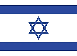
| Legal Name | State of Israel |
|---|---|
| Flag |
|
| Capital City | Jerusalem; note - the US recognized Jerusalem as Israel’s capital in December 2017 without taking a position on the specific boundaries of Israeli sovereignty |
| 31 46 N, 35 14 E | |
| Total Area | 21,937.00 km2 |
| Land Area | 21,497.00 km2 |
| Water Area | 440.00 km2 |
| Population | 9,053,300 |
| Major Cities |
|
| Currency | New Israeli shekels (ILS) |
| GDP | $395.10 Billion |
| GDP Per Capita | $43,641.40 |
This page was last updated on May 19, 2021