Maps of Reunion

Covering an area of 2,511 sq. km, Reunion Island is an overseas region of France located in the Indian Ocean east of Madagascar. Overseas territories are French-controlled lands that are not parts of France proper and are governed with much a larger focus on autonomy and self-reliance. The Reunion Island is very small and has a limited environment.
Piton des Neiges volcano can be found in the west-central part of the island. This is the island's highest point which rises to an elevation of 3,069m. Reunion is a rugged volcanic island and consists of rugged mountains that are dissected by short rivers. Situated on the eastern part of the Island is Piton de la Fournaise – an active shield volcano. The lowest point is at the Indian Ocean (0m)
The Indian Ocean surrounds the island. The waters here are generally warm and pleasant with little in the way of bad weather aside from the odd tropical storm here and there. Reunion does go through a rainy season that lasts between January and February. The weather can also get quite humid during this time as well.
The Marsouins and Galet Rivers are the two largest in the territory. Despite its small size, there is a remarkable amount of streams and rivers that run across the island. The largest settlements within Reunion can be found along these waterways too. The capital of the region Saint Denis is no exception.
Administrative Map of Reunion

Reunion is administratively divided into 4 arrondissements, 24 communes (municipalities) and 49 cantons. In alphabetical order the arrondissements are: Arrondissement of Saint-Benoit (with 6 communes), Arrondissement of Saint-Denis (with 3 communes), Arrondissement of Saint-Paul (with 5 communes) and Arrondissement of Saint-Pierre (with 10 communes).
Covering an area of 2,511 sq. km, Reunion Island is an overseas department and a region of France located in the Indian Ocean. Located on the northern coast of the Island is Saint-Denis – the capital town of Reunion. It serves as the principal administrative center of Reunion.
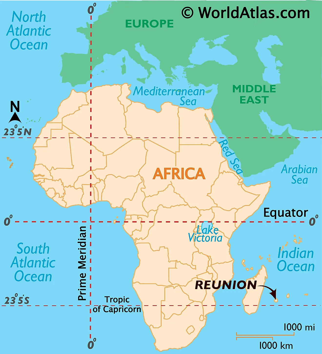
Reunion Island is an overseas department and a region of France located in the Indian Ocean. It is geographically positioned both in the Southern and Eastern Hemispheres of the Earth. Reunion belongs to the Mascarene group of Islands and is situated about 680km to the east of Madagascar and about 180km to the southwest of Mauritius.
Regional Maps: Map of
Outline Map of Reunion

The above blank map represents Reunion Island, an overseas department and a region of France located in the Indian Ocean. The above map can be downloaded, printed and used for geography education purposes like map-pointing and coloring activities.

The above blank map represents Reunion Island, an overseas department and a region of France located in the Indian Ocean.
Key Facts
| Legal Name | |
|---|---|
| Flag |
|
This page was last updated on December 26, 2023