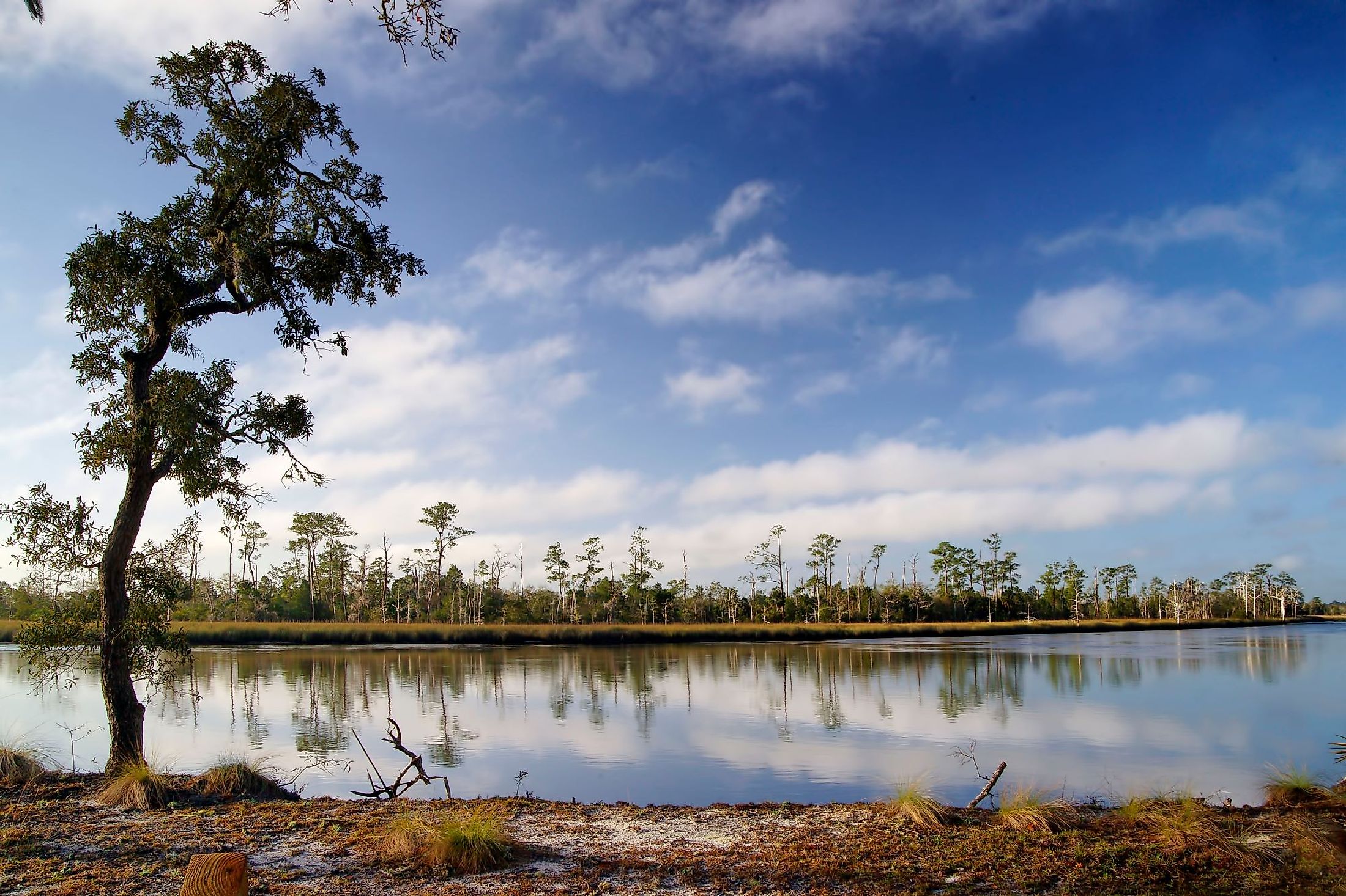
Ochlockonee River
The Ochlockonee River is a fast-flowing stream until it reaches an area just west of Tallahassee, where a dam harnesses the waters to create Lake Talquin. The river originates in the US State of Georgia and flows 332 km to eventually empty into the Gulf of Mexico in Florida at Ochlockonee Bay. The Ochlockonee is known for abundant fish stocks, with Redbreast Sunfish notable in low water and catfish in high water areas. The best fishing opportunities are often during low water periods, typically in the spring and summer. The river's course through Florida is a popular recreation area, allowing camping, canoeing, and fishing. The river is typically navigable throughout its course for most of the year, with drier periods of low water commonly occurring during the summer months.
Geography Of Ochlockonee River

The Ochlockonee River begins its flow in the red clay hills of Worth County, Georgia. For the first 260 km, it flows through rolling hills and forests. It crosses into Florida about 24 km north of Tallahassee and flows through the sandy coastal plains before emptying into the Gulf of Mexico at Panacea. The Ochlockonee River Basin extends from southwest Georgia through northern Florida, draining an area of about 16,400 sq. km. Of that area, just under 3,800 km is situated in Georgia. The river’s flow fluctuates widely throughout its length. Both floods and droughts occur occasionally. Many of the river’s headwater tributaries are diverted into farm ponds to feed the area’s predominantly agricultural lands. The Ochlockonee River then flows through the Apalachicola National Forest, the high pine bluffs, and dense hardwood forests. In its lower portion, the river flows through coastal lowlands.

There are several lakes within the Ochlockonee Watershed, including Jackson Lake and the Lake Talquin Reservoir. Lake Iamonia in northern Leon County, Florida, is connected to and fed by the Ochlockonee River. Past the Ochlockonee River State Park in Florida, the waters are increasingly influenced by the tides and saltwater blending with the fresh water. The tidal influence extends about 24 km upstream from the river’s mouth at Apalachee Bay. The Ochlockonee River finally drains into the Ochlockonee Bay, which feeds into Apalachee Bay. The median daily discharge of the river in Florida is 24 cubic m per second. The minimum of 2.86 cubic m per second was recorded in 2007, and the maximum of over 430 cubic m per second was recorded in 2005.
Climate Of Ochlockonee River
The climate along the river’s length is hot and humid in the summer and mild in the winter. Average daily highs range from under 17 °C in January to over 33 °C in July. Precipitation is common all year round, averaging more than 5 inches monthly from January through March and dropping to less than 3 inches in April.
Waters on Ochlockonee Bay are warm enough to swim in from March until the end of the year, with about 244 swimmable days in a typical year. The average water temperature in Ochlockonee Bay is 23.4 °C over the whole year, from 17.1 °C in winter to 21.6 °C in the spring, 29.2 °C in summer, and down to 25.6 °C in the fall. The lowest water temperatures tend to occur in February, averaging just under 14 °C, up to an average high of over 31 °C in July.
Ecology Of Ochlockonee River

The Ochlockonee River Wildlife Management Area (WMA) forms a significant part of the Lake Talquin State Forest at its western edge. The area is primarily forest and wetlands, along with pine-covered uplands. Cypress trees grow near ponds and other bodies of water, attracting ducks, wood storks, warblers, and other birds. The wetland areas are home to water snakes and turtles.

The Ochlockonee River State Park covers 392 acres in Florida, with oak thickets and pine flatwoods. Both saltwater and freshwater fish inhabit the waters around the Park, including bream, Spanish mackerel, and speckled perch. The river corridor is home to many rare species, including fish, animals, and plants like the Florida Maybell, least tern, and the Apalachicola dusky salamander. Many freshwater mussels are found in the river’s waters, including three endangered species.

Efforts to restore the ecology of the area of Ochlockonee River State Park have successfully reinvigorated the longleaf pine forests which once blanketed the entire region. The forests are home to many avian species, including the endangered Red-cockaded Woodpecker and other unusual species, including white squirrels, a mutation of the gray squirrel. As the river’s waters enter Apalachee Bay, the organic material it carries downstream into the shallows feeds the sea creatures. Along with the organic material, it carries sand and clay, which created the shallower areas of the bay over time. Many small fish and shellfish make their home and spawn in the estuary, in turn becoming food for the larger species that fuel the fishery and seafood industries. On Ochlockonee Bay, flounder spotted sea trout, blue crab, and sharks are among the species that are commonly caught.
Brief History Of Ochlockonee River

The area of Georgia near the river's source was occupied for thousands of years by the Hitchiti, an indigenous people. They were eventually pressured by European colonists into relocating south to Florida and, from there, were driven west along with the other historically southeastern native peoples. The name Ochlockonee comes from the Hitchiti language. In Hitchiti, Oki means water, while Lagana means yellow.
Under the Spanish, the Ochlockonee River was the western edge of their Apalachee Province. Documents dating from the 17th century call the river Claraquachine and Amarillo, the latter meaning yellowish. In 1716, another document referred to it as the Rio de Lagna, thought to be a Spanish version of the word Lagana or yellow. The British called it the Yellow River in 1720, but by 1778, maps switched the name to Okalockney or Oklokonee.
Fort Virginia Braden was established along the river between 1839 and 1842 and named after the commander's wife, who died of yellow fever. In 1863, during the Civil War, the salt works at Mashes Sands (now a beach near Panacea, FL) were attacked by the USS Stars and Stripes and a wooden steam ferryboat called the USS Somerset. Later that year, the Stars and Stripes sank the schooner, Caroline Gertrude, at the mouth of the river. The same gunboat captured a steamer just off the Ochlockonee in early 1864 and destroyed a Confederate fishery at Mashes Island in the fall of 1864.
Florida Power, a company that originated in 1899, built a dam on the river at Jackson Bluff in order to create a hydroelectric project in 1927. The dam flooded more than 23 km or about 14.5 miles along the river's banks and created a lake that stretches across about 12,000 acres. The name Talquin comes from a combination of Tallahassee and Quincy, the two cities that came together and created an area that is popular both for recreation and conservation. The state of Florida took over ownership of the dam and the lake it created in 1970, creating Lake Talquin State Park. Fishing is considered excellent in Lake Talquin State Park, with bass, sunfish, bluegill, and crappie available to anglers.
Today, over 51% of the river basin is covered in forest and forestry-related industries. Agriculture is another significant land use. The Ochlockonee River Basin drives Georgia's agricultural production, including the major commodities grown in the state: peanuts, cotton, rye, oats, soybeans, tobacco, corn, and sorghum. Cotton, in particular, is irrigation-intensive. Once in Florida, much of the land the river passes through includes parks and publicly held lands used for camping, fishing, and other recreational purposes.


