Ebro River
The 580-mile-long Ebro River is the Iberian Peninsula’s second-longest river and the longest river that flows entirely within Spain. In ancient times, the Greeks named the river “Iber,” while the Romans referred to it as “Hiber.” Flowing in the north and northeastern parts of the Iberian Peninsula, the Ebro is the peninsula’s only large river that drains into the Mediterranean Sea, and after the Nile, it is the Mediterranean Basin’s second-longest river. The Ebro River flows through the different autonomous communities in Spain, passing landscapes of exceptional natural beauty and areas housing immense biodiversity.
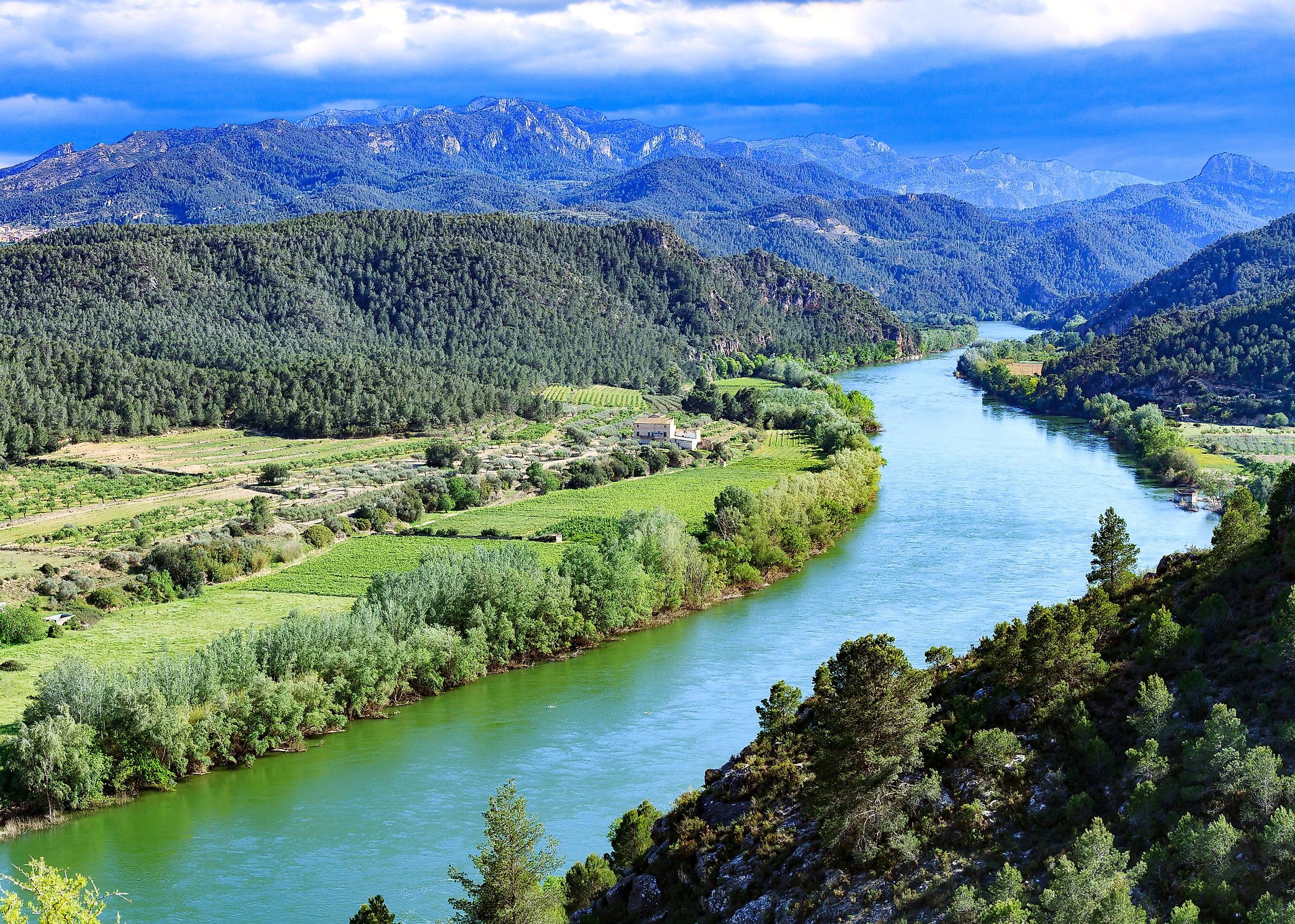
Course Of The Ebro River

The Ebro River Basin occupies a total surface area of 30,924 sq. mi, a significant portion of which is in the Spanish territory, and smaller portions are in Andorra and France. The Ebro River is Spain’s most extensive hydrographic basin, occupying about 17.3% of its surface area. The Cantabrian and the Pyrenees on the northern side, the Coastal Catalan Mountains on the eastern side, and the Iberian System on the southeastern side bound the river basin. The main channel of the Ebro River flows closer to the Iberian Mountains rather than the Pyrenees and forms an asymmetrical watershed having a triangular shape. The Ebro River Basin occupies one of the Iberian Peninsula’s biggest depressions external to the central Meseta.
The Ebro River originates from the Cantabrian Mountains in the Fontibre locality of Spain’s Cantabria province. The upper Ebro River meanders in an east-southeast direction via the rugged gorges of Burgos Province. Continuing its journey eastwards, the river flows past the Conchas de Haro, creating a wider valley amidst limestone rocks when it reaches the La Rioja and Navarre provinces. After flowing past the city of Tudela, the river water is diverted from the main channel to two irrigation channels: the Tauste Canal and the Imperial Canal. Waters from the Imperial Canal rejoin the Ebro River downstream of the city of Zaragoza.

Several tributaries join the Ebro River, including Nela, Bayas, Ega, Aragon, Cinca, Jerea, Zadorra, Arga, Gallego, and Segre, which are the left tributaries that rise from the Pyrenees and the Cantabrian Mountains. The Oca, Tiron, Iregua, Alhama, Huerva, Guadalope, Oja, Najerilla, Cidacos, Jalon, Martin, and Matarranya are the right tributaries, which rise from the Iberian System.
Throughout its course, the Ebro River flows through many notable settlements, such as the Reinosa in the Cantabria province; Miranda de Ebro and Frias in the autonomous community of Castile and Leon; Alfaro, Calahorra, Haro, and Logrono in the La Rioja province; the city of Tudela in the Navarre province; Utebo, Zaragoza, and Alagon in the autonomous community of Aragon; Aldover, Amposta, Benifallet, Flix, Mora d’Ebre, Tivenys, Tortosa, and Xerta in the Tarragona province. The Ebro River finally empties into the Mediterranean Sea via the 130 sq. mi large Ebro Delta in the Tarragona Province in the southern portion of the autonomous community of Catalonia.
Flow Volume Of The Ebro River

In terms of length and drainage basin area, Ebro is Spain’s most vital river. However, during the 20th century, the river’s mean yearly flow decreased by around 29% due to several reasons: the construction of a number of dams, increased irrigation demands, and higher evaporation rates from the reservoirs in the river basin. As the hydrological dynamics of the deltaic system at the river’s mouth are primarily controlled by river discharge, therefore a decreased discharge significantly impacts the river delta and causes an increase in salt wedge estuary. The salt wedge accelerates the erosion of the river banks and widens the river channels, which in turn causes an increase in land elevation in the lower course of the Ebro River. Studies have revealed that from 27 March 2007 to 11 April 2007, the Ebro River discharged about 1,519,000 acre-feet into the delta, with an average of 95,000 acre-feet per day.
Climate Of The Ebro River Basin

Surrounded by mountains and thus isolated from sea air masses, the Ebro River Valley experiences a continental climate. The summers in the Ebro River Valley are similar to those areas having semiarid climates. Though some of these areas often receive thunderstorms or showers, other regions are comparatively much drier and experience drought conditions except in the places where advanced irrigation is practiced. The flood plains of the Ebro River Valley, dominated by chaparral vegetation, receive rainfall between 12 to 24 inches, with the maximum rainfall received during the fall and spring seasons. Here, the summer temperatures range between 95°F and 104°F, while during winter, the temperatures drop below 32°F.
History Of The Ebro River

During classical antiquity, the Ebro River served as a boundary line between the Roman Republic in the north and the Carthaginian expansions in the south, which were formed after the First Punic War. Fearing the growing influence of the well-known Carthaginian statesman Hannibal in the Iberian Peninsula, the Roman Republic declared Saguntum a Roman protectorate. Hannibal viewed this act by the Roman Republic as a treaty violation, eventually leading to the Second Punic War.
Located along the shores of the Ebro River in the autonomous community of Aragon is Rueda de Ebro Abbey, considered one of Spain’s foremost Cistercian monasteries established in 1202. The monastery is strongly linked with the river, as it used one of the earliest big waterwheels to generate power in Spain. The monastery also helped divert the river waters, which were then used for circulating in the hydrological central heating system of the monastery buildings. In 1938, the shores along the Lower course of the Ebro River served as the site for the Battle of Ebro, one of the Spanish Civil War’s most significant and longest battles.
Ecology Of The Ebro River

Located along Spain’s eastern coast, the Ebro River Delta is one of the western Mediterranean region’s most expansive wetland areas. The delta’s rounded form is maintained due to the delicate balance between the sediment deposition by the Ebro River and the removal of this sediment by wave erosion. At present, the delta is extensively used for agricultural purposes. Moreover, the delta is home to several beaches, marshes, and slat pans that provide a suitable habitat for more than 300 avian species and serves as a critical stopover point for numerous migratory birds. About 7,802 hectares of this delta have been designated as the Ebro Delta National Park, which is internationally renowned for housing 69 vertebrate faunal species and about 8 important floral species.
However, the extensive use of the waters of the Ebro River has significantly affected the ecological functionality of the river. The river delta has also been drastically altered by the reduced water and sediment flows. All these have led to the deterioration of the water quality, water pollution from agricultural dumpings and factories, and the presence of invasive species that have strongly impacted the delicate balance of the river’s natural ecosystems.


