This Montana All-American Road Is The Ultimate US Road Trip
General Philip Sheridan had a bit of a problem. It was 1872, and he and his team had just finished an inspection of Wyoming’s new Yellowstone National Park and now needed to return to Billings, Montana. Between the world’s first national park and Billings lay terrain so treacherous that travelers preferred to spend two weeks bypassing it rather than tackling it head-on.
That all changed, however, after Sheridan heeded the advice of an old hunter who knew the terrain intimately. That advice? Cross the Beartooth Plateau. The route was treacherous, but Sheridan took the gamble, and his party completed the journey in just two days.
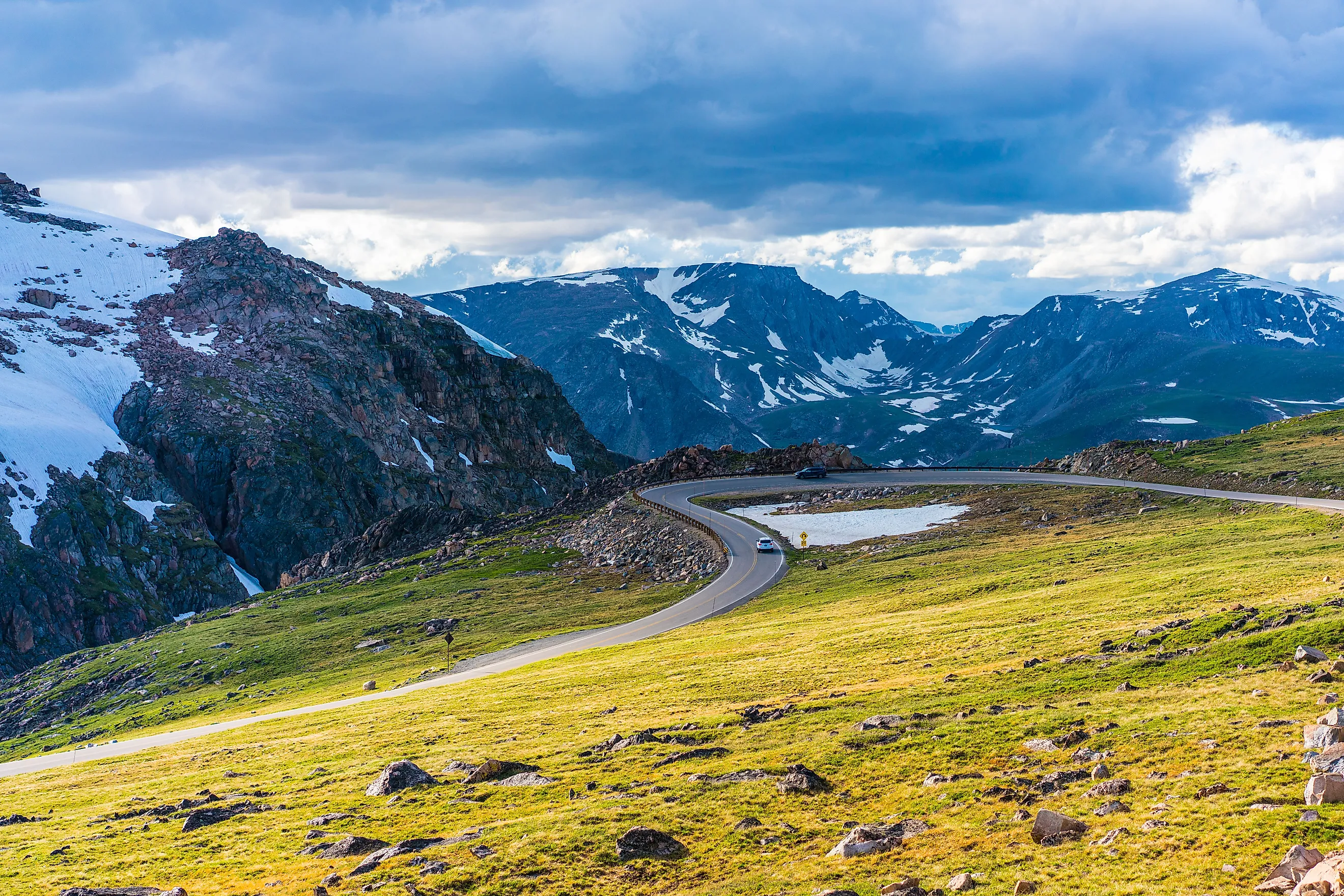
Engineers retraced the same path 60 years later to build the Beartooth Highway so the public could enjoy some of the best mountain views in America. Opened in 1937, the route transformed what had been a dangerous mountain crossing into a 68-mile journey that is now known as "the most beautiful drive in America."
The Beartooth Highway

Designated an All-American Road in 2002, this spectacular route begins and ends within Montana's borders, crossing over into Wyoming and connecting Red Lodge on its eastern end with Cooke City and Silver Gate at its western terminus near Yellowstone National Park's Northeast Entrance.
Starting in Red Lodge, the road climbs 5,000 feet through a series of dramatic switchbacks before cresting at Beartooth Pass in Wyoming. At 10,947 feet above sea level, it’s the highest paved route anywhere in the Northern Rockies and is simply breathtaking.

Adding to the magic is the fact that the route passes through portions of three National Forests, including Custer Gallatin National Forest on the Montana sections, and Shoshone National Forest in Wyoming. It also runs parallel to the sprawling Absaroka-Beartooth Wilderness, where 20 peaks exceed 12,000 feet in elevation, including Granite Peak, Montana's highest point at 12,799 feet.
While you might be tempted to do the drive in two hours without stops, don’t. Plan instead for at least four hours to fully appreciate the numerous pullouts, overlooks, and alpine lakes you’ll be presented with. Better still, allocate a full day if you intend to hike any of the trails that branch off from the highway.
It’s also worth noting that this spectacular drive is seasonal, typically opening on Memorial Day weekend (weather permitting) and closing in mid-October when heavy snowfalls arrive. Before departing, check the Montana Department of Transportation website for current conditions.
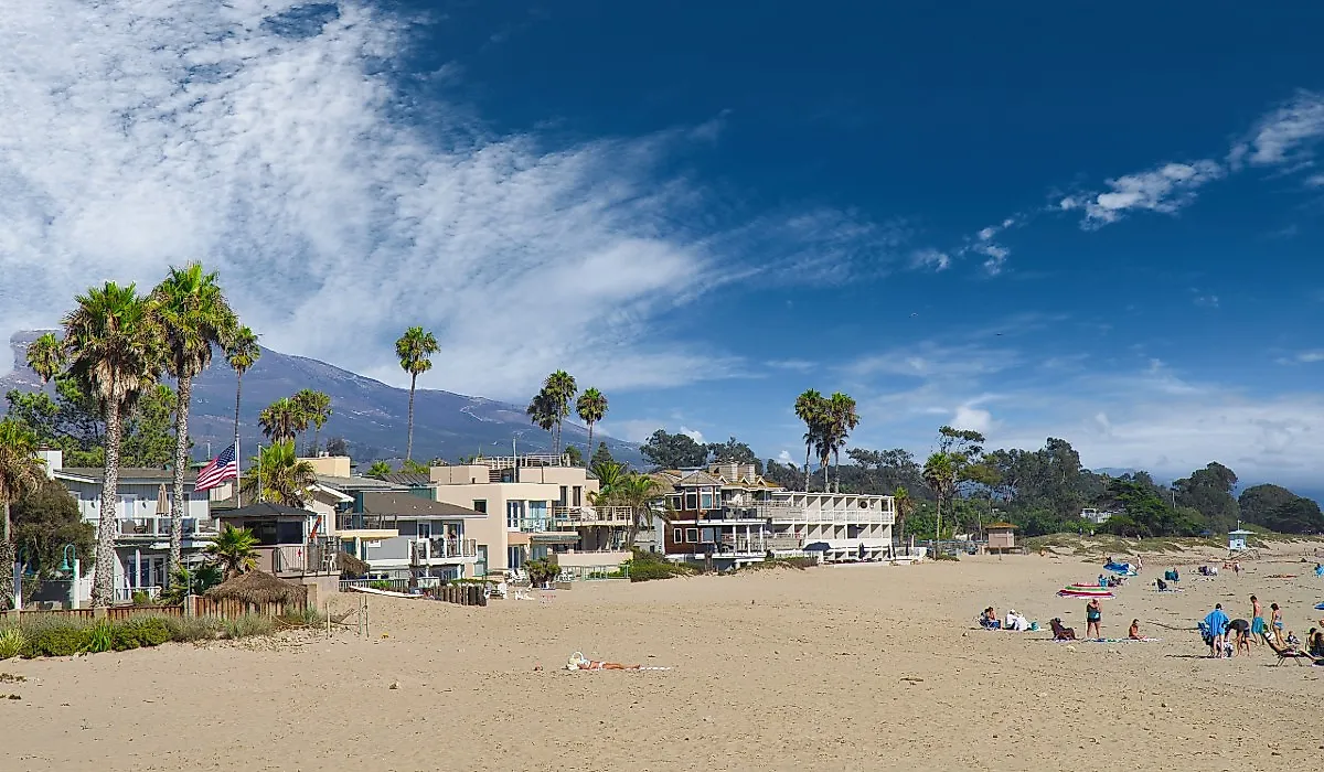
Red Lodge and Rock Creek Vista

Red Lodge is also an ideal base if you’re able to extend your visit. Start with a visit to the Carbon County Historical Society Museum to learn more about the town's mining boom, the bootlegging era during Prohibition, and its eventual revival during the construction of the scenic highway.
Leaving Red Lodge in the rearview mirror, head south on U.S. 212 and begin the climb into Custer Gallatin National Forest. Over the next 12 miles, the highway ascends some 5,400 vertical feet through dozens of switchbacks that snake up the mountain face. Make your first stop the Rock Creek Vista Point (9,190 feet elevation).

An accessible interpretive path winds through the area, with signage explaining both the region's ecology and the challenges engineers faced during construction (public restrooms are available). Looking back the way you came, Rock Creek Canyon spreads out below, Red Lodge now just a small cluster of buildings on the valley floor.
Up, Up, and Away

It’s fascinating how the character of the land changes as the altitude increases. Tall pine trees give way to stunted, gnarled specimens shaped by brutal winters and barely reach head height.

Gardner Lake comes into view on your right and is typical of the many glacial tarns scattered across the Beartooth Plateau. Don’t be surprised if you arrive in mid-July and still find ice on the lake (it’s not uncommon after particularly heavy winters). Park here and look for brook trout along the shallows, then gaze south to see the Bear's Tooth itself, the jagged granite spire that inspired the name of both the mountains and the highway.

As you drive, you'll cross the 45th parallel, the halfway mark between the Equator and the North Pole. You’ll also see the Beartooth Basin Summer Ski Area. One of the oldest alpine ski areas in the country, if sufficient snow remains, two high-speed lifts will whisk you to a truly unique summer ski experience.
Standing At The Top Of The World

At Beartooth Pass itself, you cross from Montana into Wyoming and enter an alpine zone where the growing season lasts only two months. The views here are incredible. You’ll see snowfields and small glaciers clinging to north-facing slopes on tall peaks reaching above 11,500 feet.

A little further, at what is roughly the halfway point of your drive, you’ll find the Top of the World Store, located at 9,396 feet and the only commercial establishment along this stretch of highway.

The tundra at this elevation supports some of the planet's hardiest plants, including alpine forget-me-nots and moss campion that add splashes of color in late June and July. As for wildlife, look up for golden eagles soaring on thermals, mountain goats navigating rocky outcrops, and bighorn sheep on distant ridges. Below the pass, you may even spot grizzly bears and black bears wandering through the meadows.
Beartooth Lake

Once past the summit, the highway enters Wyoming's Shoshone National Forest. The descent here feels nothing like the white-knuckle switchbacks you encountered climbing out of Red Lodge. Instead, the road meanders across a broad, rolling plateau punctuated by dozens of glacial lakes that shimmer in shades of blue and green, depending on the light.
Seven miles from the summit, and you’ll find yourself at the shoreline of Beartooth Lake. One of the largest and most accessible lakes along the route, you’ll find a campground, a boat launch, and superb fishing for several varieties of trout. The views across the lake to Beartooth Butte, a massive 410-million-year-old formation, frame the scene.

Island Lake and Long Lake, a little further along the highway, also offer camping and trout fishing. Look for the signs to Clay Butte Fire Lookout with its visitor center offering info and tips about this part of your scenic drive.
Onward to Cooke City and Silver Gate

Continue westward on Highway 212, and you’ll find yourself back in Montana and approaching the communities of Cooke City and Silver Gate. And don’t blink or you’ll miss them. With a combined population of only 140 year-round residents, it does get busier with tourists in the warmer months due to it being the northeast gateway to Yellowstone National Park.

Cooke City, at 7,708 feet, holds the distinction of being Montana's highest town and was established in 1880 as a gold mining camp. The Cooke City Store dates from 1886 and is one of the oldest general stores in the state.
Three miles to the west, Silver Gate is also worth a visit. Founded in 1932 as a stop for visitors to Yellowstone, the first thing you’ll notice is that all buildings are made from logs. This rustic log construction was a wise move and certainly gives the tiny community its distinctive character.

The final stretch of your Beartooth Highway adventure follows Soda Butte Creek through increasingly dense forest before reaching the Northeast Entrance of Yellowstone. But that’s an adventure for another day…
Tips & Tactics for Your Beartooth Highway Adventure

- Weather can change rapidly, even in midsummer, with summit temperatures 30 to 40 degrees cooler than in Red Lodge. Pack layers, including a windbreaker and warm clothing. And yes, snow squalls are possible at any time.
- Altitude sickness affects some people at elevations above 8,000 feet. Symptoms include headache, fatigue, and shortness of breath. Take your time at the higher elevations and drink plenty of water.
- This is bear country, so store all food and scented items and buy bear spray if hiking or camping.
- Fishing licenses may be needed depending on which side of the border you're on.
- Gas stations are limited along the route, so fill up in Red Lodge or Cooke City before heading out. The Top of the World Store sells gas, but prices, selection, and availability can be sketchy.
Montana's Ultimate High-Altitude Drive
Whether you're a die-hard mountaineer or prefer great views from the comfort of your car, the Beartooth Highway delivers an experience unlike any other American road. Starting and ending in Montana, this 68-mile route climbs through alpine wilderness past the treeline into a stunning landscape of exposed granite and permanent snowfields. If you only ever get to travel a single scenic byway in your lifetime, make it the Beartooth Highway.