9 Most Scenic Drives in Wisconsin
Navigating Wisconsin's network of highways puts the state's best scenery right outside your car window. You can drive up to sweeping river overlooks at Grandad Bluff Park in La Crosse or trace the wooded shoreline alongside Peninsula State Park in Fish Creek. Drivers can even take in open-water vistas of Apostle Islands National Lakeshore near Bayfield. These routes deliver an easy way to experience the region from behind the wheel.
Prescott to Kieler
Stretching 250 miles through the Driftless Region, the Wisconsin Great River Road traces Highway 35 alongside the Mississippi River. Starting in Prescott in the north, pass the sandstone cliffs of Maiden Rock and the historic river town of Alma. Approaching Trempealeau, the concrete structures of Lock and Dam No. 6 come into clear view straight from your car window. A short climb up Bliss Road leads to the summit parking lot at Grandad Bluff in La Crosse, where roadside overlooks offer sweeping vistas across Wisconsin, Minnesota, and Iowa. Drive-by turnouts along the route also provide front-row seats to river barge traffic and nesting bald eagles before the route reaches its southern endpoint in Kieler. Autumn delivers peak driving conditions, transforming the bluffs into a vibrant corridor of fall foliage.
Sturgeon Bay to Gills Rock
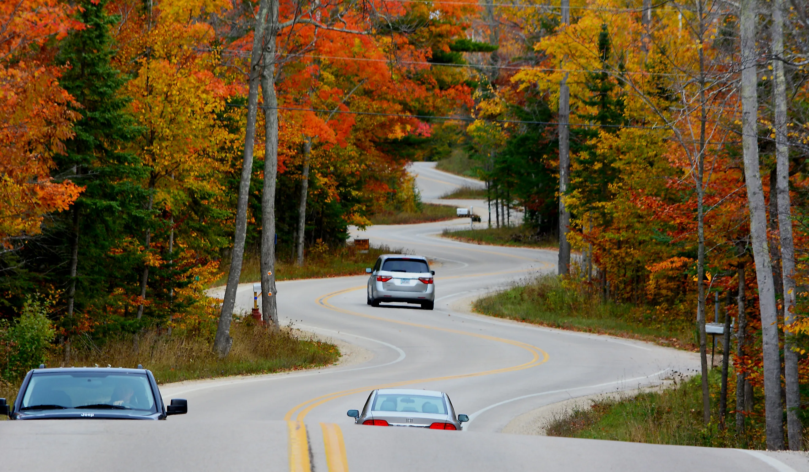
The Door County Coastal Byway follows Highways 42 and 57 on a 66-mile loop around the peninsula. Heading north from Sturgeon Bay on Highway 42, drivers trace the Niagara Escarpment's limestone cliffs alongside Lake Michigan, passing through Egg Harbor and Fish Creek. Scenic turnouts lead to views of Sven's Bluff and Eagle Bluff inside Peninsula State Park. Continuing north, the route reaches Northport and Gills Rock, home to the famously winding S-curves designed by landscape architect Jens Jensen. Sweeping south on Highway 57, the road passes Baileys Harbor with views toward Cana Island Lighthouse. Summer and fall bring ideal driving weather; make it an early morning trip to optimize clear roads and less traffic.
Ashland to Herbster
Wrapping around the Bayfield Peninsula for 70 miles, the Wisconsin Lake Superior Scenic Byway runs along Highway 13. Starting near the Northern Great Lakes Visitor Center in Ashland, drivers travel north through Washburn and Bayfield, taking in elevated vistas of Apostle Islands National Lakeshore across the open water. Past the Ojibwe tribal community at the Red Cliff reservation, Highway 13 traces red sandstone bluffs, evergreen forests, and sandy beaches. Scenic turnouts near Cornucopia offer views of sea caves along the Lake Superior shore. The route finishes near Herbster, where rocky headlands meet quiet beaches. Fall brings vibrant hardwood colors, while winter brings an equally breathtaking snowscape, but requires extra caution, like snow tires, due to sudden lake-effect snowstorms.
Lodi to Prairie du Chien

Highway 60 carries the Lower Wisconsin River Road for 100 miles alongside the free-flowing Wisconsin River. Leaving Lodi, drivers trace the shoreline near the free Merrimac Ferry before sweeping past the soaring bluffs and wooded trails of Tower Hill State Park near Spring Green. Continuing west, the road weaves beneath sandstone cliffs toward Muscoda, where Victora Riverside Park offers an easy roadside pit stop to stretch your legs right at the water's edge. The drive concludes in Prairie du Chien near the historic 19th-century Villa Louis mansion, where the Wisconsin River joins the Mississippi. Summer provides clear asphalt and peak visibility along the river bends, while early autumn offers ideal driving weather with mild temperatures, dry pavement, and minimal fog along the valley floor.
Elkhart Lake to Whitewater

The Kettle Moraine Scenic Drive covers 115 miles on a series of county roads from Elkhart Lake south to Whitewater. The surrounding countryside is filled with steep hills, long ridges, and deep sunken valleys carved out thousands of years ago by melting ice sheets. Starting near Elkhart Lake, the route heads south past Holy Hill Shrine in Hubertus and winds through the north and south sections of the Kettle Moraine State Forest. Easy roadside pull-offs provide views of Pike Lake and the Old World Wisconsin outdoor history museum before the route finishes near Whitewater. Late spring through fall delivers smooth driving; interestingly, drivers should watch closely for green-and-brown acorn route signs at rural turns, which mark where the route switches onto new county roads. Expect slow-moving weekend traffic during peak fall foliage.
Langlade to Hiles

Linking Langlade to Hiles, the Nicolet-Wolf River Scenic Byway spans 145 miles across Highways 55, 52, 32, and 70. The route cuts directly through the Chequamegon-Nicolet National Forest, featuring glacial lakes and undisturbed pine forests. Starting along the Wolf River in Langlade, the drive tracks north through Crandon before looping past Eagle River and ending near Hiles. Summer through autumn brings dry roads, but maintain cautious speeds around winding forest curves, especially at dawn and dusk when local wildlife frequently crosses the roadway.
Glidden to Hayward

The Great Divide National Scenic Byway follows Highway 77 for 29 miles through the Chequamegon-Nicolet National Forest between Glidden and Hayward. It crosses the hills of the Penokee Range, where ridgelands form the geographical divide separating water that flows north to Lake Superior from water flowing south to the Mississippi River. Heading west from Glidden, the two-lane road crosses the East Fork of the Chippewa River beneath a forest canopy. Pull-outs near Clam Lake provide views of local marshlands before the drive ends near Hayward. Summer and early fall yield optimal driving conditions. Cell service is unreliable throughout the forest, making old-school, physical navigation maps essential before starting out.
Sturgeon Bay to Jacksonport

Rustic Road 9, Glidden Drive to locals, spans seven miles along Lake Shore Drive and County T from Sturgeon Bay to Jacksonport. The narrow route runs directly along the Lake Michigan shoreline, where you can capture coastal sand dunes and the outdoor aroma of evergreen pine and cedar trees. Starting north of Sturgeon Bay, the road traces the water's edge past the quiet forests of Whitefish Dunes State Park before reconnecting to Highway 57. The roads stay in great condition from late spring through fall, but tight lanes and a strict 25 mph speed limit require a slow, deliberate pace, which is more than ideal for rolling down the windows to catch the lake breeze.
Three Lakes to Hiles

The Heritage Drive Scenic Byway covers 15 miles along Forest Road 2183 and Highway 32. The drive passes through more undisturbed forests and historic Civilian Conservation Corps planting sites, where workers replanted thousands of trees during the Great Depression. Beginning in Three Lakes, the route heads east into the Chequamegon-Nicolet National Forest, passing the Franklin Lake Recreation Area before meeting Highway 32 near Hiles. Summer and early autumn provide ideal road conditions. Drivers must adjust speeds for alternating paved and gravel surfaces, and while winter offers a beautiful backdrop, snowplowing is limited along back roads. As a result, low-riding cars risk getting stuck in deep snow; select your road trip vehicle accordingly.
Taking a road trip through Wisconsin's scenic byways offers a front-row seat to the natural beauty of the Midwest without ever stepping off the pavement. Whether tracing the ancient limestone ledges of Door County or watching the sunset over the Mississippi River bluffs, these routes capture the unfiltered character of the state's rivers, forests, and shorelines. Pack a paper map, pick a highway, and let the road lead the way to unforgettable and scenic Wisconsin views.