11 Best Hikes In Michigan
Hikers know the feeling; the burn in the calf muscles, the sweat on the eyebrows, and the heaving chest. However, the experience is often worth its cost in gold. These include the incredible views visitors will want to feast their eyes on forever, embracing the close-up encounter with nature, and the health-inducing flow of endorphins. While Connecticut— not Michigan—according to a recent ranking, is the best state for hiking in the country, Michigan, with its unspoiled forests, pretty beaches, and craggy coastlines, especially around Lake Huron, is still a hiker’s dream. Then again, the Mitten State, many will confess, is not only the most beautiful state in the Midwest but also the most gorgeous one east of The Big Muddy. Here are the best hikes in Michigan trekkers will love exploring.
Empire Bluff Trail
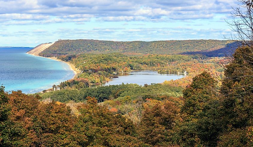
Empire Bluff Trail is in Sleeping Bear Dunes National Lakeshore, a lovely stretch of paradise on the eastern coastline of Lake Michigan as well as North and South Manitou Island. Chokeful of heart-melting scenery, including some amazing views of Lake Michigan, many consider the Empire Bluff Trail one of the best hikes in the state. Prepare for the excitement of climbing dunes and walking on bluffs that rise more than 400 feet above Lake Michigan’s gorgeous shoreline. For those wanting to do a roundtrip, Empire Bluff Trail is 1.5 miles long and should take anywhere between 30 and 45 minutes. Since the hike is relatively easy, and often does not come with throbbing sprains and strains, it is a perfect all-family adventure.
North Country National Scenic Trail
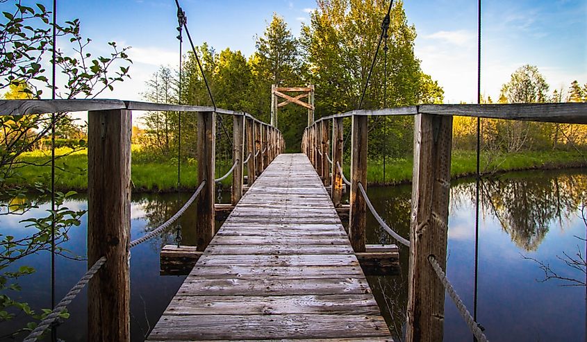
Connecting North Dakota, from the eye candies of Lake Sakakawea State Park, right through to the state of Vermont, on a stretch that spans an incredible 4,800 miles, North Country National Scenic Trail offers a whirlpool of emotional experience. While the trail meanders through 8 states, Michigan plays host to approximately a quarter of its length. The Michigan portion spans more than 1,100 miles. This means day hikers who want to grab a sneak peek will need to pick the best spots and overlooks. These should include the stretch near Baldwin and the belt that meanders along the Lake Superior shore near Grand Marais. But again, the portion that runs through the Huron-Manistee National Forest is also an eye feast. Rustic camping spots dot the trail and add to its pleasant allure.
Bare Bluff Trail
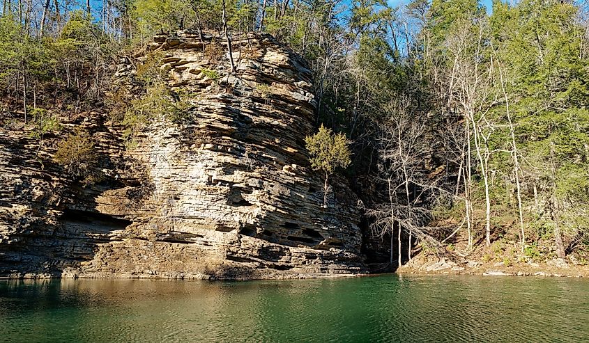
The only things required when visiting here are a pair of ground-grabbing shoes, a backpack that contains a bottle of water and bug spray, and hikers are ready to experience one of the best ones in Michigan. Some portions of this trail will take you deep into the woods, and to gorgeous canopies and shades. This trail spans approximately 4 miles, and therefore perfect for day-trippers. Then again, Bare Bluff Trail is a loop trail. This means trekkers will not have to experience the boring monotony of traveling back the same route. Upon reaching the point where the paths dissect, it is advisable to stay to the left, as the right side is rocky, and therefore a bit more difficult to climb.
Porcupine Mountains Escarpment Trail
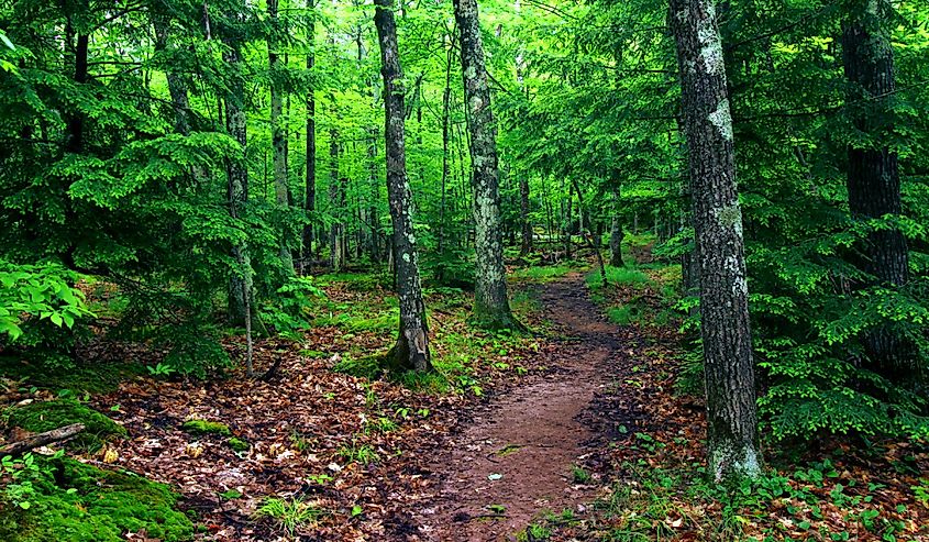
While several picturesque trails meander across the famous Porcupine Mountains, a range of small mountains that span the northwestern corner of Michigan’s Upper Peninsula, few — if any — can hold a candle to the Porcupine Mountains Escarpment Trail. This trail features yard after yard of gasp-inducing scenery and enacts a natural drama that will leave you in awe. There is a wave-like ridge; with three peaks, where a hiker will be sandwiched between the cleanest and clearest of the Great Lakes on one side, and the sparkling waters of the Lake of the Clouds on the other. Porcupine Mountains Escarpment Trail is best for seasoned hikers and spans eight miles, to and fro. After the hike, visitors may choose to pitch a tent in the camping spots around — or perhaps book a room at Mountain View Lodges located in the foothills of the Porcupine Mountains.
The Campers Trail at Port Crescent State Park
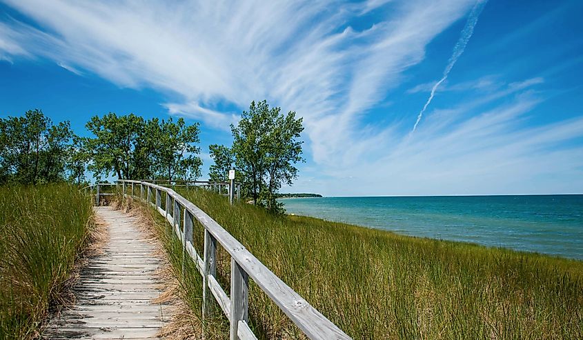
Nestled along the sandy shoreline of Lake Huron, Port Crescent State Park, located a few steps from the town of Port Austin, offers a world of adventure for outdoor enthusiasts. If you want to star-gaze, bob about on the water, or just visit for the views and the heart-ravishing quietness, Port Crescent State Park will check every box. While there are many trails in this park, the 2.3-mile-long Campers Trail is hands down the most scenic and the one you should opt for if you are looking for the most radient views. Much of this trail's course will take visitors to an area of the park completely encircled by water. On the west side, hear the continuous murmur of the Pinnebog River, the Saginaw Bay will be gleaming to the north while almost everywhere else will be the Old Pinnebog River channel.
Bond Falls Loop
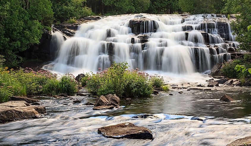
For those looking for the best in views for the best buck, prepare to lace up for the Bond Falls Loop. While the star of the show is of course, the 50-foot waterfall that is incredibly magnificent and that will overwhelm all the senses, the trail that leads to it is just as exquisite. One of the most exciting aspects of this park is that it is among the most accessible parks in the country and comes complete with a well-paved path. The trail is easy and short; it is less than a mile. Expect to walk along the water the whole time and gasp at both the upper and lower falls. Then again, this trail opens up to a spacious boardwalk that is a pleasure to stroll through. As a heads-up, Bond Falls Loop can get icy and slippery, especially in winter or spring. So do not forget to pack some Yaktrax.
Iron Belle Trail
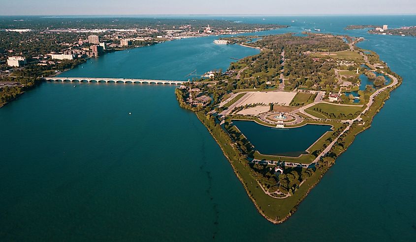
For more than 2,000 miles, Iron Belle Trail runs from the western edge of Michigan’s Upper Peninsula to Detroit’s Belle Isle, a heart-melting 982-acre island in the middle of the Detroit River. This makes it the longest designated state trail in the country. While many sections of this enormous trail ooze incredible beauty, the 8-mile Mackinac Island segment is in a class of its own. This stretch skirts Mackinac Island, a breathtaking exhibit of nature’s craftsmanship that every outdoor lover should explore. Because it is well-paved, this portion of Iron Bell Trail is remarkably accessible — even for those who use wheelchairs. Expect to turn your head after every minute to gasp at the blue-green waters of Lake Huron and several charming 19th-century buildings that dot one of the best trails in Michigan. These include the original Grand Hotel, a member of Historic Hotels of America.
Sugarloaf Mountain
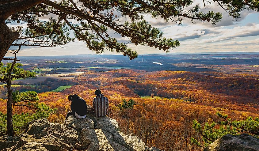
For a quick, easy hike, a stretch you can dash for in 20 to 30 minutes, Sugarloaf Mountain will fit the bill. Though its roundtrip length is not more than a mile, this trail could well be the best hike in Michigan’s Upper Peninsula. At its peak, you will be standing at approximately 1,000 feet above sea level. No one will not want to exchange the panoramic vistas at this height, which extends to the glittering waters of Lake Superior, for anything the world offers. This trail features two routes: a shorter but steeper one, and another which is pleasurably moderate but longer. After trekking through the heart-calming canopy to the top, you will find three viewing platforms, each of which points in a different direction.
Greenstone Ridge Trail
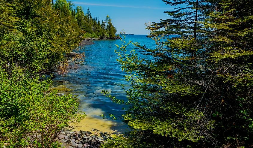
Greenstone Ridge Trail is in Isle Royale National Park, considered the least visited park in the United States, discluding the states of Hawaii and Alaska. The fact Isle Royale National Park is the least visited park in the country should say something! It is definitely remote. A visit here will feel like stepping back into a long-forgotten time when life was simple but hard. But that said, you will experience Michigan at its finest and nature in its raw beauty. While the trail’s accessibility is nothing to write home about, it opens up to views that are deliciously pristine and amazingly untouched. This trail spans about 40 miles, from Windigo, at the southwest end of the island, to Rock Harbor in the east.
Brockway Mountain
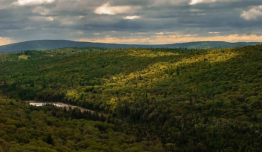
Brockway Mountain is in Copper Harbor, Michigan, a town that got its name from the role it played as a major shipping port for copper that was mined in the area during the mid-19th century. The hike to Brockway Mountain is a spellbinding panorama that includes gasp-inducing views of Lake Superior, Lake Medora, and Mount Baldy. Other natural landmarks whose views you will want to inhale include Lake Bailey, Copper Harbor, and Eagle Harbor. Encircled by peaceful greenery on every side, the 9-mile drive to the top of Brockway Mountain is a heart-racing adventure on what is the highest paved road between the Rockies and the Alleghenies. If you are driving, you will want to pull over at the Brockway Mountain Audubon Sanctuary trailhead, and for a more heartwarming visual experience, cover the remaining 1.6 miles on foot.
Au Sable River Foot Trail
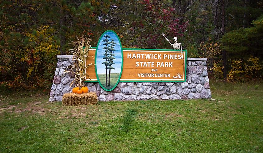
Closing up the list of the best hikes in Michigan is Au Sable River Foot Trail, a moderate, 3.2-mile-long adventure (1.6 miles one-way), that should take you two hours if you are taking it in an unhurried style. The storybook setting of this trail is among its most exciting features. Au Sable River Foot Trail is located right in the heart of northern Michigan and offers views that you will not wish to turn your back on. A trekker will walk on trails that are surrounded by rolling hills of the Hartwick Pines State Park and will inhale the fresh, crisp air that emanate from the park’s scented pines. To max out your experience, visitors may want to take a detour to the Old Growth Forest Trail which will see you imbibe even more of nature’s charm, grace, and style.
The Takeaway
Michigan is a cut above the rest of the states that make up America’s Midwest. This is because Michigan boasts incredible beauty, featured in its pretty beaches, forested hills, and whimsical coastline. These amenities are just some of the elements that make it a much sought-after destination by hikers. For the best hikes, the Mitten State is home to such standouts as the Bare Bluff, Iron Belle, and Au Sable River Foot Trails. The hardest part will be to choosing which trail to visit first!

