What Happens To The Parks As Glaciers Disappear
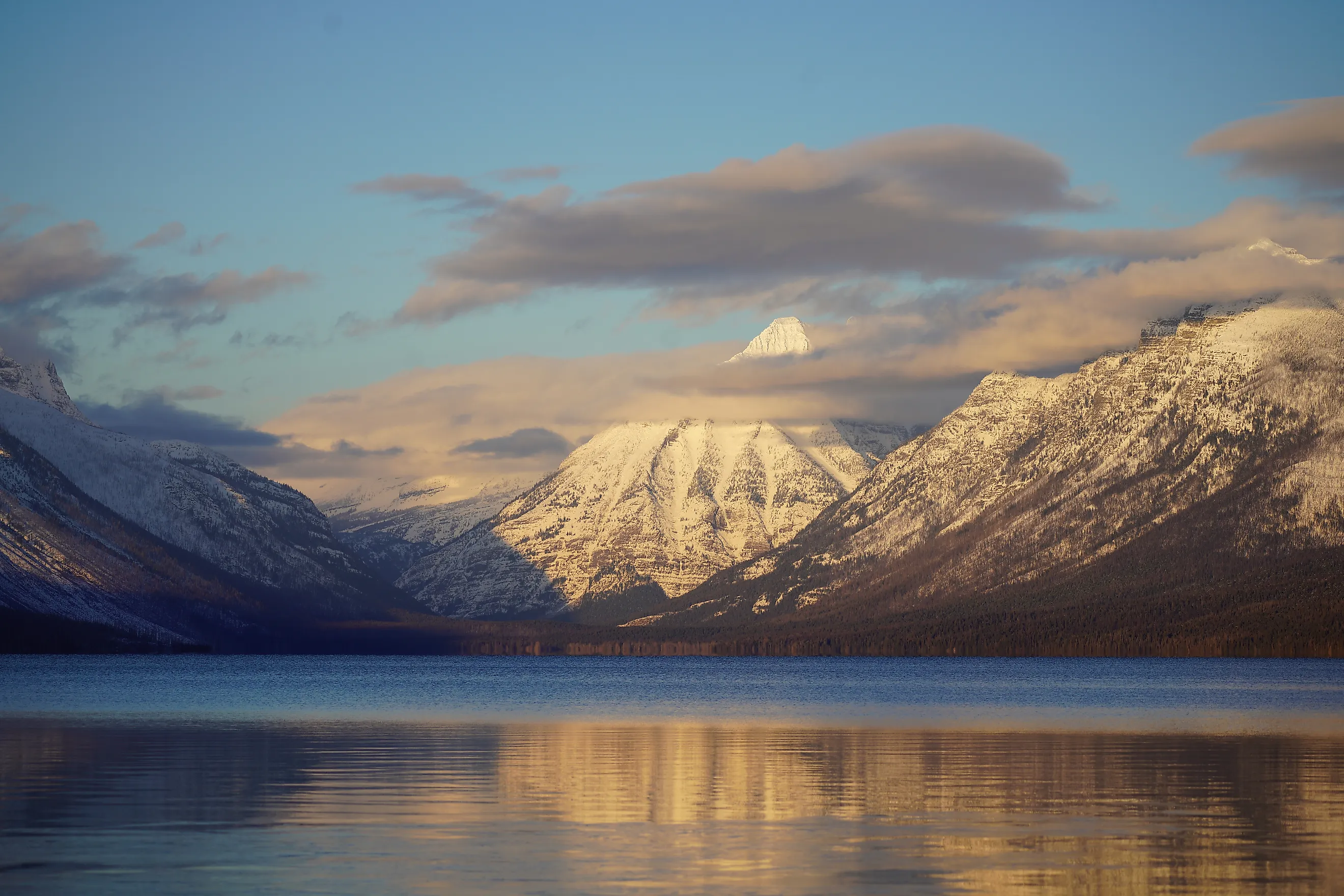
Glaciers are disappearing across some of the best-known mountain parks in the United States, and scientists can already measure the consequences far beyond the ice margins. Every named glacier studied by the U.S. Geological Survey in Glacier National Park was smaller in 2015 than in 1966, with an average area loss of 39%. Mount Rainier National Park lost 41.6% of its glacier area between 1896 and 2021. Olympic National Park has recorded major losses as well. The remaining glaciers still feed streams during dry summer weather, and their meltwater shapes conditions far downstream. In Alaska, retreat has reworked entire valleys and fjords. Research from the National Park Service, USGS, and university scientists now offers a detailed picture of what follows once the ice pulls back.
Late-Summer Rivers Carry Less Glacier Water

More than 300 glaciers sit within North Cascades National Park, and their meltwater reaches tributaries of the Skagit River long after much of the winter snow has melted. The National Park Service estimates that glaciers supply about 6% to 12% of the Skagit's summer runoff. Since 1959, that contribution to summer flow has dropped by roughly 25%. August and September matter most because seasonal snow is scarce by then, which leaves glacier ice as one of the few remaining mountain water sources.
Yosemite National Park shows an even sharper seasonal dependence. Lyell and Maclure glaciers add relatively little during the heavy spring snowmelt. In dry years, National Park Service measurements show that glacier runoff can account for as much as 90% of the Lyell Fork of the Tuolumne River during September and October. Lyell Glacier has lost most of its historic area, which leaves less stored ice to melt into Lyell Canyon late in the year.
Alpine Streams Grow Warmer

Cold glacier water forms unusually chilly headwater habitat in Glacier National Park. A U.S. Geological Survey-led study sampled 272 alpine streams while investigating the meltwater stonefly Lednia tumana and found the insect in 113 of them. Its presence tracked closely with colder water and nearness to glaciers or permanent snowfields. The western glacier stonefly, Zapada glacier, lives in similarly cold habitat. Researchers modeling future conditions in Glacier National Park later projected a 70% to 80% reduction in highly suitable habitat for specialized cold-water alpine invertebrates as ice and permanent snow decline. North Cascades National Park sits under the same temperature pressure farther west. Glacier melt reaches Skagit River tributaries during the hottest weeks of summer and helps keep the water cold enough for salmon and trout. As the glacier contribution shrinks, that cooling effect weakens during the season when river temperatures already run highest.
Retreating Ice Exposes Unstable Mountain Slopes

South Tahoma Glacier on Mount Rainier has produced decades of evidence for how glacier retreat uncovers unstable ground. Loose volcanic sediment and old glacial deposits remain on steep terrain after the ice pulls away. Sudden releases of water can sweep that material into Tahoma Creek. U.S. Geological Survey investigations found that numerous debris flows there began with glacial outburst floods before gathering rock and sediment farther downhill.
The effects have reached the park road system. Debris flows in the Tahoma Creek drainage have repeatedly damaged the Westside Road since the 1960s. The retreating glacier above the valley keeps exposing material that storms and meltwater can push into the channel.
Mount Rainier's shrinking ice cover shows the scale of that change. A 2023 National Park Service inventory found that the mountain lost 41.6% of its glacier area between 1896 and 2021. Several glaciers retreated especially fast during the most recent period studied, which left larger areas of freshly uncovered terrain around their margins.
New Lakes Form And Sometimes Drain Suddenly

Bear Glacier in Kenai Fjords National Park has retreated about four miles from its late-19th-century maximum. Water now fills part of the ground once covered by glacier ice, forming a broad proglacial lagoon near the terminus. The retreat has opened an extraordinary paddling landscape, with open water reaching toward a glacier that once extended much farther down the valley. It has also opened places where meltwater can pool against remaining ice.
In August 2018, National Park Service monitoring captured the power of one of those lakes. During a glacial lake outburst flood at Bear Glacier, the water level in a glacier-dammed source lake dropped roughly 50 to 65 feet per day during the first stage of drainage. The proglacial lake downstream rose about 6.5 feet in 96 hours. The flood released stored meltwater through the glacier system without a conventional dam breaking, a sign of how quickly the new lakes around retreating ice can shift.
Former Glacier Beds Begin Growing Forest

Exit Glacier in Kenai Fjords National Park has retreated roughly 1.4 miles from its early-19th-century maximum, uncovering ground at different times along the valley. National Park Service ecologists have documented how plants take hold on those surfaces after the ice leaves. Young terrain near the glacier starts with bare rock, thin sediment, mosses, and lichens. Yellow dryas and fireweed take root as the surface develops. Alder grows in later, and bacteria on its roots add nitrogen to the young soil. Black cottonwood grows on older ground, followed eventually by Sitka spruce. The National Park Service estimates that spruce-dominated forest can develop within roughly 100 to 200 years under local conditions. At Exit Glacier, visitors can walk across terrain uncovered in different periods and watch that succession directly, with older cottonwood and spruce stands rooted in sections of valley that have been ice-free the longest.
Harbor Seals Lose Floating Glacier Habitat

Harbor seals in Glacier Bay National Park and Preserve use icebergs from tidewater glaciers as places to rest and give birth. Muir Glacier once shed enough floating ice to support a large seal concentration in upper Muir Inlet. Researchers counted more than 1,300 harbor seals there during the 1970s.
Muir Glacier retreated rapidly during the following decades and eventually stopped feeding the inlet the same abundance of calved ice. The seals left the upper inlet as that habitat vanished. National Park Service researchers reported that no harbor seals were pupping there by 2008.
Other sections of Glacier Bay still hold active tidewater glaciers where seals use floating ice, which gives researchers a comparison within the same national park. The history of Muir Inlet ties one glacier's retreat to a documented shift of marine mammals. A fjord that once held hundreds of seals on glacier-produced ice lost that congregation after Muir Glacier pulled back from the habitat that had supported it.
The Land Rises As The Ice Weight Disappears

Upper Glacier Bay is rising because enormous amounts of ice have vanished from the region. During the Little Ice Age, thick glaciers pressed the Earth's crust downward. Researchers estimate that roughly 3,450 cubic kilometers of ice above sea level later disappeared from the wider Glacier Bay region. National Park Service measurements now record uplift of about 32 millimeters per year in upper Glacier Bay, among the fastest modern rates measured anywhere on Earth.
The movement slowly reshapes the park's coast. As the crust rebounds, formerly submerged ground rises relative to sea level and the shoreline shifts. The change stacks up year after year, so beaches and tidal areas can sit at different elevations as the rebound continues. Glacier Bay therefore holds a record of vanished ice in a particularly unusual form. Scientists can measure the loss centuries later through the continuing upward movement of the land that once carried its enormous weight.
Park Roads Face More Sediment And Erosion

At Mount Rainier National Park, glacier retreat has turned into a road and river-management problem. As ice pulls away from valley walls and old deposits, more loose sediment lies open to erosion. Tahoma Creek has repeatedly carried that material downhill in debris flows, damaging the Westside Road and forcing closures and repairs. U.S. Geological Survey records show repeated debris-flow activity in the drainage since the 1960s, several events tied to sudden releases of glacial water. Sediment also builds up in glacier-fed river channels and raises their beds through aggradation. The National Park Service treats that process as a threat to infrastructure because higher channels can send floodwater toward developed ground more easily. Along the Nisqually River, erosion has already threatened sections of the park road. Mount Rainier's 41.6% loss of glacier area between 1896 and 2021 leaves managers guarding access routes in valleys that now receive sediment from a much smaller ice cover than the one that shaped them.
A Changing Signature Across The Parks
The parks share one process, yet the ice leaves a different mark in each. In the North Cascades and Yosemite, the loss registers in late-summer streamflow and the water temperatures that salmon, trout, and cold-adapted insects depend on. On Mount Rainier, it registers in debris flows and threatened roads. In Alaska, it registers in new lagoons, rebounding land, advancing forest, and marine mammals that shift with the ice. Each measurement documents the same retreat from a different angle, which is why researchers can already describe what happens after a glacier goes, rather than only predict it. The remaining ice in these parks is now a smaller version of the force that carved the valleys around it, and the record of its retreat is written into the water, the ground, and the wildlife that scientists continue to track.