Craters Of The Moon National Monument And Preserve
On August 22, 1969, four Apollo 14 astronauts and a team of NASA scientists arrived at Craters of the Moon to train for an actual moon landing. The reason was simple. The 752,000 acres of black lava, cinder cones, and broken rift terrain in south-central Idaho looked enough like the lunar surface to be useful preparation for walking on it. Eight eruptive episodes have shaped the place over the last 15,000 years, the most recent ending only about 2,000 years ago, and the geology has not finished. Roughly 300,000 people now visit each year, drawn to a landscape that the writer Robert Limbert and a 1924 National Geographic article first introduced to the wider American public.

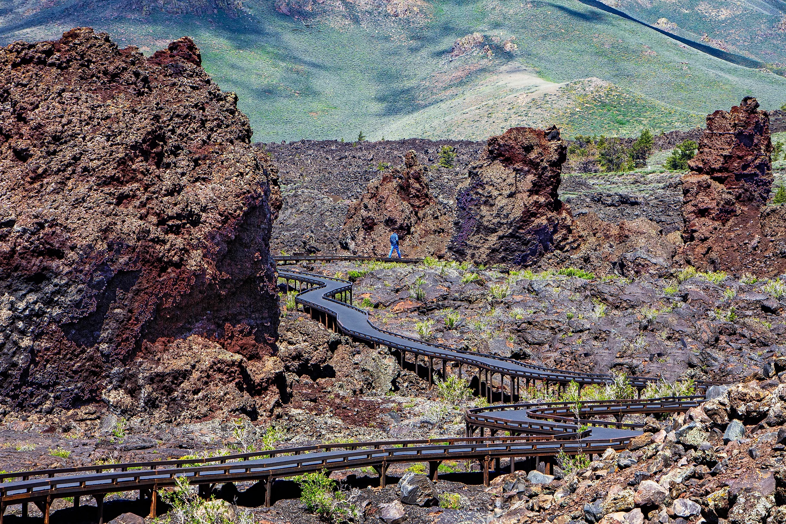
In summer, trails branch off the 7-mile paved Loop Road and lead through cones, lava tube caves, and other stretches of broken volcanic terrain. In winter, the landscape changes more than visitors expect. Snow fills the spaces between the lava flows, and the monument opens to backcountry skiers and snowshoers. Ranger-led snowshoe tours run on weekends through the cold months, and the contrast between white snow and black basalt is the most photographed scene of the season.
Location
The only entrance is on the north side of the park, at the Robert Limbert Visitor Center off Highway 20/26/93. Boise sits about 170 miles to the west, and the closest towns offering services are Carey (25 miles southwest of the visitor center) and Arco (19 miles northeast and the official mailing address for the monument). Other regional anchors include Twin Falls 90 miles southwest, Pocatello 100 miles southeast, and Idaho Falls 85 miles east. The monument covers a substantial portion of the Snake River Plain, the volcanic basin that defines southern Idaho.
Formation and History

Eight eruptive episodes have remade this landscape over the last 15,000 years. The most recent ended about 2,000 years ago, when the Great Rift, a 52-mile-long volcanic fissure, opened and pushed lava across the surface. The two types of flow on display are pāhoehoe (smooth and ropey) and ʻaʻā (sharp, broken, rough underfoot), both Hawaiian terms in standard geological use. Older flows have been reclaimed by vegetation, while the most recent surfaces still look raw. The collective result is the largest young lava field in the lower 48 states, where "young" means formed within the last 10,000 years. Geologists expect another eruption eventually, though not on a timescale that affects current visitors.
Human presence in the Snake River Plain dates back at least 12,000 years to the end of the last Ice Age. The Shoshone and Bannock peoples are the tribes most directly connected to the area, and their oral tradition (notably the Serpent Legend) describes the last major eruption with enough specificity that it suggests eyewitness memory.

European Americans approached the area cautiously. Army Captain Benjamin Bonneville surveyed the region in 1833 on assignment from the War Department. In 1862, more than 1,000 emigrants veered north of the Oregon Trail onto Goodale's Cutoff (which paralleled the route now connecting Carey and Arco) and got their first look at the lava flows. The wider American public did not pay attention until 1920, when Robert W. Limbert spent 17 days hiking, mapping, and photographing the 50-plus miles of the Great Rift. His March 1924 National Geographic piece, "Among the 'Craters of the Moon,'" reached enough readers to put the place on the map, and President Calvin Coolidge proclaimed Craters of the Moon a national monument on May 2, 1924, two months later. Four subsequent presidents expanded the boundary. In October 1970, Congress designated 43,243 acres of the monument as the Craters of the Moon Wilderness, one of the first wilderness areas in the National Park System.
The 1969 NASA training trip was not symbolic. The space program continues to use Craters as analog terrain, and the monument's 2017 designation as an International Dark Sky Park added another draw on clear nights, when the cosmos comes through almost unfiltered.
Flora and Fauna

Nearly 300 vertebrate species and over 750 plant species live in a landscape that looks barren from a distance. Of the 62 mammals on the official park list, the pika (a small relative of the rabbit) is the most consistently spotted by visitors. Pronghorn pass through in the spring and fall on their seasonal migration. At least 11 bat species use the volcanic caves as roosts, and the yellow-bellied marmot is the most visible of the larger rodents, often sunning on top of the basalt. Great Basin pocket mice and yellow pine chipmunks are part of the resident small-mammal community as well, common across the Great Basin and the Pacific Northwest.
Birders can come with a long checklist. 223 species have been recorded at the monument. The shrubland and rocky-area specialists (Clark's nutcrackers, ravens, mountain chickadees) are present year-round, while migrants (warblers, sparrows, flycatchers) move through twice a year, and the cold-weather species (northern shrikes, snow buntings, rough-legged hawks, and the occasional snowy owl) arrive when full Idahoan winter sets in.
Five snake species and five lizard species share the rocks. Four amphibians have adapted to the sagebrush desert: the boreal chorus frog, the Pacific tree frog, the western toad, and the Great Basin spadefoot toad, which can stay in a near-death dormant state for years during extended droughts.

The wildflowers do most of the visual work in spring. The dozens of species in bloom against the black volcanic slopes produce what locals call "cinder gardens," and the contrast is sharp enough to be the reason most early-summer visitors come. Limber pines and Rocky Mountain junipers are the dominant trees on the older lava flows.
Camping
The Lava Flow Campground runs year-round, with vehicle access between roughly May and November. The 42-site campground is first-come, first-served, with charcoal grills and picnic tables at every site. Some sites accommodate RVs, but no hookups are provided. Vault toilets stay open year-round; the flush toilets close when the road does. Standard fees run around $15 in summer and $8 in shoulder season.
Winter camping is the under-used option. Once the road closes, tent camping is permitted at Lava Flow with a short snowshoe-in, and tents are also allowed at the Devil's Orchard and Tree Molds parking lots. The major upside: it is free. A no-cost permit from the visitor center is the only requirement.
Why Craters Holds Up
Idaho lands lower than it should on most national-park itineraries, and Craters of the Moon lands lower still. The annual visitor count of around 300,000 is a small fraction of the 285 million people who pass through the National Park System every year, which means the monument still rewards a slower visit on its own terms. The lava is real, the wilderness is real, and the cosmos overhead at night is one of the better dark-sky views left in the lower 48.