7 Great Road Trips to Take in Wyoming
Wyoming’s road trips run on long stretches between towns. The Snowy Range Scenic Byway climbs above 10,800 feet through alpine terrain. The Seminoe-Alcova Scenic Backway runs 64 miles between Alcova and Sinclair with no services. Drives toward Yellowstone pass through active wildlife areas. Across these routes you’ll see glacial valleys, sagebrush basins, and high mountain passes. These seven byways show how varied road trips across Wyoming can be.
Seminoe-Alcova Scenic Backway

This scenic backroad runs lightly populated, with mountains, reservoirs, and good fishing spots. The drive is 64 miles long, stretching from Alcova to Sinclair. Near Alcova, the terrain is mountainous, with rolling hills. Traveling south, the route continues on County Road 407 to the Carbon County line, where it becomes County Road 351. Much of the route passes through arid land, with no towns, gas stations, or telephones along the way. The road varies from two to single lanes, with passing pullouts. Some sections are paved, others unpaved. On County Road 291, drivers will notice that the road transitions from paved to gravel as it winds toward County Road 351, and returns to paved. The route is safe for most vehicles between May and November. Due to its elevation changes, it is not recommended for vehicles pulling large trailers or motorhomes.
Passing through the Seminoe Mountains, the drive typically takes about 2.5 hours or longer, depending on stops for recreation and sightseeing. Notable attractions along the stretch from Alcova in the north to Sinclair in the south include the Alcova Dam and Alcova Reservoir. The 265-foot dam, built between 1935 and 1938, is a popular spot for water sports and fishing. Also along the way is the Cottonwood Creek Dinosaur Trail, a half-mile trail home to many vertebrate and plant fossils, ideal for stretching your legs. Finally, Seminoe State Park, known for its abundant walleye and trout, concludes the drive. Visitors can camp in tents or set up at one of the RV sites to explore the 600-acre expanse, with swimming, hiking, and picnicking.
Red Gulch/Alkali Scenic Backway

Native and frontier history is on full display along this often-untrodden scenic backway. The 32-mile road passes through the Big Horn Basin and traverses land inhabited for 12,000 years, when Paleo-Indian mammoth hunters roamed the area. Along the way, drivers will see rock cairns and sheepherder monuments showcasing the region’s history.
The road begins in the north at U.S. Route 14, four miles west of Shell, or at the southern entrance at Wyoming Highway 31, north of Hyattville. Near each entrance are kiosks that provide historic information about the byway, and businesses like the Paintrock Inn in Hyattsville, ideal for a meal before the drive. The gravel and dirt road is bumpy and rutted in places, with grades below seven percent. The road runs through the foothills of the Bighorn Mountains, and there are no towns, stores, or gas stations along the way. It is not recommended to drive the byway from November to April, as wet conditions can leave the road impassable.
Attractions along the route include the Red Gulch Dinosaur Tracksite, located off County Road 1109, featuring 165-million-year-old dinosaur tracks. Another highlight is the scenic view from Alkali Road, where, at the summit of Red Gulch Road and Alkali Road, you can see the expansive Big Horn Basin. At the end of the road stands the Southern End of Backway kiosk, which describes the area’s history, culture, and archaeology.
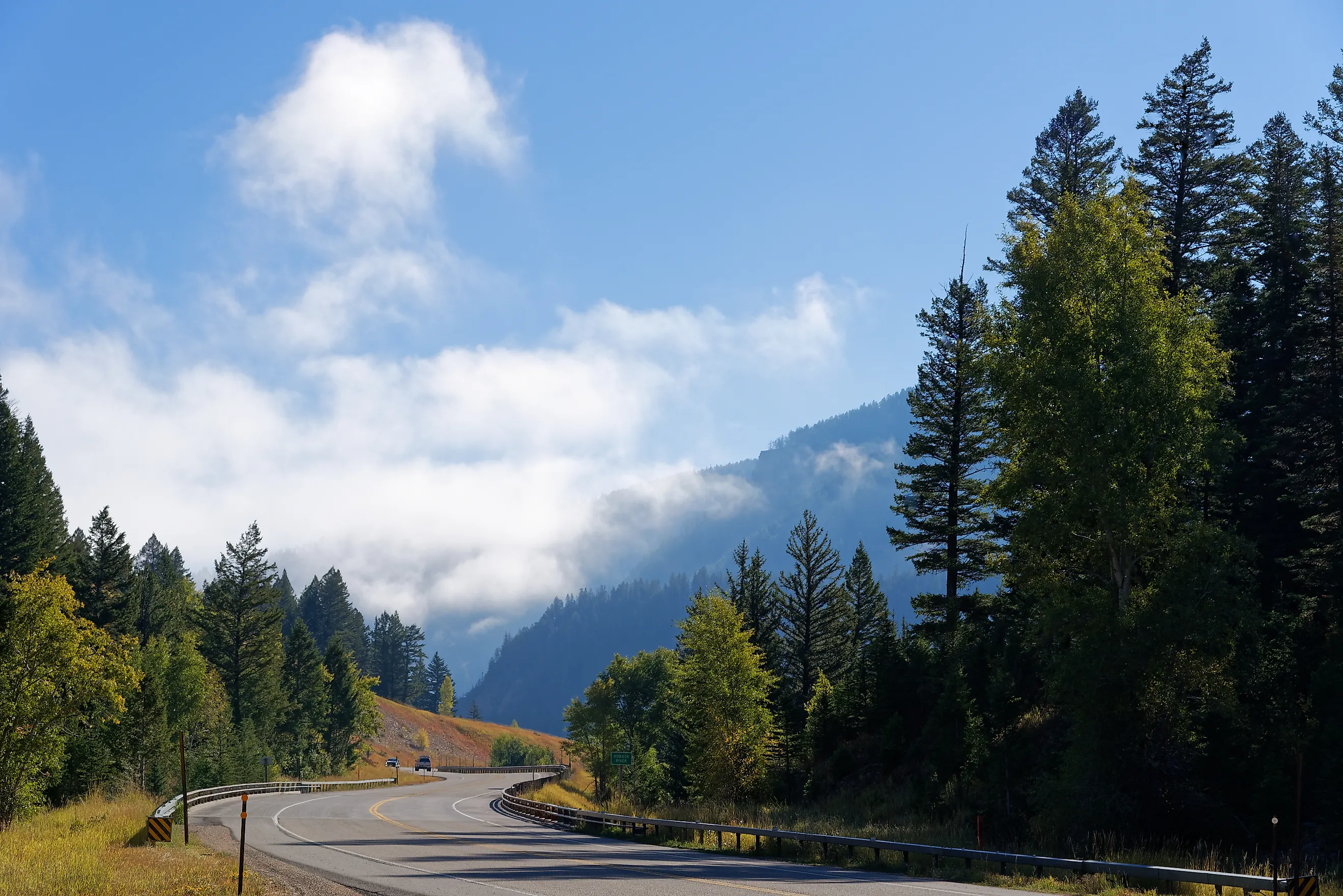
Centennial Scenic Byway

This 163-mile byway connects Dubois, Jackson, and Pinedale on a horseshoe-shaped route along US 26/287 and US 26/89/191. It spans two national forests, a national park, and three counties. There are several visitor centers along the route and numerous trailheads. Coming from the north end, the route passes through Dubois, where the National Bighorn Sheep Interpretive Center welcomes travelers. Visitors can spend time learning about and witnessing one of the largest herds of Rocky Mountain Bighorn Sheep in the region through interpretive programs and presentations. From there, it climbs to Togwotee Pass, reaching an elevation of 9,658 feet along the Continental Divide. The road then descends west to Moran Junction and turns south, entering Grand Teton National Park on the stretch between Moran Junction and Jackson, where visitors can take in views of the Teton Range for nearly 20 miles. You can also make it a rest stop and camp for the night to explore the 310,000-acre park.
At the northern end of the byway lies Shoshone National Forest, which spans over 2.4 million acres and is home to wildlife such as elk, moose, antelope, and both black and grizzly bears. Just beyond the road to Brooks Lake, a turnoff leads to Falls Campground, a shaded site with 54 campsites surrounded by pine and fir trees. Visitors can access Brooks Lake Creek Falls via a short foot trail that leads to a viewpoint, with guardrails in place to protect against the steep drop into the canyon. The campground requires proper food storage due to bear activity. Bear boxes are available on-site, and the stay limit is 16 days. The byway is open year-round and can be driven in four hours.
Snowy Range Scenic Byway

This route crosses the Medicine Bow Mountain Range along a 29-mile stretch of State Highway 130 in southern Wyoming, passing through Medicine Bow National Forest. The drive takes about an hour with no stops in the summer, rising from roughly 8,000 feet on the sagebrush-covered valley floor to 10,847 feet at Snowy Range Pass. The landscape transitions into a high-altitude alpine environment. There are no service stations or retail stores along the route, so travelers should plan accordingly. The nearest services are in Rawlins and Laramie.
Starting in the east just outside Centennial, a visitor center welcomes travelers with trail maps and information on local flora and fauna. It is open seven days a week during the summer and fall, with limited hours in winter and spring. Further along, the Green Rock Picnic Area, located west of Barber Lake Road, offers a stop known for its abundant wildflowers, though the road closes here during the winter months. At the summit of the Snowy Range Scenic Byway, Libby Flats offers panoramic views of the surrounding mountains, including a clear vantage of Medicine Bow Peak and, on especially clear days, views extending to the Never Summer Wilderness in Colorado. The route ends in the west at Saratoga, a town of 1,700. The Saratoga Sandwich Company is a good food stop, with gyros and burritos before heading back.
Mirror Lake Scenic Byway

This scenic byway stretches from Evanston, Wyoming, to Kamas, Utah, traveling through the western portion of the Uinta Mountains. Beginning just south of Evanston, State Highway 150 branches off Interstate 80 and, after about 20 miles, reaches the Wyoming-Utah border, where it continues as Utah State Road 150. The byway spans approximately 78 miles and takes between two and three hours to complete. Travelers should plan ahead, as full services are only available in Evanston and Kamas.
Just east of Evanston, Bear River State Park serves as an easy first stop, with paved walking trails looping through cottonwood groves and a fenced wildlife area where bison and elk can be seen up close. About nine miles south, Sulphur Creek Reservoir offers a larger stop with boat ramps, shoreline fishing access, and open space for picnicking or short breaks by the water. As the road climbs, several informal pullouts near Bald Mountain Pass offer quick stops to take in alpine views and cooler temperatures before continuing into higher elevations. Those looking for a different experience can also follow County Road 173 to the ghost town of Piedmont, where charcoal kilns and the rustic remains of homes mark the once-thriving Union Pacific Railroad community.
Chief Joseph Scenic Byway

This scenic byway runs along State Highway 296, linking Cody with the Beartooth Highway and the Northeast Gate of Yellowstone National Park. Crossing the Shoshone National Forest through the Absaroka Mountains, the route consists of 47 miles of paved road running from the junction of US 120 to its connection with US 212. North of the road lie the Clarks Fork and Yellowstone Rivers, while to the south rise the Absaroka Mountains and the North Absaroka Wilderness. The drive typically takes about one hour, and summer and fall are the best times to travel.
Near Yellowstone National Park, the road becomes winding and steep, featuring the state’s highest highway bridge over Sunlight Creek and cresting at 8,060 feet at Dead Indian Pass. The most notable stop, Dead Indian Summit Overlook, offers a paved turnout with views, along with short walking paths along the ridge for better viewpoints. Just before the pass, pullouts near Sunlight Creek provide a chance to stop and look down into the canyon, while anglers often access sections of the Clarks Fork River below for fishing. Services remain limited along the route, with Cody providing the nearest full stop. Spots like the Cody Steakhouse work for pre- or post-drive meals, while electric vehicles can be charged at the Buffalo Bill Center of the West, a strong place to explore local history.
Buffalo Bill Cody Scenic Byway

The byway follows US 14/16/20 through the Wapiti Valley to the East Entrance of Yellowstone National Park. Beginning about 25 miles west of Cody, at the Shoshone National Forest border, the drive takes around 45 minutes, following the North Fork of the Shoshone River with frequent pullouts where the river runs close to the road.
The Wapiti Campground, located 30 miles west of Cody, offers more than just lodging, with direct river access for fishing and short walking paths along the water, making it a practical stop to get out and stretch. Nearby, Elk Fork Campground provides a quieter alternative with fewer sites and similar river access. At the eastern end, Pahaska Tepee, the former hunting lodge of William “Buffalo Bill” Cody, is open for tours inside the preserved two-story log building, where original furnishings and exhibits give a clearer look at frontier life just two miles from Yellowstone’s entrance.
The route also runs along the edge of Shoshone National Forest, where pullouts and trailheads provide access to short hikes and river viewpoints. Continuing west brings drivers directly into Yellowstone National Park, where geothermal features, river canyons, and established trail networks extend the drive into a full-day or multi-day trip.
Drive Through Wyoming’s Landscapes
These routes cover a range of terrain across Wyoming, from high mountain passes and forested byways to open basins and remote backroads with few services. Several connect directly to Yellowstone National Park, while others, like the Seminoe-Alcova Backway, offer long stretches with little development in between. With clear changes in elevation, road conditions, and access to recreation along the way, each drive offers a different version of road-tripping across the state.