Where is Stevens County, Washington?
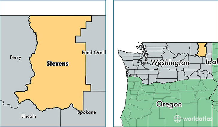
Stevens County is a county equivalent area found in Washington, USA. The county government of Stevens is found in the county seat of Colville.
With a total 6,580.4 sq. km of land and water area, Stevens County, Washington is the 228th largest county equivalent area in the United States. Home to 43,650 people, Stevens County has a total 21011 households earning 41742 on average per year.
Stevens County, Washington - Quick Facts
| FIPS Code | 53065 |
| Area Codes | 509 |
| Time Zone | PST |
| Major Cities | Colville (population: 12,019), Kettle Falls (population: 5,261), Chewelah (population: 5,109), Loon Lake (population: 2,106), Valley (population: 1,901), Ford (population: 1,784), Clayton (population: 1,668), Springdale (population: 1,532), Addy (population: 1,453), Evans (population: 877) |
| Land Area | 16,853 sq miles |
| Water Area | 2,478 sq miles |
| Household Income | $41,742 |
| Housing Units | 21,011 |
| Median Home Value | $173,500 |
| High School Grads | 91% of population |
| Holders of Bachelors Degrees | 19% of population |
| Retail Spending | $6,712 per capita |
| Food & Accomodation Sales | $27,654 per capita |
This page was last updated on June 30, 2016.