Where is Klickitat County, Washington?
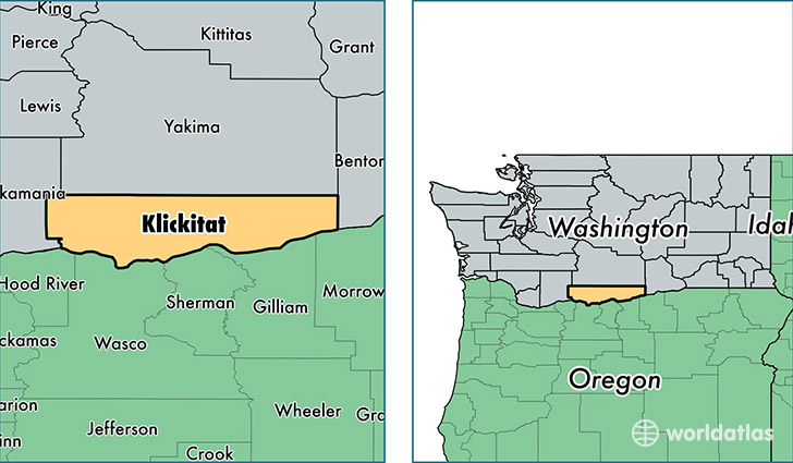
Klickitat County is a county equivalent area found in Washington, USA. The county government of Klickitat is found in the county seat of Goldendale.
With a total 4,931.72 sq. km of land and water area, Klickitat County, Washington is the 341st largest county equivalent area in the United States. Home to 20,861 people, Klickitat County has a total 9834 households earning 41694 on average per year.
Klickitat County, Washington - Quick Facts
| FIPS Code | 53039 |
| Area Codes | 509 |
| Time Zone | PST |
| Major Cities | Goldendale (population: 7,256), White Salmon (population: 6,260), Lyle (population: 1,767), Dallesport (population: 1,061), Trout Lake (population: 976), Glenwood (population: 465), Wishram (population: 411), Centerville (population: 407), Klickitat (population: 392), Roosevelt (population: 299) |
| Land Area | 8,054 sq miles |
| Water Area | 1,871 sq miles |
| Household Income | $41,694 |
| Housing Units | 9,834 |
| Median Home Value | $194,700 |
| High School Grads | 87% of population |
| Holders of Bachelors Degrees | 20% of population |
| Retail Spending | $3,268 per capita |
| Food & Accomodation Sales | $16,096 per capita |
This page was last updated on June 30, 2016.