Where is Lunenburg County, Virginia?
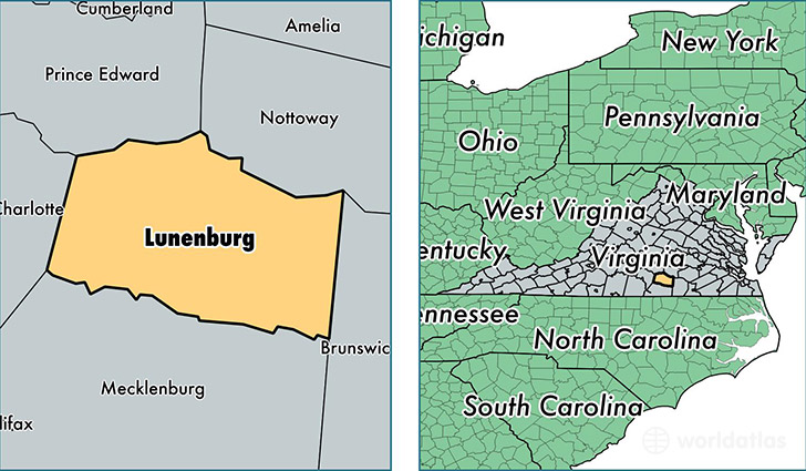
Lunenburg County is a county equivalent area found in Virginia, USA. The county government of Lunenburg is found in the county seat of Lunenburg.
With a total 1,119.86 sq. km of land and water area, Lunenburg County, Virginia is the 2432nd largest county equivalent area in the United States. Home to 12,466 people, Lunenburg County has a total 5899 households earning 35237 on average per year.
Lunenburg County, Virginia offers the following attraction to visitors: Oxon Cove Park & Oxon Hill Farm NHD
Lunenburg County, Virginia - Quick Facts
| FIPS Code | 51111 |
| Area Codes | 434 |
| Time Zone | EST |
| Major Cities | Victoria (population: 4,885), Kenbridge (population: 4,153), Lunenburg (population: 211) |
| Land Area | 4,813 sq miles |
| Water Area | 432 sq miles |
| Household Income | $35,237 |
| Housing Units | 5,899 |
| Median Home Value | $100,400 |
| High School Grads | 69% of population |
| Holders of Bachelors Degrees | 12% of population |
| Retail Spending | $4,227 per capita |
This page was last updated on June 30, 2016.