Where is Kane County, Utah?
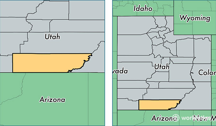
Kane County is a county equivalent area found in Utah, USA. The county government of Kane is found in the county seat of Kanab.
With a total 10,640.13 sq. km of land and water area, Kane County, Utah is the 124th largest county equivalent area in the United States. Home to 7,254 people, Kane County has a total 5834 households earning 48540 on average per year.
Kane County, Utah offers the following attractions to visitors: Grand Staircase-Escalante NM, Zion NP
Kane County, Utah - Quick Facts
| FIPS Code | 49025 |
| Area Codes | 435 |
| Time Zone | MST |
| Major Cities | Kanab (population: 5,630), Orderville (population: 540), Glendale (population: 401), Duck Creek Village (population: 251), Alton (population: 132), Mount Carmel (population: 113) |
| Land Area | 2,801 sq miles |
| Water Area | 3,990 sq miles |
| Household Income | $48,540 |
| Housing Units | 5,834 |
| Median Home Value | $162,300 |
| High School Grads | 94% of population |
| Holders of Bachelors Degrees | 25% of population |
| Retail Spending | $11,098 per capita |
| Food & Accomodation Sales | $20,941 per capita |
This page was last updated on June 30, 2016.