Where is Mohave County, Arizona?
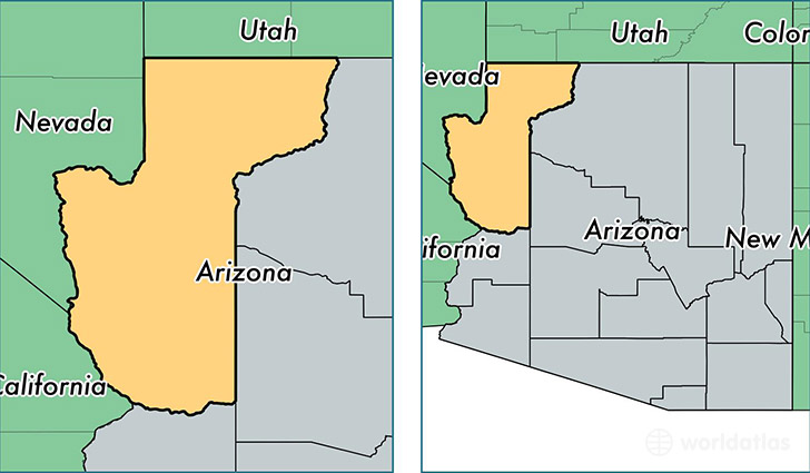
Mohave County is a county equivalent area found in Arizona, USA. The county government of Mohave is found in the county seat of Kingman.
With a total 34,863.07 sq. km of land and water area, Mohave County, Arizona is the 19th largest county equivalent area in the United States. Home to 203,361 people, Mohave County has a total 111725 households earning 39200 on average per year.
Mohave County, Arizona offers the following attractions to visitors: Grand Canyon Parashant NM, Grand Canyon West Airport, Pipe Spring NM
Mohave County, Arizona - Quick Facts
| FIPS Code | 4015 |
| Area Codes | 928 |
| Time Zone | MST |
| Major Cities | Lake Havasu City (population: 56,684), Kingman (population: 51,557), Bullhead City (population: 41,220), Fort Mohave (population: 14,081), Golden Valley (population: 12,293), Mohave Valley (population: 7,014), Colorado City (population: 6,180), Littlefield (population: 3,994), Dolan Springs (population: 2,258), Topock (population: 2,137) |
| Land Area | 78,518 sq miles |
| Water Area | 13,311 sq miles |
| Household Income | $39,200 |
| Housing Units | 111,725 |
| Median Home Value | $133,900 |
| High School Grads | 84% of population |
| Holders of Bachelors Degrees | 12% of population |
| Retail Spending | $14,489 per capita |
| Food & Accomodation Sales | $274,299 per capita |
| Universities and Colleges | Charles of Italy Beauty College |
This page was last updated on June 30, 2016.