Where is Bristol County, Rhode Island?
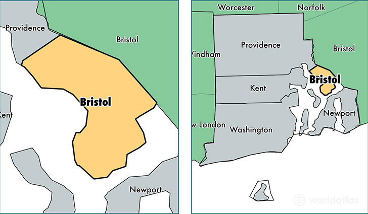
Bristol County is a county equivalent area found in Rhode Island, USA.
With a total 115.9 sq. km of land and water area, Bristol County, Rhode Island is the 3113th largest county equivalent area in the United States. Home to 49,060 people, Bristol County has a total 20752 households earning 71238 on average per year.
Bristol County, Rhode Island - Quick Facts
| FIPS Code | 44001 |
| Area Codes | 401 |
| Time Zone | EST |
| Major Cities | Bristol (population: 22,601), Barrington (population: 16,070), Warren (population: 10,471), Prudence Island (population: 215) |
| Land Area | 18,942 sq miles |
| Water Area | 24 sq miles |
| Household Income | $71,238 |
| Housing Units | 20,752 |
| Median Home Value | $341,000 |
| High School Grads | 90% of population |
| Holders of Bachelors Degrees | 44% of population |
| Retail Spending | $5,917 per capita |
| Food & Accomodation Sales | $68,287 per capita |
| Universities and Colleges | Roger Williams University |
This page was last updated on June 30, 2016.