Where is Josephine County, Oregon?
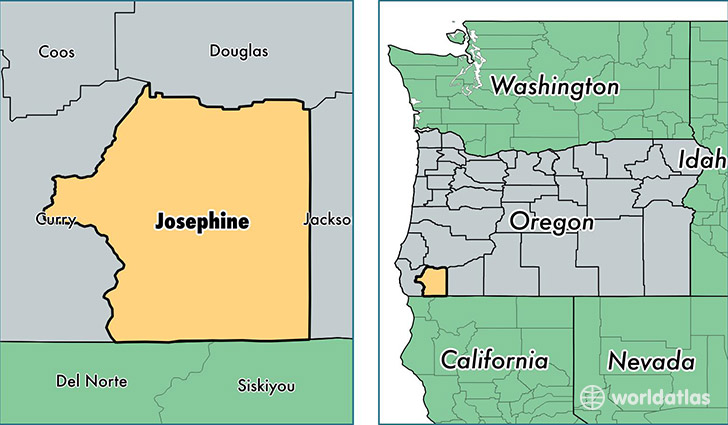
Josephine County is a county equivalent area found in Oregon, USA. The county government of Josephine is found in the county seat of Grants Pass.
With a total 4,252.32 sq. km of land and water area, Josephine County, Oregon is the 409th largest county equivalent area in the United States. Home to 83,599 people, Josephine County has a total 37830 households earning 37733 on average per year.
Josephine County, Oregon offers the following attraction to visitors: Oregon Caves NM
Josephine County, Oregon - Quick Facts
| FIPS Code | 41033 |
| Area Codes | 541 |
| Time Zone | PST |
| Major Cities | Grants Pass (population: 68,117), Cave Junction (population: 6,280), Merlin (population: 2,384), Williams (population: 2,211), Selma (population: 2,068), Wolf Creek (population: 1,527), O Brien (population: 757), Wilderville (population: 737), Kerby (population: 523) |
| Land Area | 32,278 sq miles |
| Water Area | 1,640 sq miles |
| Household Income | $37,733 |
| Housing Units | 37,830 |
| Median Home Value | $220,900 |
| High School Grads | 88% of population |
| Holders of Bachelors Degrees | 17% of population |
| Retail Spending | $12,694 per capita |
| Food & Accomodation Sales | $108,909 per capita |
This page was last updated on June 30, 2016.