Where is Greene County, Ohio?
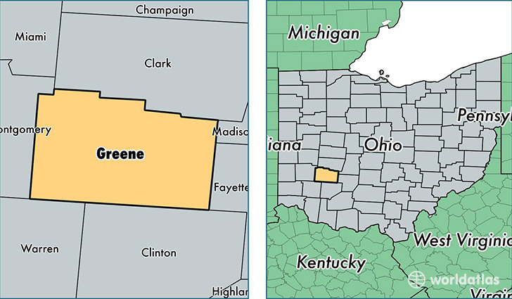
Greene County is a county equivalent area found in Ohio, USA. The county government of Greene is found in the county seat of Xenia.
With a total 1,078.1 sq. km of land and water area, Greene County, Ohio is the 2509th largest county equivalent area in the United States. Home to 163,820 people, Greene County has a total 68927 households earning 58080 on average per year.
Greene County, Ohio offers the following attractions to visitors: Charles Young Buffalo Soldiers National Monument, Dayton Aviation Heritage NHP
Greene County, Ohio - Quick Facts
| FIPS Code | 39057 |
| Area Codes | 937 |
| Time Zone | EST |
| Major Cities | Dayton (population: 63,673), Fairborn (population: 40,993), Xenia (population: 37,711), Bellbrook (population: 10,845), Jamestown (population: 7,022), Cedarville (population: 5,989), Yellow Springs (population: 5,228), Spring Valley (population: 2,482), Wilberforce (population: 2,025), Bowersville (population: 342) |
| Land Area | 63,251 sq miles |
| Water Area | 414 sq miles |
| Household Income | $58,080 |
| Housing Units | 68,927 |
| Median Home Value | $158,000 |
| High School Grads | 92% of population |
| Holders of Bachelors Degrees | 36% of population |
| Retail Spending | $12,776 per capita |
| Food & Accomodation Sales | $283,253 per capita |
| Universities and Colleges | Central State University, Payne Theological Seminary, Wilberforce University |
This page was last updated on June 30, 2016.