Where is Adams County, Ohio?
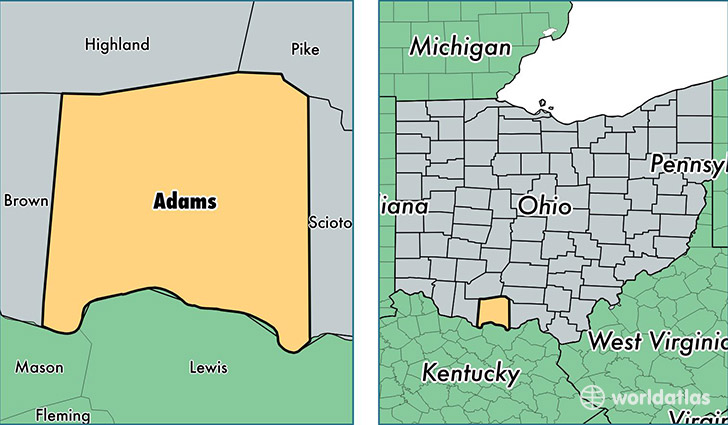
Adams County is a county equivalent area found in Ohio, USA. The county government of Adams is found in the county seat of West Union.
With a total 1,518.37 sq. km of land and water area, Adams County, Ohio is the 1795th largest county equivalent area in the United States. Home to 28,129 people, Adams County has a total 12766 households earning 35678 on average per year.
Adams County, Ohio - Quick Facts
| FIPS Code | 39001 |
| Area Codes | 937 |
| Time Zone | EST |
| Major Cities | West Union (population: 8,918), Peebles (population: 8,236), Winchester (population: 4,852), Manchester (population: 4,241), Seaman (population: 2,791), Blue Creek (population: 1,546), Lynx (population: 431), Cherry Fork (population: 29) |
| Land Area | 10,861 sq miles |
| Water Area | 584 sq miles |
| Household Income | $35,678 |
| Housing Units | 12,766 |
| Median Home Value | $92,900 |
| High School Grads | 77% of population |
| Holders of Bachelors Degrees | 11% of population |
| Retail Spending | $7,485 per capita |
| Food & Accomodation Sales | $19,039 per capita |
This page was last updated on June 30, 2016.