Where is Sullivan County, New York?
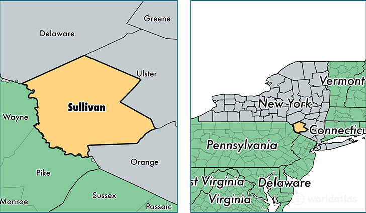
Sullivan County is a county equivalent area found in New York, USA. The county government of Sullivan is found in the county seat of Monticello.
With a total 2,581.5 sq. km of land and water area, Sullivan County, New York is the 774th largest county equivalent area in the United States. Home to 75,943 people, Sullivan County has a total 49304 households earning 48089 on average per year.
Sullivan County, New York - Quick Facts
| FIPS Code | 36105 |
| Area Codes | 845,607 |
| Time Zone | EST |
| Major Cities | Monticello (population: 11,213), Liberty (population: 7,150), Bloomingburg (population: 6,584), Wurtsboro (population: 4,474), Livingston Manor (population: 4,003), Woodbourne (population: 2,879), South Fallsburg (population: 2,436), Rock Hill (population: 2,274), Roscoe (population: 2,155), Jeffersonville (population: 2,055) |
| Land Area | 29,322 sq miles |
| Water Area | 968 sq miles |
| Household Income | $48,089 |
| Housing Units | 49,304 |
| Median Home Value | $172,100 |
| High School Grads | 85% of population |
| Holders of Bachelors Degrees | 21% of population |
| Retail Spending | $10,670 per capita |
| Food & Accomodation Sales | $120,652 per capita |
| Universities and Colleges | Yeshivath Zichron Moshe |
This page was last updated on June 30, 2016.