Where is Franklin County, New York?
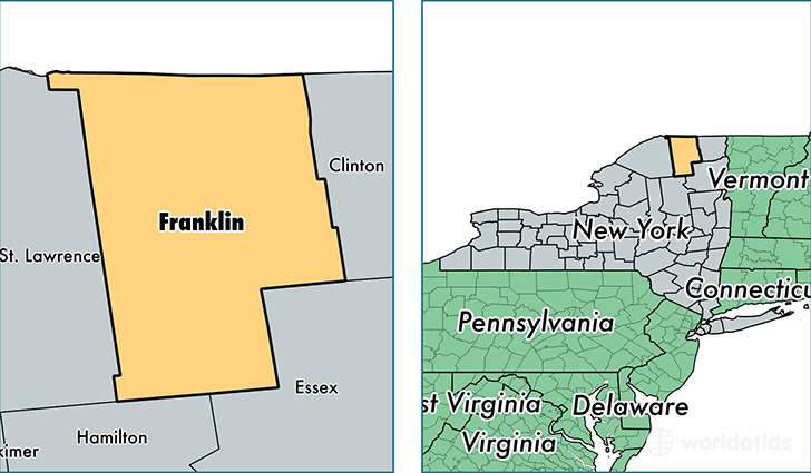
Franklin County is a county equivalent area found in New York, USA. The county government of Franklin is found in the county seat of Malone.
With a total 4,396.3 sq. km of land and water area, Franklin County, New York is the 394th largest county equivalent area in the United States. Home to 51,262 people, Franklin County has a total 25185 households earning 45667 on average per year.
Franklin County, New York - Quick Facts
| FIPS Code | 36033 |
| Area Codes | 518 |
| Time Zone | EST |
| Major Cities | Malone (population: 15,896), Saranac Lake (population: 7,491), Tupper Lake (population: 6,143), Hogansburg (population: 3,525), North Bangor (population: 2,926), Chateaugay (population: 2,852), Constable (population: 2,216), Brushton (population: 2,143), Moira (population: 1,732), Fort Covington (population: 1,577) |
| Land Area | 19,792 sq miles |
| Water Area | 1,629 sq miles |
| Household Income | $45,667 |
| Housing Units | 25,185 |
| Median Home Value | $97,100 |
| High School Grads | 84% of population |
| Holders of Bachelors Degrees | 17% of population |
| Retail Spending | $9,437 per capita |
| Food & Accomodation Sales | $42,710 per capita |
| Universities and Colleges | Paul Smiths College of Arts and Science |
This page was last updated on June 30, 2016.