Where is Williams County, North Dakota?
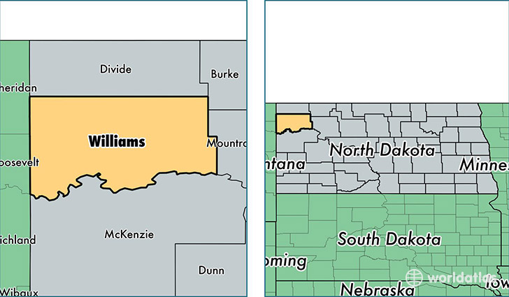
Williams County is a county equivalent area found in North Dakota, USA. The county government of Williams is found in the county seat of Williston.
With a total 5,562.96 sq. km of land and water area, Williams County, North Dakota is the 292nd largest county equivalent area in the United States. Home to 32,130 people, Williams County has a total 14673 households earning 76210 on average per year.
Williams County, North Dakota offers the following attraction to visitors: Fort Union Trading Post NHS
Williams County, North Dakota - Quick Facts
| FIPS Code | 38105 |
| Area Codes | 701 |
| Time Zone | CST |
| Major Cities | Williston (population: 21,901), Tioga (population: 2,081), Ray (population: 1,052), Epping (population: 555), Grenora (population: 434), Trenton (population: 348), Alamo (population: 246), Wildrose (population: 231), Zahl (population: 150), McGregor (population: 148) |
| Land Area | 12,405 sq miles |
| Water Area | 2,077 sq miles |
| Household Income | $76,210 |
| Housing Units | 14,673 |
| Median Home Value | $151,400 |
| High School Grads | 90% of population |
| Holders of Bachelors Degrees | 20% of population |
| Retail Spending | $20,610 per capita |
| Food & Accomodation Sales | $36,595 per capita |
This page was last updated on June 30, 2016.