Where is Alleghany County, North Carolina?
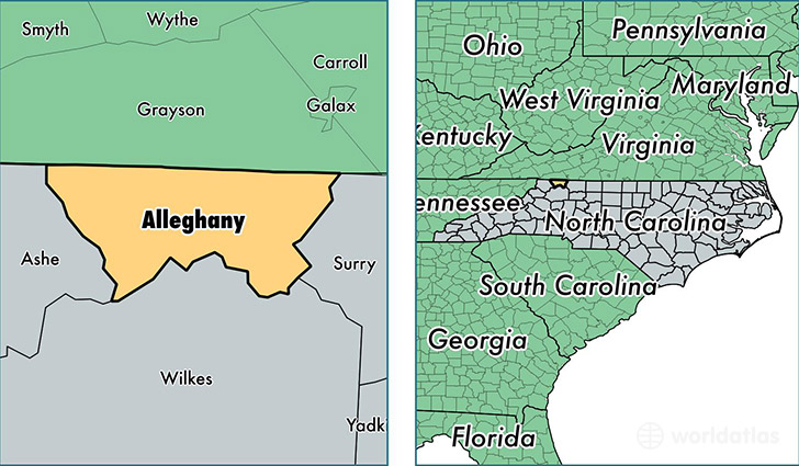
Alleghany County is a county equivalent area found in North Carolina, USA. The county government of Alleghany is found in the county seat of Sparta.
With a total 612.66 sq. km of land and water area, Alleghany County, North Carolina is the 2967th largest county equivalent area in the United States. Home to 10,879 people, Alleghany County has a total 8092 households earning 35170 on average per year.
Alleghany County, North Carolina offers the following attraction to visitors: Blue Ridge Parkway
Alleghany County, North Carolina - Quick Facts
| FIPS Code | 37005 |
| Area Codes | 336 |
| Time Zone | EST |
| Major Cities | Sparta (population: 6,485), Ennice (population: 1,619), Laurel Springs (population: 1,473), Glade Valley (population: 1,128), Piney Creek (population: 601), Roaring Gap (population: 293) |
| Land Area | 4,200 sq miles |
| Water Area | 235 sq miles |
| Household Income | $35,170 |
| Housing Units | 8,092 |
| Median Home Value | $156,100 |
| High School Grads | 79% of population |
| Holders of Bachelors Degrees | 18% of population |
| Retail Spending | $6,719 per capita |
| Food & Accomodation Sales | $11,251 per capita |
This page was last updated on June 30, 2016.