Where is Mississippi County, Missouri?
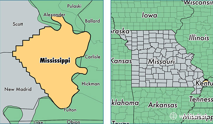
Mississippi County is a county equivalent area found in Missouri, USA. The county government of Mississippi is found in the county seat of Charleston.
With a total 1,110.49 sq. km of land and water area, Mississippi County, Missouri is the 2454th largest county equivalent area in the United States. Home to 14,232 people, Mississippi County has a total 5679 households earning 29787 on average per year.
Mississippi County, Missouri - Quick Facts
| FIPS Code | 29133 |
| Area Codes | 573 |
| Time Zone | CST |
| Major Cities | Charleston (population: 7,117), East Prairie (population: 5,797), Bertrand (population: 1,243), Wyatt (population: 429), Anniston (population: 225) |
| Land Area | 5,495 sq miles |
| Water Area | 412 sq miles |
| Household Income | $29,787 |
| Housing Units | 5,679 |
| Median Home Value | $60,600 |
| High School Grads | 72% of population |
| Holders of Bachelors Degrees | 10% of population |
| Retail Spending | $11,946 per capita |
| Food & Accomodation Sales | $10,000 per capita |
This page was last updated on June 30, 2016.