Where is Iron County, Missouri?
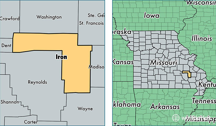
Iron County is a county equivalent area found in Missouri, USA. The county government of Iron is found in the county seat of Ironton.
With a total 1,429.84 sq. km of land and water area, Iron County, Missouri is the 2000th largest county equivalent area in the United States. Home to 10,267 people, Iron County has a total 5259 households earning 36387 on average per year.
Iron County, Missouri - Quick Facts
| FIPS Code | 29093 |
| Area Codes | 573 |
| Time Zone | CST |
| Major Cities | Ironton (population: 4,312), Annapolis (population: 1,588), Arcadia (population: 1,199), Belleview (population: 860), Viburnum (population: 753), Pilot Knob (population: 705), Des Arc (population: 595), Middle Brook (population: 519), Bixby (population: 252), Vulcan (population: 140) |
| Land Area | 3,964 sq miles |
| Water Area | 550 sq miles |
| Household Income | $36,387 |
| Housing Units | 5,259 |
| Median Home Value | $78,800 |
| High School Grads | 77% of population |
| Holders of Bachelors Degrees | 11% of population |
| Retail Spending | $6,524 per capita |
| Food & Accomodation Sales | $5,296 per capita |
This page was last updated on June 30, 2016.