Where is Franklin County, Kentucky?
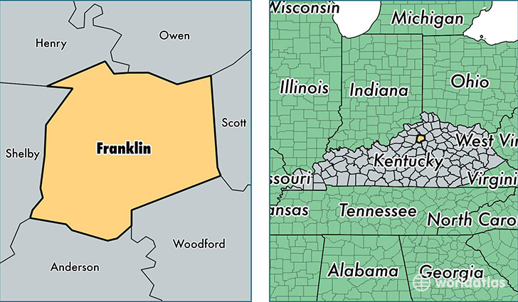
Franklin County is a county equivalent area found in Kentucky, USA. The county government of Franklin is found in the county seat of Frankfort.
With a total 549.1 sq. km of land and water area, Franklin County, Kentucky is the 3002nd largest county equivalent area in the United States. Home to 49,880 people, Franklin County has a total 23151 households earning 46071 on average per year.
Franklin County, Kentucky - Quick Facts
| FIPS Code | 21073 |
| Area Codes | 502 |
| Time Zone | EST |
| Major Cities | Frankfort (population: 50,564) |
| Land Area | 19,259 sq miles |
| Water Area | 208 sq miles |
| Household Income | $46,071 |
| Housing Units | 23,151 |
| Median Home Value | $139,300 |
| High School Grads | 86% of population |
| Holders of Bachelors Degrees | 27% of population |
| Retail Spending | $12,816 per capita |
| Food & Accomodation Sales | $80,515 per capita |
This page was last updated on June 30, 2016.