Where is Labette County, Kansas?
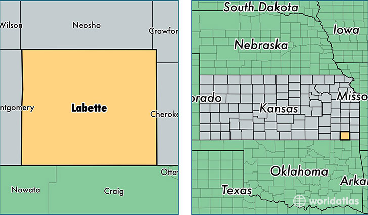
Labette County is a county equivalent area found in Kansas, USA. The county government of Labette is found in the county seat of Oswego.
With a total 1,691.57 sq. km of land and water area, Labette County, Kansas is the 1564th largest county equivalent area in the United States. Home to 20,960 people, Labette County has a total 10026 households earning 40916 on average per year.
Labette County, Kansas - Quick Facts
| FIPS Code | 20099 |
| Area Codes | 620 |
| Time Zone | CST |
| Major Cities | Parsons (population: 12,815), Oswego (population: 2,791), Chetopa (population: 1,657), Altamont (population: 1,512), Edna (population: 954), Mound Valley (population: 812), Dennis (population: 367), Bartlett (population: 203) |
| Land Area | 8,093 sq miles |
| Water Area | 645 sq miles |
| Household Income | $40,916 |
| Housing Units | 10,026 |
| Median Home Value | $66,100 |
| High School Grads | 90% of population |
| Holders of Bachelors Degrees | 20% of population |
| Retail Spending | $9,305 per capita |
| Food & Accomodation Sales | $14,150 per capita |
This page was last updated on June 30, 2016.