Where is Neosho County, Kansas?
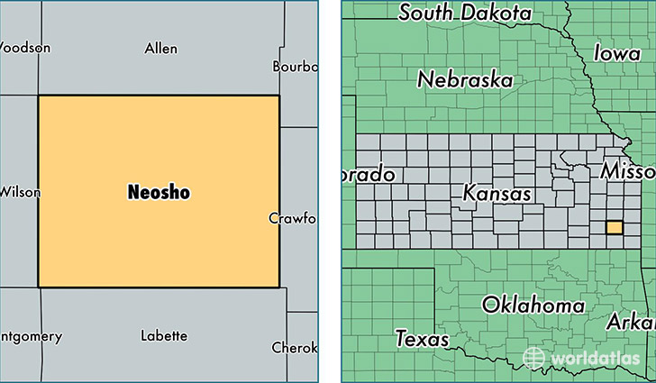
Neosho County is a county equivalent area found in Kansas, USA. The county government of Neosho is found in the county seat of Erie.
With a total 1,496.48 sq. km of land and water area, Neosho County, Kansas is the 1846th largest county equivalent area in the United States. Home to 16,416 people, Neosho County has a total 7625 households earning 42071 on average per year.
Neosho County, Kansas - Quick Facts
| FIPS Code | 20133 |
| Area Codes | 620 |
| Time Zone | CST |
| Major Cities | Chanute (population: 11,218), Erie (population: 2,200), Thayer (population: 1,275), Saint Paul (population: 1,021), Galesburg (population: 473), Stark (population: 189) |
| Land Area | 6,338 sq miles |
| Water Area | 571 sq miles |
| Household Income | $42,071 |
| Housing Units | 7,625 |
| Median Home Value | $68,900 |
| High School Grads | 90% of population |
| Holders of Bachelors Degrees | 16% of population |
| Retail Spending | $12,360 per capita |
| Food & Accomodation Sales | $13,085 per capita |
This page was last updated on June 30, 2016.