Where is Jefferson County, Kansas?
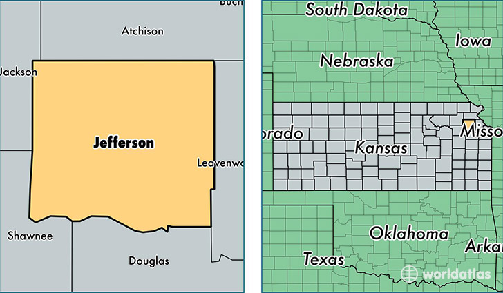
Jefferson County is a county equivalent area found in Kansas, USA. The county government of Jefferson is found in the county seat of Oskaloosa.
With a total 1,441.79 sq. km of land and water area, Jefferson County, Kansas is the 1985th largest county equivalent area in the United States. Home to 18,855 people, Jefferson County has a total 8167 households earning 56875 on average per year.
Jefferson County, Kansas - Quick Facts
| FIPS Code | 20087 |
| Area Codes | 913,785 |
| Time Zone | CST |
| Major Cities | Meriden (population: 3,331), McLouth (population: 2,853), Ozawkie (population: 2,635), Oskaloosa (population: 2,611), Perry (population: 2,512), Valley Falls (population: 2,433), Nortonville (population: 1,112), Winchester (population: 1,061), Grantville (population: 573) |
| Land Area | 7,280 sq miles |
| Water Area | 532 sq miles |
| Household Income | $56,875 |
| Housing Units | 8,167 |
| Median Home Value | $125,800 |
| High School Grads | 92% of population |
| Holders of Bachelors Degrees | 21% of population |
| Retail Spending | $3,880 per capita |
| Food & Accomodation Sales | $4,409 per capita |
This page was last updated on June 30, 2016.