Where is Clay County, Kansas?
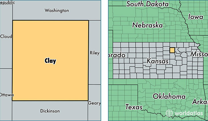
Clay County is a county equivalent area found in Kansas, USA. The county government of Clay is found in the county seat of Clay Center.
With a total 1,698. sq. km of land and water area, Clay County, Kansas is the 1558th largest county equivalent area in the United States. Home to 8,317 people, Clay County has a total 4032 households earning 45233 on average per year.
Clay County, Kansas - Quick Facts
| FIPS Code | 20027 |
| Area Codes | 785 |
| Time Zone | CST |
| Major Cities | Clay Center (population: 6,016), Wakefield (population: 1,423), Green (population: 324), Morganville (population: 306), Longford (population: 260) |
| Land Area | 3,211 sq miles |
| Water Area | 645 sq miles |
| Household Income | $45,233 |
| Housing Units | 4,032 |
| Median Home Value | $85,700 |
| High School Grads | 95% of population |
| Holders of Bachelors Degrees | 21% of population |
| Retail Spending | $8,756 per capita |
| Food & Accomodation Sales | $5,547 per capita |
This page was last updated on June 30, 2016.