Where is Posey County, Indiana?
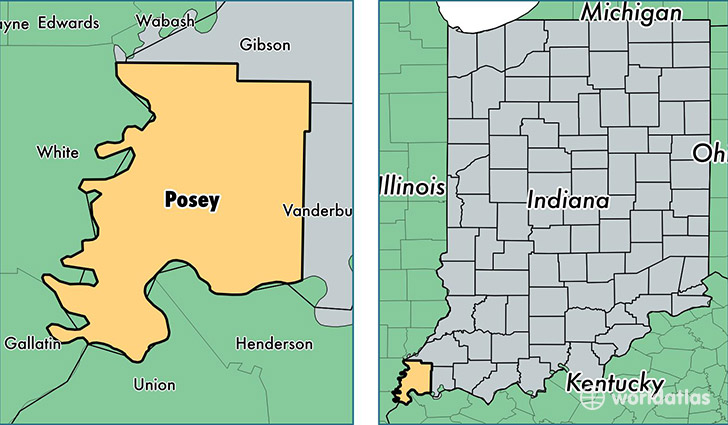
Posey County is a county equivalent area found in Indiana, USA. The county government of Posey is found in the county seat of Mount Vernon.
With a total 1,086.05 sq. km of land and water area, Posey County, Indiana is the 2494th largest county equivalent area in the United States. Home to 25,540 people, Posey County has a total 11269 households earning 58750 on average per year.
Posey County, Indiana - Quick Facts
| FIPS Code | 18129 |
| Area Codes | 812 |
| Time Zone | CST |
| Major Cities | Mount Vernon (population: 13,265), Wadesville (population: 3,534), Poseyville (population: 2,513), New Harmony (population: 2,017), Cynthiana (population: 851), Griffin (population: 359) |
| Land Area | 9,861 sq miles |
| Water Area | 410 sq miles |
| Household Income | $58,750 |
| Housing Units | 11,269 |
| Median Home Value | $127,900 |
| High School Grads | 92% of population |
| Holders of Bachelors Degrees | 21% of population |
| Retail Spending | $10,225 per capita |
| Food & Accomodation Sales | $17,130 per capita |
This page was last updated on June 30, 2016.