Where is Vanderburgh County, Indiana?
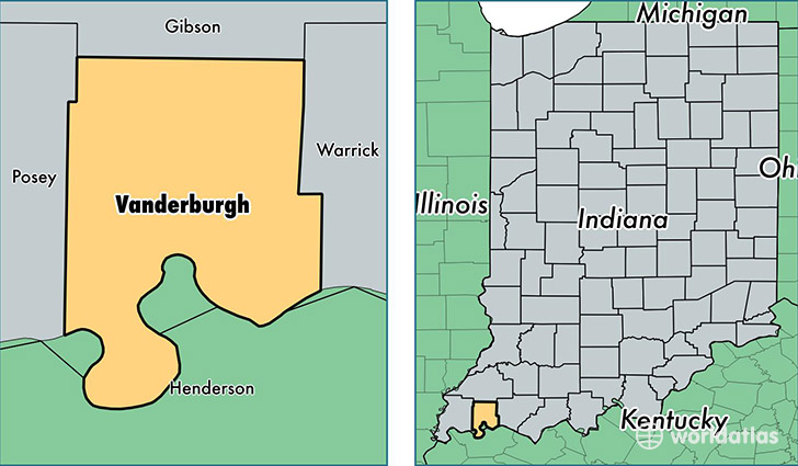
Vanderburgh County is a county equivalent area found in Indiana, USA. The county government of Vanderburgh is found in the county seat of Evansville.
With a total 612.09 sq. km of land and water area, Vanderburgh County, Indiana is the 2969th largest county equivalent area in the United States. Home to 182,006 people, Vanderburgh County has a total 83065 households earning 43540 on average per year.
Vanderburgh County, Indiana - Quick Facts
| FIPS Code | 18163 |
| Area Codes | 812 |
| Time Zone | CST |
| Major Cities | Evansville (population: 184,008) |
| Land Area | 70,273 sq miles |
| Water Area | 234 sq miles |
| Household Income | $43,540 |
| Housing Units | 83,065 |
| Median Home Value | $112,900 |
| High School Grads | 89% of population |
| Holders of Bachelors Degrees | 23% of population |
| Retail Spending | $17,308 per capita |
| Food & Accomodation Sales | $516,819 per capita |
| Universities and Colleges | University of Evansville, University of Southern Indiana, Rogers Academy of Hair Design, Indiana Business College-Evansville |
This page was last updated on June 30, 2016.