Where is Pope County, Illinois?
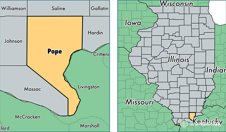
Pope County is a county equivalent area found in Illinois, USA. The county government of Pope is found in the county seat of Golconda.
With a total 969.44 sq. km of land and water area, Pope County, Illinois is the 2677th largest county equivalent area in the United States. Home to 4,276 people, Pope County has a total 2459 households earning 38371 on average per year.
Pope County, Illinois - Quick Facts
| FIPS Code | 17151 |
| Area Codes | 618 |
| Time Zone | CST |
| Major Cities | Golconda (population: 2,903), Herod (population: 527), Eddyville (population: 280) |
| Land Area | 1,651 sq miles |
| Water Area | 369 sq miles |
| Household Income | $38,371 |
| Housing Units | 2,459 |
| Median Home Value | $98,900 |
| High School Grads | 88% of population |
| Holders of Bachelors Degrees | 14% of population |
| Retail Spending | $2,245 per capita |
| Food & Accomodation Sales | $1,219 per capita |
This page was last updated on June 30, 2016.