Where is Clay County, Illinois?
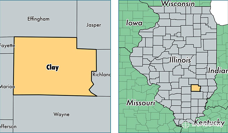
Clay County is a county equivalent area found in Illinois, USA. The county government of Clay is found in the county seat of Louisville.
With a total 1,216.24 sq. km of land and water area, Clay County, Illinois is the 2284th largest county equivalent area in the United States. Home to 13,520 people, Clay County has a total 6332 households earning 40640 on average per year.
Clay County, Illinois - Quick Facts
| FIPS Code | 17025 |
| Area Codes | 618 |
| Time Zone | CST |
| Major Cities | Flora (population: 6,694), Louisville (population: 2,970), Clay City (population: 1,754), Xenia (population: 1,602), Sailor Springs (population: 84) |
| Land Area | 5,220 sq miles |
| Water Area | 468 sq miles |
| Household Income | $40,640 |
| Housing Units | 6,332 |
| Median Home Value | $75,300 |
| High School Grads | 88% of population |
| Holders of Bachelors Degrees | 14% of population |
| Retail Spending | $8,375 per capita |
This page was last updated on June 30, 2016.