Where is Guthrie County, Iowa?
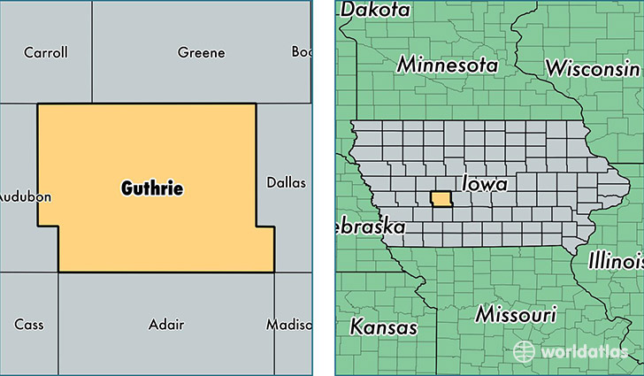
Guthrie County is a county equivalent area found in Iowa, USA. The county government of Guthrie is found in the county seat of Guthrie Center.
With a total 1,536.05 sq. km of land and water area, Guthrie County, Iowa is the 1764th largest county equivalent area in the United States. Home to 10,722 people, Guthrie County has a total 5726 households earning 50609 on average per year.
Guthrie County, Iowa - Quick Facts
| FIPS Code | 19077 |
| Area Codes | 641,712,515 |
| Time Zone | CST |
| Major Cities | Panora (population: 2,778), Guthrie Center (population: 2,630), Stuart (population: 2,281), Casey (population: 845), Bayard (population: 679), Menlo (population: 640), Bagley (population: 574), Yale (population: 480), Jamaica (population: 356) |
| Land Area | 4,140 sq miles |
| Water Area | 591 sq miles |
| Household Income | $50,609 |
| Housing Units | 5,726 |
| Median Home Value | $97,100 |
| High School Grads | 91% of population |
| Holders of Bachelors Degrees | 17% of population |
| Retail Spending | $8,262 per capita |
| Food & Accomodation Sales | $8,345 per capita |
This page was last updated on June 30, 2016.