Allamakee County, IA, USA
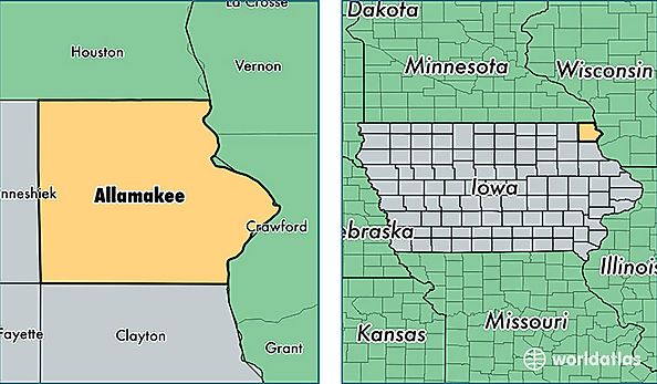
Allamakee County is a county equivalent area found in Iowa, USA. The county government of Allamakee is found in the county seat of Waukon.
With a total 1,706.21 sq. km of land and water area, Allamakee County, Iowa is the 1540th largest county equivalent area in the United States. Home to 14,038 people, Allamakee County has a total 7592 households earning 48831 on average per year.
Allamakee County, Iowa offers the following attraction to visitors: Effigy Mounds NM
Allamakee County, Iowa - Quick Facts
| FIPS Code | 19005 |
| Area Codes | 563 |
| Time Zone | CST |
| Major Cities | Waukon (population: 6,262), Postville (population: 3,259), Lansing (population: 2,124), Harpers Ferry (population: 1,032), New Albin (population: 861), Waterville (population: 595), Dorchester (population: 529) |
| Land Area | 5,420 sq miles |
| Water Area | 639 sq miles |
| Household Income | $48,831 |
| Housing Units | 7,592 |
| Median Home Value | $114,400 |
| High School Grads | 89% of population |
| Holders of Bachelors Degrees | 15% of population |
| Retail Spending | $8,922 per capita |
| Food & Accomodation Sales | $8,456 per capita |