Where is Marion County, Florida?
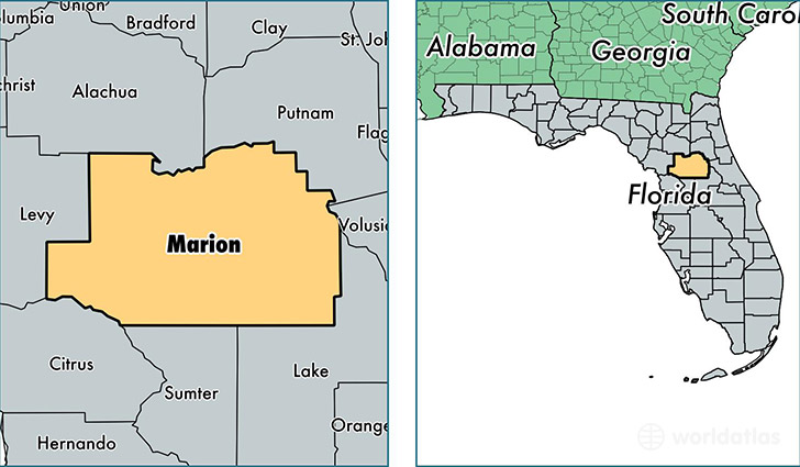
Marion County is a county equivalent area found in Florida, USA. The county government of Marion is found in the county seat of Ocala.
With a total 4,306.28 sq. km of land and water area, Marion County, Florida is the 404th largest county equivalent area in the United States. Home to 339,167 people, Marion County has a total 162448 households earning 39453 on average per year.
Marion County, Florida - Quick Facts
| FIPS Code | 12083 |
| Area Codes | 352 |
| Time Zone | EST |
| Major Cities | Ocala (population: 209,611), Summerfield (population: 27,771), Dunnellon (population: 20,297), Belleview (population: 16,475), Silver Springs (population: 10,409), Ocklawaha (population: 8,360), Fort McCoy (population: 8,171), Citra (population: 6,703), Reddick (population: 5,060), Anthony (population: 4,156) |
| Land Area | 130,953 sq miles |
| Water Area | 1,588 sq miles |
| Household Income | $39,453 |
| Housing Units | 162,448 |
| Median Home Value | $119,400 |
| High School Grads | 85% of population |
| Holders of Bachelors Degrees | 17% of population |
| Retail Spending | $13,060 per capita |
| Food & Accomodation Sales | $353,110 per capita |
This page was last updated on June 30, 2016.