Where is Levy County, Florida?
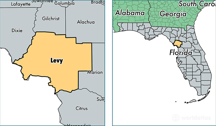
Levy County is a county equivalent area found in Florida, USA. The county government of Levy is found in the county seat of Bronson.
With a total 3,659.12 sq. km of land and water area, Levy County, Florida is the 482nd largest county equivalent area in the United States. Home to 39,613 people, Levy County has a total 19688 households earning 34348 on average per year.
Levy County, Florida - Quick Facts
| FIPS Code | 12075 |
| Area Codes | 352 |
| Time Zone | EST |
| Major Cities | Williston (population: 11,873), Chiefland (population: 7,978), Bronson (population: 5,477), Morriston (population: 5,010), Inglis (population: 2,757), Cedar Key (population: 1,803), Yankeetown (population: 503), Gulf Hammock (population: 389), Otter Creek (population: 148) |
| Land Area | 15,295 sq miles |
| Water Area | 1,118 sq miles |
| Household Income | $34,348 |
| Housing Units | 19,688 |
| Median Home Value | $92,200 |
| High School Grads | 81% of population |
| Holders of Bachelors Degrees | 11% of population |
| Retail Spending | $8,920 per capita |
| Food & Accomodation Sales | $32,401 per capita |
This page was last updated on June 30, 2016.