Where is Perry County, Arkansas?
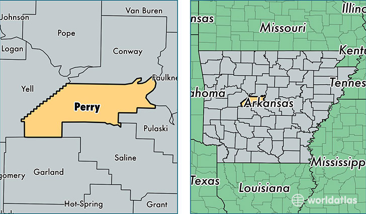
Perry County is a county equivalent area found in Arkansas, USA. The county government of Perry is found in the county seat of Perryville.
With a total 1,451.76 sq. km of land and water area, Perry County, Arkansas is the 1973rd largest county equivalent area in the United States. Home to 10,245 people, Perry County has a total 4868 households earning 42455 on average per year.
Perry County, Arkansas - Quick Facts
| FIPS Code | 5105 |
| Area Codes | 501 |
| Time Zone | CST |
| Major Cities | Perryville (population: 3,638), Bigelow (population: 3,245), Houston (population: 1,794), Perry (population: 899), Casa (population: 839), Adona (population: 561) |
| Land Area | 3,956 sq miles |
| Water Area | 552 sq miles |
| Household Income | $42,455 |
| Housing Units | 4,868 |
| Median Home Value | $77,700 |
| High School Grads | 85% of population |
| Holders of Bachelors Degrees | 12% of population |
| Retail Spending | $3,162 per capita |
| Food & Accomodation Sales | $1,718 per capita |
This page was last updated on June 30, 2016.