Where is Crawford County, Arkansas?
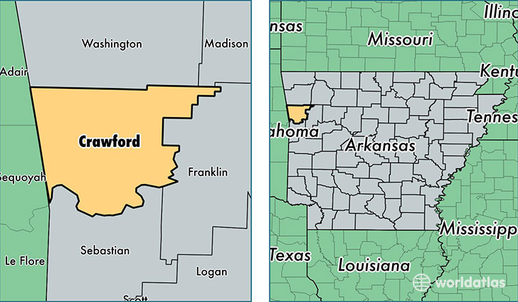
Crawford County is a county equivalent area found in Arkansas, USA. The county government of Crawford is found in the county seat of Van Buren.
With a total 1,562.26 sq. km of land and water area, Crawford County, Arkansas is the 1729th largest county equivalent area in the United States. Home to 61,697 people, Crawford County has a total 26290 households earning 39479 on average per year.
Crawford County, Arkansas - Quick Facts
| FIPS Code | 5033 |
| Area Codes | 479 |
| Time Zone | CST |
| Major Cities | Van Buren (population: 34,072), Alma (population: 13,786), Mulberry (population: 4,427), Mountainburg (population: 3,653), Rudy (population: 2,944), Cedarville (population: 1,596), Chester (population: 1,046), Dyer (population: 576), Natural Dam (population: 517), Uniontown (population: 437) |
| Land Area | 23,821 sq miles |
| Water Area | 591 sq miles |
| Household Income | $39,479 |
| Housing Units | 26,290 |
| Median Home Value | $102,800 |
| High School Grads | 82% of population |
| Holders of Bachelors Degrees | 14% of population |
| Retail Spending | $7,666 per capita |
| Food & Accomodation Sales | $53,249 per capita |
This page was last updated on June 30, 2016.