Where is Columbia County, Arkansas?
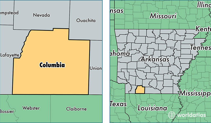
Columbia County is a county equivalent area found in Arkansas, USA. The county government of Columbia is found in the county seat of Magnolia.
With a total 1,985.88 sq. km of land and water area, Columbia County, Arkansas is the 1246th largest county equivalent area in the United States. Home to 23,933 people, Columbia County has a total 11513 households earning 35128 on average per year.
Columbia County, Arkansas - Quick Facts
| FIPS Code | 5027 |
| Area Codes | 870 |
| Time Zone | CST |
| Major Cities | Magnolia (population: 16,790), Waldo (population: 3,513), Taylor (population: 2,231), Emerson (population: 1,729), McNeil (population: 1,048) |
| Land Area | 9,241 sq miles |
| Water Area | 766 sq miles |
| Household Income | $35,128 |
| Housing Units | 11,513 |
| Median Home Value | $78,900 |
| High School Grads | 85% of population |
| Holders of Bachelors Degrees | 20% of population |
| Retail Spending | $8,143 per capita |
| Food & Accomodation Sales | $21,775 per capita |
This page was last updated on June 30, 2016.