Where is Clay County, Arkansas?
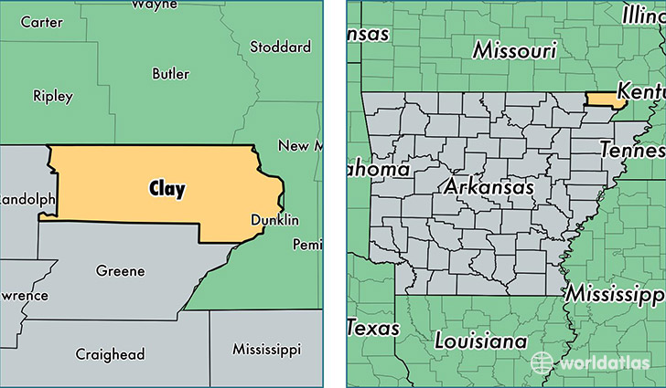
Clay County is a county equivalent area found in Arkansas, USA. The county government of Clay is found in the county seat of Corning.
With a total 1,661.31 sq. km of land and water area, Clay County, Arkansas is the 1603rd largest county equivalent area in the United States. Home to 15,118 people, Clay County has a total 8003 households earning 31502 on average per year.
Clay County, Arkansas - Quick Facts
| FIPS Code | 5021 |
| Area Codes | 870 |
| Time Zone | CST |
| Major Cities | Piggott (population: 4,999), Corning (population: 4,855), Rector (population: 3,705), Pollard (population: 570), Knobel (population: 492), Greenway (population: 400), Success (population: 311), Saint Francis (population: 95), Datto (population: 91), McDougal (population: 91) |
| Land Area | 5,837 sq miles |
| Water Area | 639 sq miles |
| Household Income | $31,502 |
| Housing Units | 8,003 |
| Median Home Value | $62,400 |
| High School Grads | 76% of population |
| Holders of Bachelors Degrees | 10% of population |
| Retail Spending | $8,255 per capita |
| Food & Accomodation Sales | $6,345 per capita |
This page was last updated on June 30, 2016.