Where is Yukon Koyukuk Borough, Alaska?
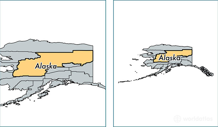
Yukon Koyukuk Borough is a county equivalent area found in Alaska, USA.
With a total 382,812.6 sq. km of land and water area, Yukon Koyukuk Borough, Alaska is the 1st largest county equivalent area in the United States. Home to 5,547 people, Yukon Koyukuk Borough has a total 4024 households earning 34710 on average per year.
Yukon Koyukuk Borough, Alaska offers the following attraction to visitors: Gates of the Arctic NP & Preserve (North Slope)
Yukon Koyukuk Borough, Alaska - Quick Facts
| FIPS Code | 2290 |
| Area Codes | 907 |
| Time Zone | PST-1 |
| Major Cities | Nenana (population: 810), Fort Yukon (population: 604), Galena (population: 485), McGrath (population: 419), Huslia (population: 286), Nulato (population: 272), Tanana (population: 254), Minto (population: 216), Allakaket (population: 214), Grayling (population: 200) |
| Land Area | 2,142 sq miles |
| Water Area | 145,505 sq miles |
| Household Income | $34,710 |
| Housing Units | 4,024 |
| Median Home Value | $106,500 |
| High School Grads | 80% of population |
| Holders of Bachelors Degrees | 9% of population |
| Retail Spending | $7,151 per capita |
| Food & Accomodation Sales | $5,429 per capita |
This page was last updated on June 30, 2016.