Where is Cooke County, Texas?
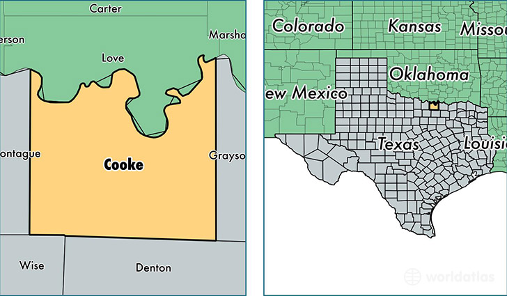
Cooke County is a county equivalent area found in Texas, USA. The county government of Cooke is found in the county seat of Gainesville.
With a total 2,326.95 sq. km of land and water area, Cooke County, Texas is the 976th largest county equivalent area in the United States. Home to 38,761 people, Cooke County has a total 16580 households earning 50067 on average per year.
Cooke County, Texas - Quick Facts
| FIPS Code | 48097 |
| Area Codes | 940 |
| Time Zone | CST |
| Major Cities | Gainesville (population: 26,290), Valley View (population: 4,779), Muenster (population: 2,881), Lindsay (population: 943), Era (population: 433), Myra (population: 231), Rosston (population: 44) |
| Land Area | 14,966 sq miles |
| Water Area | 875 sq miles |
| Household Income | $50,067 |
| Housing Units | 16,580 |
| Median Home Value | $117,100 |
| High School Grads | 84% of population |
| Holders of Bachelors Degrees | 20% of population |
| Retail Spending | $13,006 per capita |
| Food & Accomodation Sales | $52,556 per capita |
This page was last updated on June 30, 2016.