Mount Blackburn, Alaska
Mount Blackburn, an old shield volcano, is the tallest peak in the Wrangell Mountains, an impressive and daunting range located in Alaska. The peak itself is the fifth-highest in the United States and the twelfth-highest in North America. It also is the second-highest volcano in the United States, with Mount Bona occupying the first position.
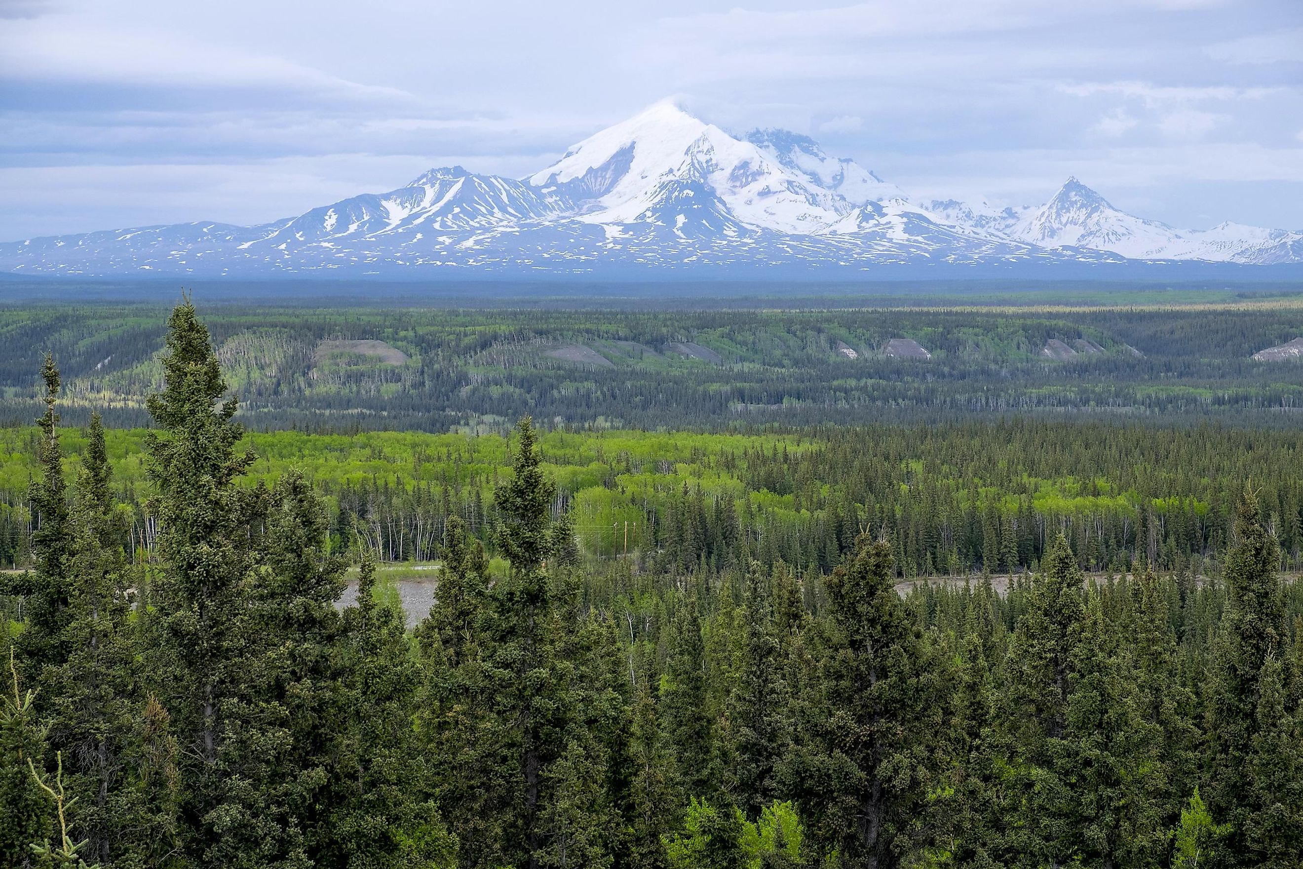
The Wrangell Mountains

The Wrangell Mountains are part of the Pacific Coast Range, which runs through southeastern Alaska. They measure 60 miles across and run for around 100 miles in length, from the St. Elias Mountains on the Yukon border in Canada to the Copper River. These snowy peaks are some of the tallest in the country - and continent. In fact, the range has several peaks that exceed 10,000 feet. The two highest are Mount Sanford, which measures 16,237 feet, and Mount Blackburn, the tallest, which reaches 16,390 feet.
Almost all of the mountains along the range were once volcanoes, though they have all gone dormant. The most recently active peak was Mount Wrangell itself, which last erupted in 1902. This mountain region became well-known in the early 20th century with the discovery of zinc, copper, and gold deposits. Today, the Wrangell-Saint Elias National Park And Preserve protect large parts of this mountain range. This preserve (in combination with several other adjoining parks and preserves) forms a National Heritage Site that protects the natural landscape and beauty of the region.
Geology And Landscape Of Mount Blackburn

Mount Blackburn is one of the many peaks along the Wrangell Mountain range. It is the tallest in the range, and the most dramatic massif, with steep relief. It has a west face that drops 11,000 feet across four horizontal miles and is the most dramatic, with the remaining faces dropping between 8,000 and 10,000 feet across 8 miles or less. The massif is also snow and ice-covered, containing mainly glaciers and icefields. These snowfields drain into glaciers that measure upwards of 45 miles in length. One of these glaciers is the Kennicott Glacier which flows to the southeast for roughly 20 miles near the town of McCarthy. Another is the Nabesna Glacier, which flows to the north and is part of the Kuskulana Glacier system.
Climate
The Wrangell Mountains are close to the Gulf of Alaska, which means it has a rather severe climate. The average rainfall is roughly 91 inches per year, and snow measures approximately 76 inches annually. There is a median of 233 days that receive precipitation each year (only 95 days are actual sunny days). The highest temperatures occur in July and hit an average of 64 degrees Fahrenheit. Conversely, the lowest temperatures occur in January and average 28 degrees Fahrenheit.
Wildlife

Despite the high elevations and abundance of ice and snow, one can still find wildlife in the Wrangell Mountains. The composition of species, however, changes with elevation from the base of these mountains. Some of the most common species include mountain goats, Dall sheep, and caribou. In the lowlands surrounding the mountains, moose, brown bears, and black bears also roam. Many species of birds can also be spotted in these mountains. All this wildlife and more are protected within the boundaries of several national parks and preserves found in the area.
Climbing History

Mount Blackburn consists of two summits, the West Peak and East Blackburn. The West Peak is the highest point of Mount Blackburn and was first ascended in 1958. A crew of six climbed the peak via the Northwest Ridge and consisted of explorers Leon Blumer, Adolf Bitterlich, Bruce Gilbert, Hans Gmoser, and Dick Wahlstrom.
The other major summit, called both East Blackburn and Kennedy Peak, was conquered much earlier, in 1912, by George Handy and Dora Keen. This route involved ascending via the East face and Kennicott Glacier. Over time, this pass became impractical and sometimes impossible as the glaciers and ice flows receded in many places. It was not until 1977 that the second ascension of East Blackburn was recorded. This path went via the Southeast Ridge and also hit the West Peak before descending along the Northwest Ridge.
The mountain continues to draw climbers who wish to reach its impressive peaks. The most common climbing route starts 7,200 feet up at an airstrip on one of the glaciers. From there, climbers traverse the Nabesna Glacier, approach the North Ridge, and continue to the peak. The ascension involves crossing the largest interior valley glacier on the planet, huge crevasses, volatile weather, and regions prone to avalanches. Because of this, it is a trip best left to expert climbers.

As the fifth-highest peak in the US, Mount Blackburn is truly impressive. Whether visitors wish to take in its scenic beauty, dare a climb, explore it from the air, or simply bask in awe of nature, Mount Blackburn is a striking sight even 4 million years after it was formed. Though the landscape and shape of the Wrangell Mountains have changed over the years through time, erosion, and, more recently, global warming, these mountains are well worth visiting for the way they emphasize the size and power of our great Earth.


