This Quiet Washington City Is Hiding In Plain Sight
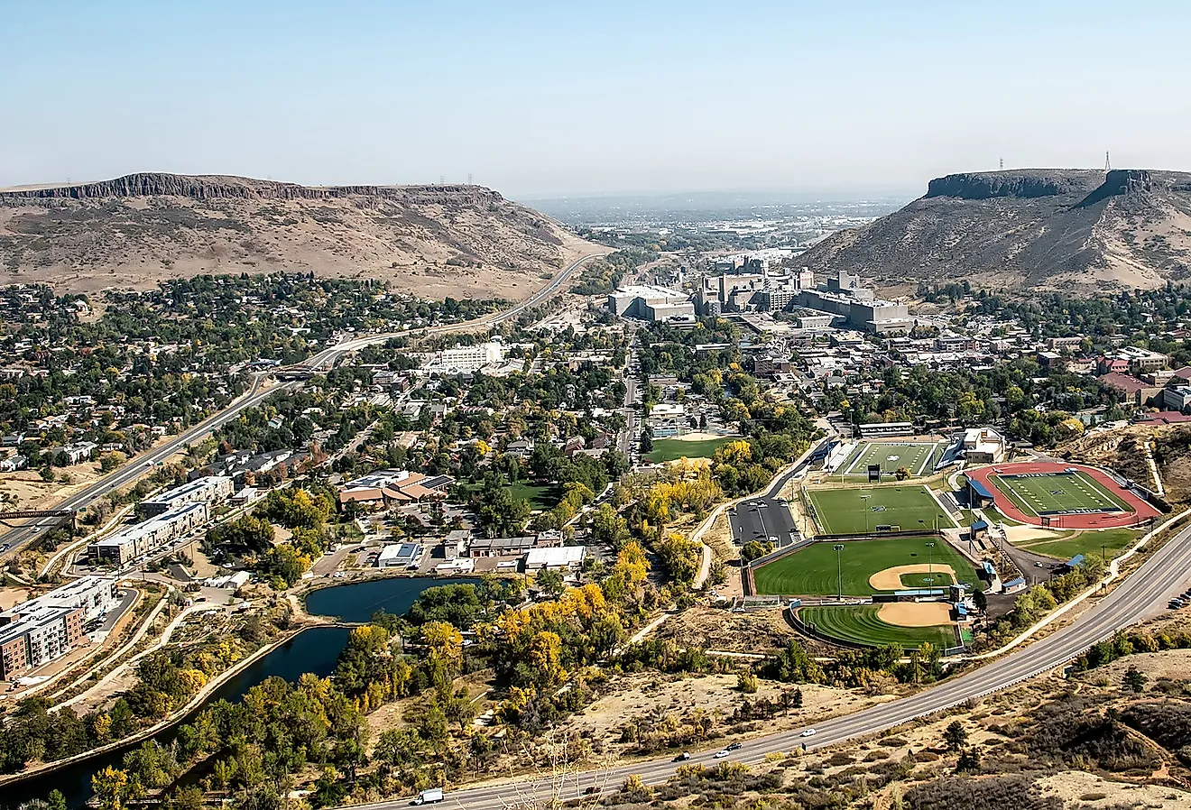
Yakima runs on irrigated farmland, rail history, and long growing seasons that shape daily life in the valley. With nearly 98,000 residents, it serves as a commercial and cultural hub for the Yakima Valley, supported by agriculture, a historic downtown, and institutions like the Yakima Valley Museum in Franklin Park. The city’s modern footprint traces back to an 1880s railroad relocation, and today it also functions as a practical gateway to Snoqualmie Pass and the White Pass area within Gifford Pinchot National Forest.
Taken together, those pieces explain why Yakima continues to matter to the surrounding valley, both as a working agricultural center and as a base for reaching the mountains.
How this Busy Rural Oasis Came to Be

More specifically, located in the fertile Yakima Valley, Yakima developed within the context of longstanding Native American heritage, railway expansion, and modern farming operations. Long before American settlement, the region was home to the Confederated Tribes and Bands of the Yakama Nation, whose people relied on the Yakima River for fishing.
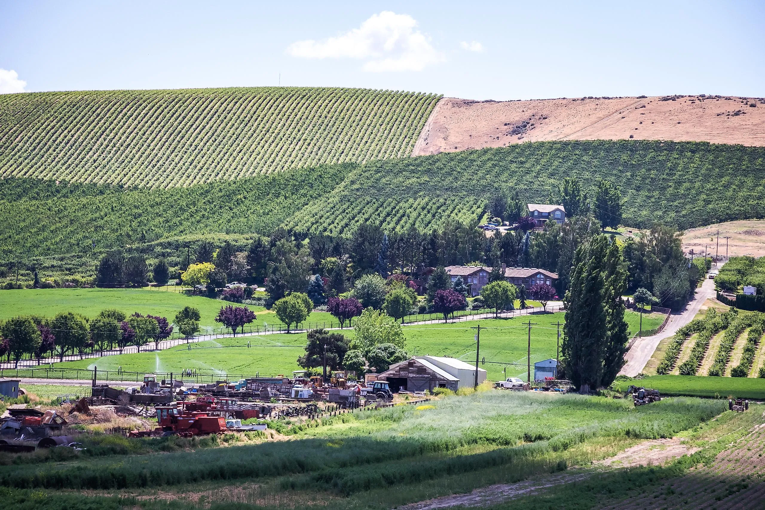
Non-Native settlement accelerated in the latter half of the 19th century after the arrival of the Northern Pacific Railroad. Then, in 1884, a dispute led the railroad to establish a new townsite about 4 miles away, and more than 100 buildings were moved there. Large-scale irrigation projects later transformed the semi-arid valley into some of the most productive farmland in the country, anchoring the city’s economy, especially in apples, hops, pears, and a few other crops that favored the region's climate.

Yakima was officially incorporated in 1886 as North Yakima and was renamed in 1918. It has grown steadily into an agricultural and distribution center since then. In more recent years, tourism has become a more visible part of the local economy, with parks in and around town, as well as a historic downtown area with restaurants, shops, and community spaces.
Yakima Valley Museum

A good place to begin a visit is the Yakima Valley Museum, which provides a comprehensive look at the cultural, social, and natural history of the Yakima Valley. Exhibits here cover Native American heritage, early settlement, the region’s unique agricultural development, and other local industries.
Permanent displays include horse-drawn vehicles and other historical artifacts, alongside rotating exhibits focused on different chapters of Yakima Valley life. The museum also features a working 1930s Art Deco soda fountain and regularly offers educational programs for a range of age groups.
Located in Franklin Park, the Yakima Valley Museum serves as both a research resource and a community gathering space. For those who want a deeper understanding of the valley’s past, it provides a straightforward look at the people, industries, and events that shaped the region.
Yakima Area Arboretum

Just a short drive from the museum, the Yakima Area Arboretum stretches across 46 acres along the Yakima River, focused on plant life that thrives in central Washington’s dry conditions. The grounds feature native and adapted trees, seasonal display gardens, and open natural areas similar to what you see across the valley.
A network of footpaths winds through woodland and meadow areas, making it easy to wander, take photos, or study native plant life. The arboretum also hosts workshops, plant sales, and seasonal events tied to the growing calendar. For those interested in botany, landscape design, or an easy walk along the river, the Yakima Area Arboretum offers a quieter stretch of green space within the city.
Gifford Pinchot National Forest

The city is also fairly close to some of the state's most expansive alpine wilderness areas, within a couple of hours' drive. Stretching across much of southwest Washington, the White Pass area in Gifford Pinchot National Forest sits a little over 50 miles west of Yakima. Within, you'll find a range of hiking trails, backcountry campsites, scenic drives, and access to lakes and rivers suited to different experience levels.
Established in 1908 and renamed in 1948 to honor conservationist Gifford Pinchot, it was also among the oldest national forests in the United States. It encompasses parts of the Cascade Range, including the flanks of Mount Adams and Mount St. Helens, and its varied elevations support dense old-growth stands, subalpine meadows, and abundant wildlife, making it a vital preserve within Washington's natural landscape and a significant outdoor destination.
Snoqualmie Pass

If you’re driving to Yakima from Seattle via I-90, you’ll cross Snoqualmie Pass, the main Cascade pass on this route. Winter storms can bring heavy snowfall and chain restrictions, so travelers should check current Washington State highway conditions for Snoqualmie Pass before departing. Most notably, the pass marks a transition across the Cascade crest, from the wetter western slopes to the drier interior of eastern Washington.
Be aware that heavy winter snowfall makes it a key area for regular snowpack monitoring and seasonal travel advisories, while also making it a cool spot for snowshoeing and skiing. In summer, however, nearby trailheads provide access to a number of alpine lakes, viewpoints, and wildflower meadows near the boundary between the Mount Baker-Snoqualmie and Okanogan-Wenatchee National Forests.
Moreover, numerous scenic overlooks offer wide views across forested peaks and volcanic landscapes, even if you just want to pull off the road for a quick break. This stretch of highway is also worth allowing extra time for, particularly for its scenic overlooks and trail access.
See Sunny Yakima on Your Next Road Trip

From its agricultural foundations to its surrounding mountains and forests, Yakima blends regional history with outdoor access. Museums, gardens, and nearby wilderness areas make it a steady presence in central Washington rather than just a pass-through city. With over 109 clear days and 92 partly sunny days on average each year, Yakima sees frequent sunshine across seasons. That mix of working farmland, established institutions, and Cascade access continues to shape how the city fits into the valley today.