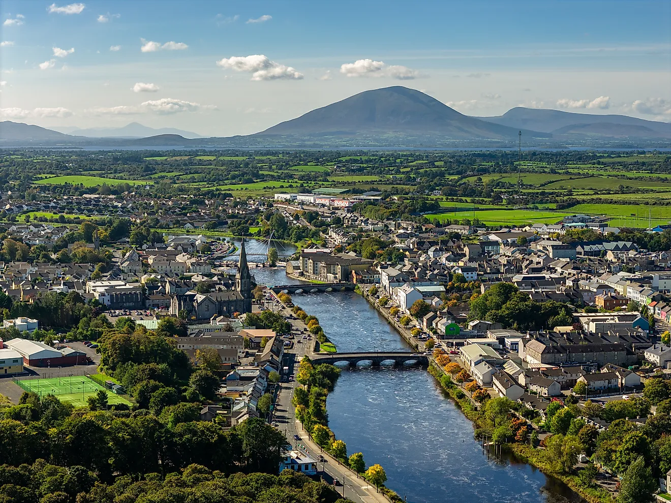
12 Of The Most Adorable Small Towns In Michigan
Where Michigan is most itself, land tilts toward big water and a ridge rises behind it. Harbors hold working boats, a lift bridge ticks to its own clock, an ore dock cuts the horizon, and a dune or basalt knob waits for an after-dinner climb.
These towns follow a simple shore-and-summit rule: small populations, a beach or harbor close enough to hear the gulls, and a lookout within easy reach. The map leans north, where dark skies and old lighthouses still do their jobs. Expect specifics, not slogans; places built to the lake and backed by height, measured in ferry bells, snow lines, and the steady breath of Superior and Michigan. Let's discover the 12 most adorable towns in Michigan.
Copper Harbor

Copper Harbor is the last town on Michigan’s northernmost road, where U.S. 41 ends in a stand of spruce and basalt. It’s the only place in the state where the northern lights, 19th-century military history, lava flows, and mountain biking all meet within walking distance. The town sits on a natural harbor once used by Ojibwe traders, and later fortified in 1844 by the U.S. Army at Fort Wilkins to protect copper prospectors. Just outside the village, the Keweenaw Mountain Lodge, built by the WPA in 1934, is now a certified Dark Sky Park, with open stargazing fields and guided night hikes.

The Brockway Mountain Drive switchbacks west of town and reaches 1,328 feet, with roadside pull-offs overlooking Lake Superior and the forested interior of the Keweenaw Peninsula. Estivant Pines, on the town’s south side, holds some of the last virgin white pines in the state—accessible by two loop trails maintained by the Michigan Nature Association. The Copper Harbor Lighthouse is reachable by boat tour from Copper Harbor Marina area, where interpretive signs line the harbor’s rock shoreline. Dinner service at Harbor Haus includes a salute with cowbells when the Isle Royale ferry returns to port, visible through the dining room’s lakefront windows.
Houghton

Houghton was built on a slope and carved by mining, with staircases, stone alleys, and the state's only double-deck vertical lift bridge. The Portage Lake Lift Bridge connects Houghton to Hancock across a glacial channel that once divided two copper-rich ranges. Michigan Technological University anchors the town, where snow measurements regularly top 200 inches and engineering students build sleds, rail bikes, and concrete canoes. The Keweenaw Waterway system runs through downtown, originally dredged for shipping but now lined with docks, trails, and a cold-water research lab.
The A.E. Seaman Mineral Museum, located on MTU’s campus, holds North America’s largest public collection of native copper and Keweenaw minerals, many pulled from local shafts in the 19th century. Downhill from campus, the Downtown Houghton Waterfront Trail runs alongside Portage Lake and links to Kestner Waterfront Park, where a historic ore car and playground sit near a public beach. Across Shelden Avenue, Suomi Home Bakery serves pannukakku and nisu from a narrow brick storefront that’s operated since 1960. On the edge of downtown, Black Ice Comics & Books offers used paperbacks and indie comics in a basement space. Each stop reflects the town’s geology, weather, and student-driven economy.
Ontonagon

Ontonagon sits at the mouth of a river that once floated copper down from the Porcupine Mountains. The town’s name comes from an Ojibwe phrase meaning “my bowl is lost,” a reference to a wooden dish carried downstream. Ontonagon holds the oldest county in the Upper Peninsula and the western gateway to Porcupine Mountains Wilderness State Park. Logging and mining shaped the grid, but the lakefront has shifted toward tourism, with boardwalks, marinas, and campgrounds taking over the old mill sites. The Ontonagon River still divides the town, crossed by a lift bridge rebuilt in 2006.
The Ontonagon County Historical Museum operates both the town’s main archive and the Ontonagon Lighthouse, accessible by guided tour from the riverfront. Syl’s Café, on River Street, serves pasties, whitefish, and house-baked pies in the same location it’s held since 1972. Just south of town, Rose Island County Park includes a disc golf course, a public boat launch, and trails along the Ontonagon River floodplain. At the north end, Ontonagon Township Park runs directly onto Lake Superior, with campsites, picnic tables, and uninterrupted beach access for sunset watching or rock hunting.
Marquette

Marquette faces Lake Superior with an ore dock that rises from the bay like a colonnade. The town exported iron for over a century and still uses active tracks that run within yards of downtown. Northern Michigan University shapes the central district, where student work and local history overlap in shared storefronts. The Peter White Public Library hosts poetry readings, concerts, and exhibitions year-round in a granite building across from Mattson Lower Harbor Park. In winter, city plows prioritize bike lanes and ski trails over side streets, Marquette was the first city in Michigan to do so.
Cliff jumping at Black Rocks, inside Presque Isle Park, draws swimmers every summer to a volcanic outcrop that dates to the Midcontinent Rift. On the city’s east side, Sugarloaf Mountain rises above County Road 550, with a summit platform overlooking Lake Superior, the Huron Mountains, and the Marquette harbor. The Marquette Maritime Museum offers tours of the Marquette Harbor Light and includes exhibits on shipwrecks, fog signals, and the U.S. Coast Guard. Contrast comes at Contrast Coffee Co., where espresso is roasted on-site and served with scratch-made syrups.
Munising

Munising faces Grand Island and a row of sandstone cliffs that rise directly from Lake Superior. The town's shoreline forms the southern anchor of Pictured Rocks National Lakeshore, the first in the country to be designated for scenic preservation. Its name comes from an Ojibwe word meaning “at the island,” referencing the sheltered harbor created by Grand Island’s bulk. Munising's layout follows the shore, with paddle shops, ferry docks, and old motels running parallel to the water. Lake freighters occasionally anchor offshore, waiting to pass the Soo Locks.
Pictured Rocks Cruises departs from Bayshore Drive and runs daily trips to Spray Falls and Chapel Rock, with close passes under the multicolored cliffs. Miners Castle Road leads northeast of town to an overlook of Miners Castle and a short trail to Miners Beach. Falling Rock Café & Bookstore serves espresso, bagels, and used paperbacks in a converted hardware store across from City Hall. To the west, Wagner Falls Scenic Site offers a boardwalk loop through cedar swamp to a coldwater cascade. Every stop ties back to water, either tumbling over limestone, carved into cliff, pooled in harbor, or stretching open into the lake.
L'Anse

L’Anse sits in a natural harbor at the base of Keweenaw Bay, where Superior’s waves are broken by a long curve of land and the western U.P.’s only active sawmill. The town is part of the L’Anse Indian Reservation, home of the Keweenaw Bay Indian Community, and includes both tribally managed lands and historic French mission sites. Just inland rises Mount Arvon, Michigan’s highest point at 1,979 feet, accessible by forest roads and marked by a USGS summit sign nailed to a tree. The village itself remains centered around a short main street, a working waterfront, and an overlook cemetery with lake views.
The L’Anse Waterfront Park includes a swimming beach, a long pier, and the entry point for the snowmobile trail that follows the rail grade out of town. Hilltop Restaurant, known locally for its plate-sized cinnamon rolls, sits near the top of Broad Street and serves breakfast through dinner year-round. The Baraga County Historical Museum operates inside a white-frame building on U.S. 41 and contains Ojibwe artifacts, mining relics, and photographs of the 1896 fire that burned much of downtown.
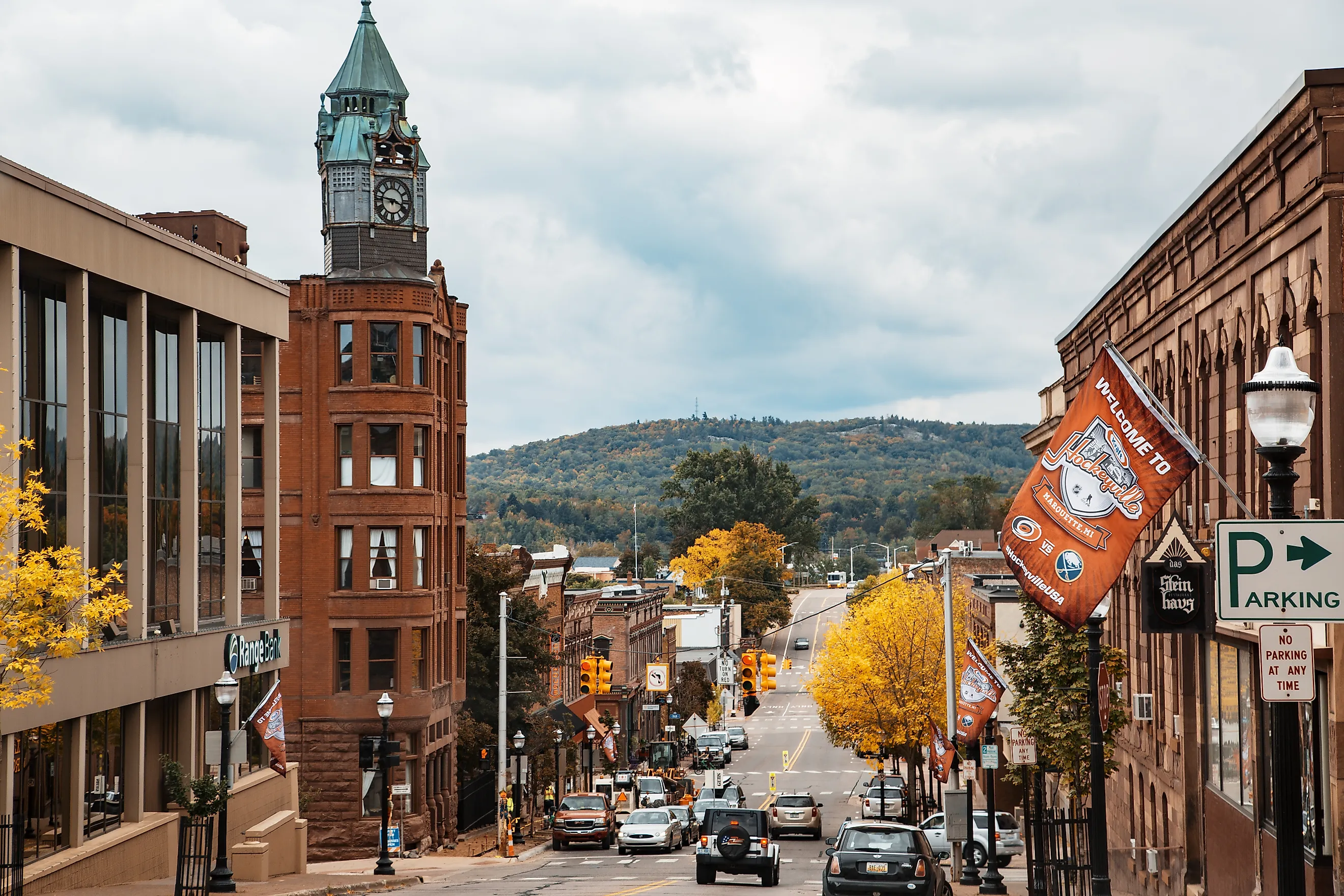
Ishpeming

Ishpeming is the birthplace of organized skiing in the United States and home to the National Ski Hall of Fame. Iron ore built the town, and the pits and tailings are still visible across the hills. Ishpeming’s elevation, over 1,400 feet, gives it some of the heaviest snowfall in the state, averaging more than 200 inches per year. Cliff Shaft Mine Museum, housed in a decommissioned iron mine with two Egyptian Revival headframes, offers underground tours and a collection of mining artifacts from the Marquette Iron Range.
Al Quaal Recreation Area, just north of downtown, includes cross-country ski loops, a luge run, a summer disc golf course, and panoramic views over Teal Lake. The town’s grid follows the lakefront and rail line, with Hematite Drive leading to Da Yoopers Tourist Trap, a roadside museum and music shop with scrap-metal sculptures and parody memorabilia. The U.S. Ski and Snowboard Hall of Fame displays vintage gear, Olympic footage, and memorabilia from ski jumpers, Nordic racers, and alpine athletes, most with ties to the Upper Midwest.
Leland

Leland was built where the Carp River flows into Lake Michigan through a narrow channel of fish shanties, net sheds, and smokehouses now known as Fishtown. The harbor once supported a fleet of commercial fishing tugs; today, it hosts the Manitou Island Transit ferry and a few remaining working boats. The wooden docks and gray clapboard buildings remain largely unchanged since the 1900s, protected by the Fishtown Preservation Society. Leland’s layout follows the narrow peninsula between Lake Michigan and Lake Leelanau, with views of both visible from elevated streets.
Fishtown’s Carlson’s Fishery still smokes whitefish on-site and sells it by the pound or in sandwiches wrapped to go. The Leelanau Historical Society Museum sits just uphill and documents Anishinaabe history, fur trading, and the town’s early resort era with photographs, baskets, and lighthouse logs. Van’s Beach, at the end of Cedar Street, opens onto a wide stretch of Lake Michigan shoreline with breakwater access and views of South Manitou Island. The Bluebird Restaurant & Tavern, in operation since 1927, serves local trout and cherry pie with seating that overlooks the river channel.
Empire

Empire marks the southern entrance to Sleeping Bear Dunes National Lakeshore and was once a lumber town tied to the Empire Lumber Company, whose smoke stack still stands near the beach. The village sits between South Bar Lake and Lake Michigan, with a short strip of storefronts on M-22 and a grid of sand roads behind them. It’s one of the few towns fully inside the national lakeshore boundary. The Philip A. Hart Visitor Center for Sleeping Bear Dunes is located in town and includes trail maps, logging artifacts, and park film screenings.
Empire Bluff Trail, accessed from Wilco Road, climbs through beech-maple forest to a boardwalk with views of Platte Bay and the Manitou Passage. Joe’s Friendly Tavern has operated since 1946 and serves whitefish sandwiches and draft beer with vintage taxidermy lining the back room. Empire Area Museum Complex includes a restored blacksmith shop, one-room schoolhouse, and depot, all within walking distance of downtown. Empire Beach, located at the end of Niagara Street, offers direct Lake Michigan access, a rock pier, and views of the Sleeping Bear dune line to the north.
Charlevoix

Charlevoix occupies the narrow strip of land between Lake Michigan and Lake Charlevoix, bisected by the Pine River Channel and its drawbridge. The channel allows boat traffic to pass from the inland lake to the open water, stopping cars and pedestrians on Bridge Street every half hour during peak season. Architect Earl Young built more than two dozen stone houses throughout town, known locally as “Mushroom Houses,” made of boulders, cedar shake, and curved lines. The Harsha House Museum preserves photographs and documents from the lumber and resort eras, along with early examples of the town’s printed newspapers.
The Charlevoix South Pier Lighthouse stands at the end of a breakwall lined with anglers and sightseers, with direct views west toward Beaver Island. Ferry service to Beaver Island leaves from the end of Bridge Street, where the Emerald Isle runs from May to October. Lake Michigan Beach Park, just south of the lighthouse, offers public swimming and access to the dunes above. Stafford’s Weathervane Restaurant, designed by Earl Young, sits along the channel and serves whitefish and steak with boats passing just outside the windows.
Petoskey

Petoskey faces Little Traverse Bay from a bluff above the water, where glacial movement once shaped the shoreline into steep drops and curved inlets. The town is named after Odawa leader Ignatius Petosega, and Petoskey stones, fossilized coral hexagons found along the beach, bear his name. Ernest Hemingway spent his first summers here and referenced the area in The Nick Adams Stories. The rail line that once brought tourists to the Perry Hotel is now part of the Little Traverse Wheelway, a 26-mile path running along the bay.
Bayfront Park sits below the bluff with a marina, breakwall, and benches facing the water. The pedestrian tunnel under U.S. 31 connects to Pennsylvania Park and the Gaslight District, where McLean & Eakin Booksellers carries regional history, fiction, and hardcover reprints in a two-story space on Lake Street. The Little Traverse History Museum, inside the former train depot, documents Hemingway’s time in the area and the town’s resort economy with photographs, railway timetables, and Odawa artifacts.
Harbor Springs

Harbor Springs occupies the deepest natural harbor on the Great Lakes, a bowl of water protected by bluff and point, once used as a seasonal Odawa village. The town’s name comes from the natural springs that surfaced near the shore, still visible in a small basin beside Bay Street. For most of its modern history, Harbor Springs has been a seasonal landing for yachts, artists, and industrial families from Chicago. The bluffline above town is lined with cedar-shake cottages and summer chapels, visible from the public dock or along a sail into the bay.
The Tunnel of Trees begins just south of town on M-119, a narrow, canopied route that runs along the bluff past farms, trailheads, and lake views. The Andrew J. Blackbird Museum, once the home of the Odawa leader and interpreter, preserves family artifacts, writings, and 19th-century maps of Emmet County. Tom’s Mom’s Cookies operates from a small shop off State Street and produces small-batch cookies using the original 1985 recipe. Pond Hill Farm, five miles up the bluff, offers cider, trout fishing, and a hiking loop on former orchard land with views of the bay.
Taken together, these towns prove Michigan’s small-scale formula: water at your feet, height at your back, and history running through the block. Ore docks, fish shanties, lift bridges, ferries, dunes, and dark skies combine into places that work first and then welcome. In each town, there’s a harbor to walk, a hill to climb, and a story to read in the lighthouse logbook and ledger, written in ice and sand.