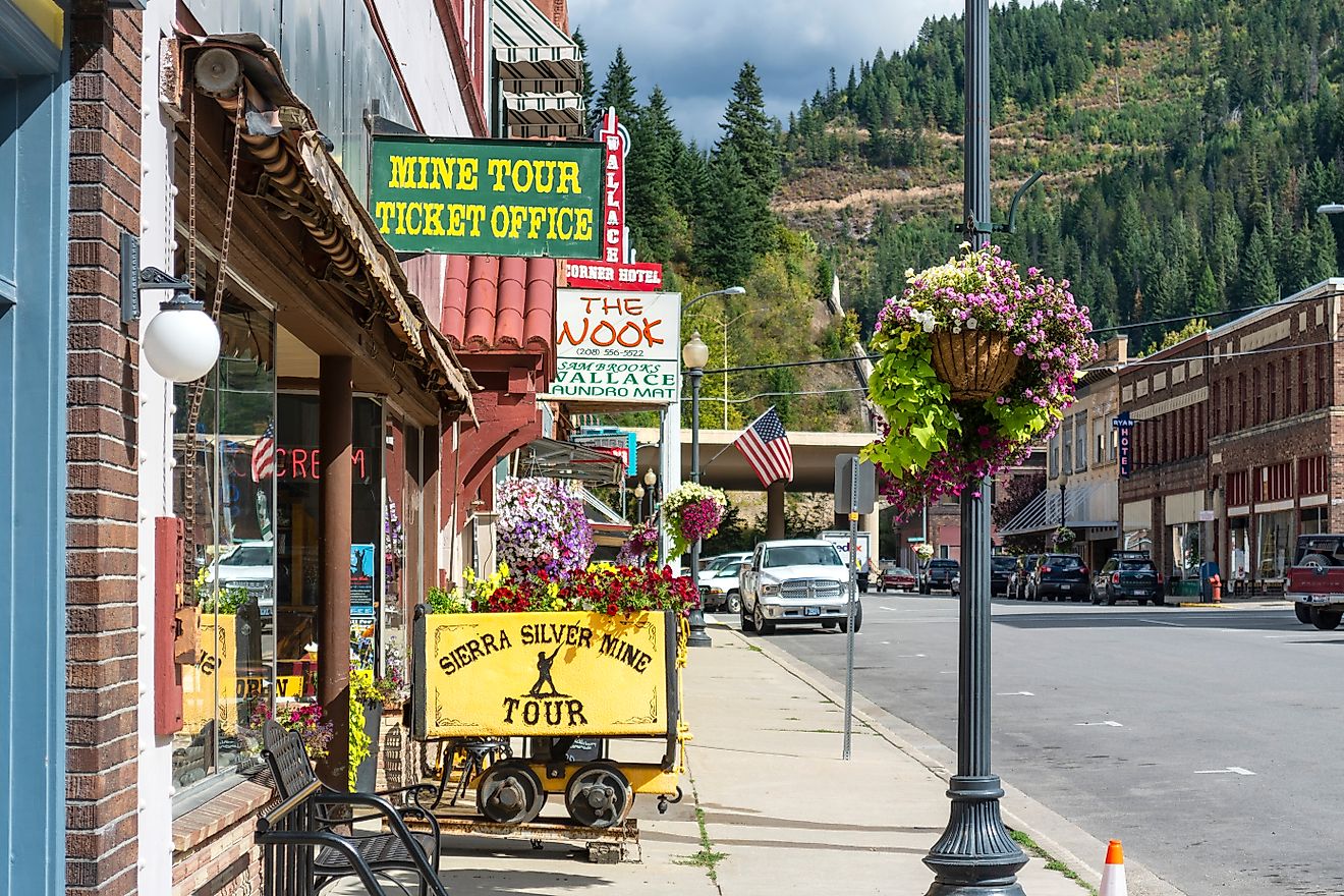
11 Of The Most Adorable Small Towns In California's Sierra Nevada
At altitude, adorable has to work for a living. In the Sierra Nevada, flower baskets share railings with bear boxes, and the prettiest streets double as snowplow routes. These towns didn’t paint themselves cute for visitors; they were built to outlast granite winters and short summers.
This list favors places pinned between rock and water, lake edges, river bends, hot-spring benches, where you can step from shoreline to main street in the length of a crosswalk. These 11 towns are the Sierra’s small operating system, specific, stubborn, and good at keeping people warm.
Tahoe City

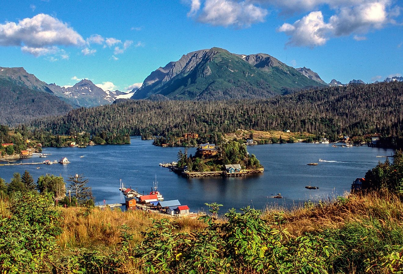
Tahoe City sits on the only outlet of Lake Tahoe, the Truckee River, which flows beneath the historic 1913 Lake Tahoe Dam just steps from the town center. This detail alone makes it geographically rare. The town is also home to one of the oldest ski areas in California (Granlibakken, opened in 1928), yet it has no chain stores, fast food, or sprawl. Tahoe City is compact, walkable, and framed by water and forest on every side. It’s one of the few lakefront towns where you can walk from a beach to a bookstore in under five minutes.
Commons Beach anchors the lakeshore with picnic lawns, a small amphitheater, and access to the Tahoe City Lakeside Trail, which stretches for miles along the water. Across the street, Fire Sign Café serves simple breakfasts in a converted A-frame with a woodstove. The Gatekeeper’s Museum, housed in a hand-hewn log cabin, holds artifacts from Tahoe’s early timber and resort days, as well as the Marion Steinbach Indian Basket Museum, which contains over 800 pieces. For coffee and mountain views, locals favor Tahoe House Bakery & Gourmet.
Mammoth Lakes

Mammoth Lakes sits at 7,880 feet on an ancient volcanic caldera, just south of the Long Valley supervolcano fault zone. The town is surrounded by jagged peaks, obsidian domes, and more than a dozen alpine lakes formed by glacial activity. The air is thin and dry. Lodgepole pines grow in sidewalk cracks. In winter, the local population of about 7,000 supports one of the largest ski resorts in the western U.S., but in summer, Mammoth shifts into a high-alpine lake town with nearly endless backcountry access.
Twin Lakes, at the edge of town, is accessible by bike from Main Street and rents canoes and kayaks from Tamarack Lodge. The Mammoth Mountain Scenic Gondola climbs to 11,053 feet and offers access to the Eleven53 Interpretive Center, which has geology exhibits and aerial views of the Minarets and Yosemite’s eastern edge. Stellar Brew, a low-ceilinged coffeehouse with local art and rotating breakfast wraps, is a staple for hikers and climbers heading into the Lakes Basin. For dinner, The Warming Hut on Old Mammoth Road serves house-made pasta and seasonal plates in a space lined with photos of early ski history.
June Lake

June Lake sits on a glacial loop beneath Carson Peak, with a four-lake chain running parallel to its single main road. Unlike most Eastern Sierra towns, it faces west, which means long sunsets over water, rare in this region. The town has no traffic lights and fewer than 700 residents year-round. Locals call it the "Switzerland of California," but the terrain is older and more severe. June Lake’s oldest buildings still bear WPA-era stonework, and the air smells like granite dust and pine sap.
The June Lake Loop (Highway 158) passes four lakes, Gull, June, Silver, and Grant, with June Lake Beach offering cold, shallow swimming and full views of the cirque above. Silver Lake Café sits by Silver Lake on the June Lake Loop, serving breakfast and lunch with mountain views, pancakes, and burgers. The June Lake Brewing taproom pours local IPAs and kölsches with seating in a gravel lot lined with skis and food trucks. For hiking, the Rush Creek Trail climbs steeply from Silver Lake toward Agnew Lake and the backside of the Ansel Adams Wilderness. Locals buy snacks and ice at the General Store, which hasn’t changed in decades, and still stocks avalanche beacons behind the counter.
Lee Vining

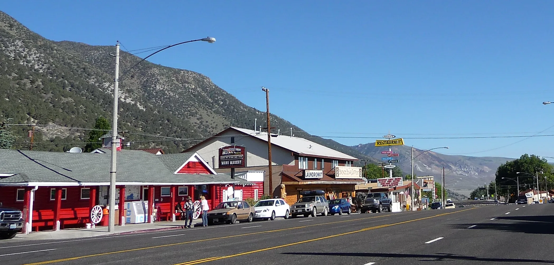
Lee Vining stands at the edge of Mono Lake, one of North America’s oldest lakes, with water twice as salty as the ocean and shorelines marked by tufa towers, limestone spires formed underwater and exposed by decades of water diversion. The town is a launch point to Tioga Pass, the highest paved mountain pass in California, but it remains mostly unchanged since the mid-20th century. Snow closes the highway half the year. Winds push dust off the Mono Basin. The whole place feels like a staging area between worlds, high desert and alpine.
The Mono Basin Scenic Area Visitor Center, just north of town, has floor-to-ceiling lake views, Native Paiute exhibits, and a short film that runs on a loop. At the edge of Mono Lake, the South Tufa Area has a flat walking trail with access to the largest cluster of tufa formations. Back in town, Nicely’s is a longtime diner with trout and eggs on the breakfast menu and a rotating pie case near the door. For gas station coffee and hardback field guides, the Mono Lake Committee Information Center & Bookstore is a regional anchor.
Bridgeport

Bridgeport sits in a wide, glacially carved valley surrounded by granite peaks and volcanic ridges. The town is known for having one of the largest intact courthouse buildings in the West, Mono County Courthouse, built in 1880 and still in use. Bridgeport is also the only Eastern Sierra town with a year-round geothermal hot spring open to the public, perched on a hillside with views of the Sierra Crest. The air smells like cattle and sagebrush, and the main street is lined with motels that haven’t changed their signage since the 1950s.
Travertine Hot Springs, south of town on a dirt road, has mineral pools set in colorful calcium terraces with open views of Sawtooth Ridge. The Bridgeport Reservoir, just north of town, offers shore fishing and small boat access, with the best light in late spring and early fall. For coffee and daybreak chatter, locals stop at High Sierra Bakery, which sells maple bars and fresh rye bread from a back oven. The Walker River Lodge rents rods at the front desk and displays photos of trout caught along the East Walker River, known for its deep-cut canyons and fast water.
Bishop

Bishop lies at the base of the Eastern Sierra escarpment, where the Owens Valley drops below 4,200 feet and the granite wall of the Sierra Nevada rises over 10,000 feet above it. The town sits on land once farmed by Paiute irrigation networks, some of which still feed alfalfa fields through open ditches. Bishop is the only incorporated city in Inyo County, but it runs like a ranch town with a mountain problem. Climbers, fishers, and packers all use it as a base. Mule Days, held every Memorial Day, draws thousands for pack string competitions and horse-trailer tailgating.
Erick Schat’s Bakkery is known for sheepherder bread, stuffed rolls, and cases of carved sandwiches. Mountain Rambler Brewery, across from the DMV, serves beers brewed on-site with a view of Mt. Tom from the patio. The Laws Railroad Museum, just north of town, preserves 19th-century buildings relocated to the old narrow-gauge rail yard, barns, depots, a saloon, and a schoolhouse filled with ledgers and sewing machines. Up Bishop Creek Canyon, South Lake and Lake Sabrina offer trailheads into the John Muir Wilderness. Locals buy bait and propane at Mahogany Smoked Meats, which also sells slabs of elk jerky from a case near the cash register.
Nevada City

Nevada City was never torn down and rebuilt. The original gold rush architecture, two- and three-story brick blocks with iron shutters, remains intact across its narrow, sloped streets. The town had electric lights before San Francisco and a theater before Sacramento. It’s a place where mining tunnels still run beneath storefronts, and the cemetery on the hill lists more causes of death than years on most markers. The elevation sits just above the fog line, just below snow line, with dogwoods in the gullies and black oaks over the ridgelines.
The Nevada Theatre, opened in 1865 and still in use, has hosted everyone from Mark Twain to Mötley Crüe. The Firehouse No. 1 Museum, built in 1861, displays mining tools, 19th-century clothing, and early fire gear under its red bell tower. Treats on Broad Street serves house-made ice cream and espresso with a view of the Masonic Temple. Down the hill, the South Yuba River State Park has access to the old Bridgeport Covered Bridge and a series of swimming holes upstream from the trailhead. The Outside Inn, a 1940s motor lodge converted into themed rooms, anchors the south end of town and still rents gear for people heading to the river.
Downieville

Downieville is built on a sliver of flat land where the Downie River meets the North Yuba, surrounded by steep forested walls with no room to grow in any direction. It was once the capital of California’s short-lived mining district and still has a two-cell jail, a working courthouse from 1854, and wooden footbridges linking neighborhoods cut off by creeks. Most buildings back directly into rock. Mountain bikers haul full-face helmets through town alongside fishermen carrying fly rods, both headed to trails or rivers that begin within walking distance of Main Street.
The Downieville Museum, located inside an 1852 general store, has original ledgers, mining maps, and household tools left behind by early settlers. St. Charles Place is a small bar-and-grill in Downieville’s historic center, with a riverside patio and a straightforward burger-and-beer menu. Mountain Messengers, California’s oldest weekly newspaper still printed with movable type, is headquartered behind a wooden screen door a few blocks up Commercial Street. The Downieville Downhill trail drops 5,000 vertical feet into town and finishes two blocks from the river bridge. Locals swim beneath the Highway 49 bridge, where the current pulls strongest, and sun themselves on flat granite slabs while someone’s dog dries off next to a pile of bikes.
Graeagle

Graeagle began as a company town built around a box factory operated by the California Fruit Exchange. The original red-painted mill buildings still line Highway 89, now converted into galleries, gear shops, and rental cabins. The town sits in the Middle Fork Feather River watershed, with pine forest on all sides and a wide open meadow running down the center. Each summer, the volunteer fire department installs American flags on every fence post along the highway, a tradition that started decades ago without ceremony and never stopped.
Graeagle Mill Pond is the town’s main gathering place, stocked with trout and edged by grass and picnic tables. The Graeagle Meadows Golf Course begins just south of the pond and winds along forested fairways with views of Eureka Peak. Graeagle Outpost sits by the Mill Pond, serving deli sandwiches, scoops, espresso, and grab-and-go picnic staples for lake-side afternoons. At the edge of town, the trailhead to Madora Lake leads to a small granite-ringed swimming spot with no formal signage and few visitors outside of July. Plumas-Eureka State Park, ten minutes up the road, preserves mining equipment, a blacksmith shop, and the stamp mill that once processed ore from nearby shafts.
Markleeville

Markleeville sits at the confluence of creeks below Monitor Pass, where volcanic hills meet granite basins and the road closes each winter without warning. It’s the seat of Alpine County, California’s least populated, and has fewer than 200 full-time residents. The town's layout is one block wide, with wooden buildings staggered along Hot Springs Road, and no stoplights or chain businesses in any direction. Every July, it hosts the Death Ride, a 129-mile cycling event that crosses five Sierra passes and fills every shoulder with road bikes and cowbells.
Grover Hot Springs State Park lies just west of town, with sulfur-fed mineral pools bordered by stone decks and lodgepole pines. The Alpine County Museum, a short walk from the center of town, includes an 1890s jail, a stamp mill, and mining tools used in nearby Silver Mountain City before it was abandoned. Cutthroat Tavern sits on Hot Springs Road in downtown Markleeville, serving local beer and straightforward pub fare to riders, anglers, and locals. Trails from the edge of town climb into the Mokelumne Wilderness or drop toward the East Fork Carson River, depending on the weather.
Thread these places together and a pattern emerges: compact main streets parked beside lakes, rivers, and hot springs; 19th-century courthouses and museums still working; cafes that track the seasons as closely as the snowpack. From Tahoe City to Markleeville, each town holds its own waterline and memory, with trails starting at the curb and night skies that go dark. Taken together, they’re the Sierra’s durable heartbeat, and worth knowing by name.