Where Is The Torres Strait Located?
The Torres Strait is located at the maritime border of Australia and New Guinea. It is bordered by the Western Province of New Papua Guinea to the north and Cape of York Peninsula (Queensland, Australia) to the south. The strait is 93 miles wide and 15 m deep, with many coral reefs and shoals rendering navigation hazardous. The Torres Strait was discovered by and and named after Luis Vaez de Torres in 1606, a Spanish maritime voyager of the 16th and 17th centuries.
History
In 1605, a Spanish navigation team led by Portuguese navigators Pedro Fernandes de Queiros and Luis Torres sailed from Peru to the South Pacific before returning to Mexico. Upon arrival, Torres returned voyaging to Manila through the Maluku Islands, and it is believed that he sailed through the south coast of Papua Guinea, sighting the northernmost borders of Australia’s mainland. Although Torres did not reveal his discovery to anyone, he recorded the existence of the strait in his testimony, proving that there was a passage south of New Guinea, which he named the Torres Strait. The next navigation along the strait was conducted by James Cook in 1774 after Scottish geographer Dalrymple Alexander published a book that included a reference about the existence of the Torres Strait.
Geography
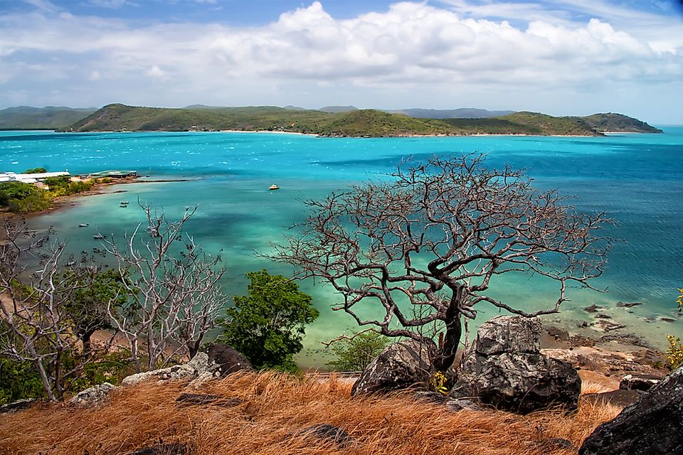
The Torres Strait became recognized as a maritime border between New Papua Guinea and Australia in 1978, but is administered under the control of the Australian government. It links the Coral Sea to the Gulf of Carpentaria in the west and Arafura Sea to the east. The strait is divided into five main islands clusters comprising of 274 atolls, of which only 17 hold permanent settlements of a unique multicultural coastal community. The islands have varying topographies based on their formation process. Those located near New Guinea’s coastline are low and are considered to have been formed through alluvial deposits by rivers flowing into the sea. The central Islands were formed from coral cays, while those in the east were formed through volcanic eruptions. The western islands have a steep rocky topography, having been formed from granite, while those in the north are part of the Great Dividing Range of islands formed during the last Ice Age.
Over 6,800 Torres Strait Islanders live on the Islands, while over 40,000 inhabit the surrounding mainland. The native inhabitants of the islands are distinct tribes comprising of the Papuans of neighboring New Guinea and Aboriginal groups of the Australian mainland. The groups speak two distinct languages, namely Kala Lagaw Ya and Miriam Mir, both of which form the Torres Strait Creole.
Threats
In the last century, the Torres Strait was used by asylum seekers sneaking to New Guinea, thus increasing the population pressure in the region. Despite being an established sea route, the maze of reefs and islands makes it hazardous for sea vessels to navigate. Pollution from mining waste in the Fly River poses health risks to Torres Islanders. Additionally, global warming has resulted in increased water levels, thus threatening the settlement patterns for Islanders.


