Jarvis Island
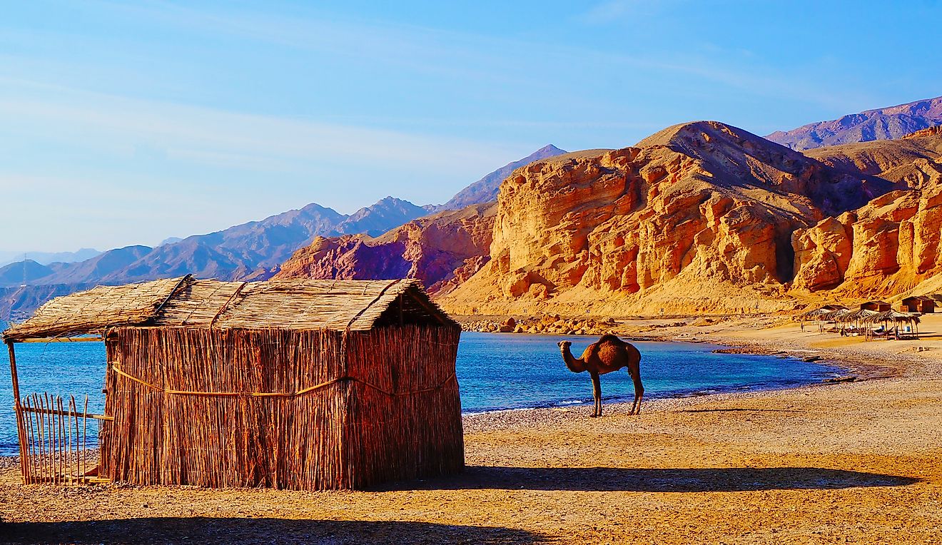
Jarvis Island, formerly referred to as Volunteer Island, Brook Island, Jervis Island, or Bunker Island, is a coral island in the South Pacific Ocean located about midway between the Cooks Island and Hawaii and is administered by the United States. It forms a part of the Line Islands volcanic chain, of which most of the islands belong to Kiribati. The coral island is uninhabited and administered by the US Fish and Wildlife Service as a National Wildlife Refuge. Jarvis Island covers about 4.5 square kilometers, making it the largest of the three US equatorial islands, which include Howland and Baker Islands. The US claimed the Jarvis Island in 1857 through the Guano Islands Act.
Location
Jarvis Island is one of the Equatorial (Line) Islands located in the South Pacific Ocean. It is located approximately 40 kilometers south of the Equator, about midway between Cooks Island and Hawaii, approximately 2,430 kilometers to the southwest of Honolulu, and about 1,850 kilometers southeast of the Baker and Howland Islands. It borders the Christmas Islands to the southwest and Rawaki Islands to the east.
Geography
Jarvis Island covers an area of approximately 4.5 square kilometers, making it the 6th largest island in the Line Island volcanic chain and the largest of the US equatorial islands. It is about 3.26 kilometers long and 2.2 kilometers wide and has a coastline of about 8.54 kilometers. Jarvis comprises a relatively flat sandy terrain, mostly 4-6 meters high, with the highest point being 7 meters. The island’s highest point is 380.6 kilometers away from the nearest higher point (Kiritimati’s Joe’s Hill), making it the world’s 36th most isolated summit.
The central basin is a dried lagoon, while the fringing reef is narrower. The island does not have a harbor or port, but ships can land on the western shoreline or the southwest corner near the day beacon. Jarvis Island experiences a tropical desert climate characterized by a hot sun, high temperatures and constant blowing wind during the day while the nights are compartively much cooler.
Island History
While on a British ship Eliza Frances, Captain Brown discovered the Jarvis Island on August 21, 1821. In 1841, the US surveyed the island and took its formal possession in March 1857 under the Guano Islands Act. In the same year, Charles Davis explored the island and officially claimed it for the US on February 27, 1858. Guano was mined on the island in the late 1800s until the US abandoned Jarvis in 1879. At that time, about 8,000 tonnes of mined guano had been collected from the island. The United Kingdom took possession of the island in June 1889 but did not develop it. The US reclaimed the island in March 1935 as its unincorporated territory and placed it under the Department of Interior the following year. In 1942, the Japanese forces attacked the island, forcing the evacuation of the colonialist.
Wildlife

Jarvis Island is a nesting, foraging, and roosting habitat for several marine animals, shorebirds, and seabirds. It once hosted the largest seabird colonies in the South Pacific Ocean. However, guano mining in the 1800s affected the bird’s population. In 2004, there were only 14 seabird species, including Polynesian storm petrel, Brown noddies, and Grey-backed tarn. Feral cats, introduced in the 1930s, also disrupted the island’s vegetation and wildlife. Their complete eradication between the 1960s and 1990 has contributed to the increase in seabird diversity and numbers.